VAN HORLICK CREEK 28-VH21-1
Cascades Natural Resource District
Distance
4.66 km
Last Road Report
Aug 26, 2026
Closures
No Posted Closures
Location
VAN HORLICK CREEK 28-VH21-1
Permit Holder
Interwest Timber Ltd.
Waypoints
Conditions
Start to 0.4 km
Somewhat Degraded
48d ago
0.4 to 0.5 km
Heavily Degraded
48d ago
0.5 to 4.7 km
Somewhat Degraded
48d ago
Description
No description.
Road Bulletins
Modes of Travel
Distance Travelled
10.10km
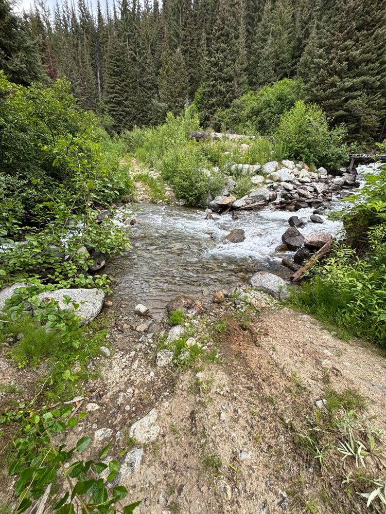
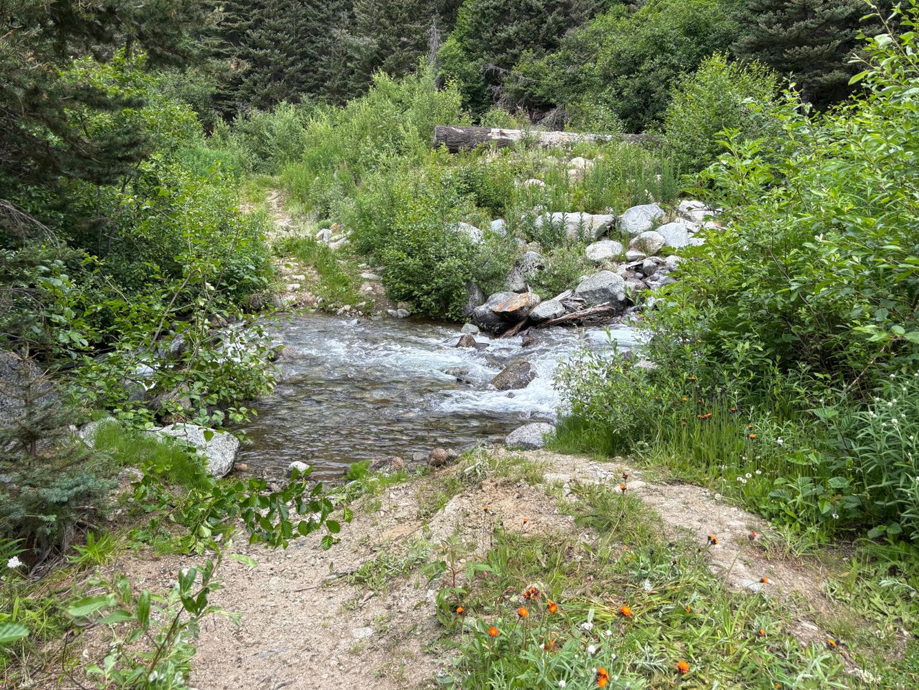
The creek crossing at the beginning of the road is the crux, the rest of the road is largely fine, albeit slow going as there's quite a few sleeper waterbars that catch you out if you try to go quicker.
I disagree that you need an upgraded or custom off road vehicle to pass the creek. I made it across in a stock Cherokee Trailhawk. That being said, this is a capable, high clearance, short wheel base 4x4 vehicle with skid plates and off road tires, all of which were necessary to cross this creek. As was a spotter, and some confidence. I would not do this crossing in anything other than a HC 4X4, but stock vehicles can absolutely make it across.
The previous review noting boulders on the other side of the creek being an issue was also easy to remedy by hand. All the problematic boulders were moved to the side without issue. The boulders in the actual creek are the problem, as they cannot be moved, so you need the clearance. I did scrape one, but that's what skid plates are for 😄
I disagree that you need an upgraded or custom off road vehicle to pass the creek. I made it across in a stock Cherokee Trailhawk. That being said, this is a capable, high clearance, short wheel base 4x4 vehicle with skid plates and off road tires, all of which were necessary to cross this creek. As was a spotter, and some confidence. I would not do this crossing in anything other than a HC 4X4, but stock vehicles can absolutely make it across.
The previous review noting boulders on the other side of the creek being an issue was also easy to remedy by hand. All the problematic boulders were moved to the side without issue. The boulders in the actual creek are the problem, as they cannot be moved, so you need the clearance. I did scrape one, but that's what skid plates are for 😄
Modes of Travel:
Distance Travelled:
4.66 km

Distance Travelled
10.10km
It appears the far side of the crossing has eroded since the last time I was here and the previous update. Some time spent with shovels and moving large boulders could bring it back to its original state again. Upgraded high clearence vehicles could probably make it as is.
Rest of the road is pretty great still with small waterbars and slightly grown in.
The foot bridge off to the side of the crossing still looks good and is wide enough for quads and foot traffic to easily cross.
Rest of the road is pretty great still with small waterbars and slightly grown in.
The foot bridge off to the side of the crossing still looks good and is wide enough for quads and foot traffic to easily cross.
Distance Travelled:
4.66 km
Distance Travelled
10.10km
Creek crossing/bridge bypass is the only real obstacle (see photos). Road has water bars but is drivable to the end without much difficulty.
Distance Travelled:
4.66 km
Distance Travelled
10.10km
Somewhat deeper than avg water bars. Good crossover or better.
The 4x4 bypass for the bridge is real tho so *effectively* it's a 4x4 road now. 30" tires and a short wheelbase was enough for me
The 4x4 bypass for the bridge is real tho so *effectively* it's a 4x4 road now. 30" tires and a short wheelbase was enough for me
Distance Travelled:
4.66 km


Distance Travelled
10.10km
We drove and parked at the footbridge/washout. There were a few shallow waterbars easily manageable in Tacoma. The bypass looked manageable as well in a 4x4 vehicle. However, I would need to move a few boulders in the creak area to avoid hitting them with the bottom of my truck.
Distance Travelled
10.10km
Similar to previous reports, but I underestimated the creek crossing from the pictures. I did it with my fully stock long-box full cab Tacoma and found the water higher than pictured, with limited and narrow line options for my relatively longer wheel base. I ended up banging the hitch and front skid plate a few times.
The water crossing would be easier with a shorter wheelbase or a vehicle you don’t mind picking up a dent or two in. A high-clearance 4×4 with a bit more than stock capability would handle it without trouble.
The water crossing would be easier with a shorter wheelbase or a vehicle you don’t mind picking up a dent or two in. A high-clearance 4×4 with a bit more than stock capability would handle it without trouble.
Distance Travelled:
4.66 km


Distance Travelled
10.10km
If you can make it through the creek crossing the road is in very decent shape all the way to the end, with one short overgrown section and some moderate waterbars. The deepest waterbars are all before the creek. The crossing goes but requires high clearance and careful line placement - it's off camber on both sides with uneven rocks on the uphill exit, and a little bit of a stepdown mid-creek.


Distance Travelled
10.10km
There were reports that the creek was impassible at the pulled bridge on the first switchback. But there is a walking bridge and a 4x4 bypass. It's a typical Duffey creek crossing. I imagine high water would be sketchy, but it was a little rocky and only a foot or so of water. Mostly stock Tacoma made it through no problem.
Some deeper water bars though. Starting to get grown in...
Some deeper water bars though. Starting to get grown in...