Recent Bulletins
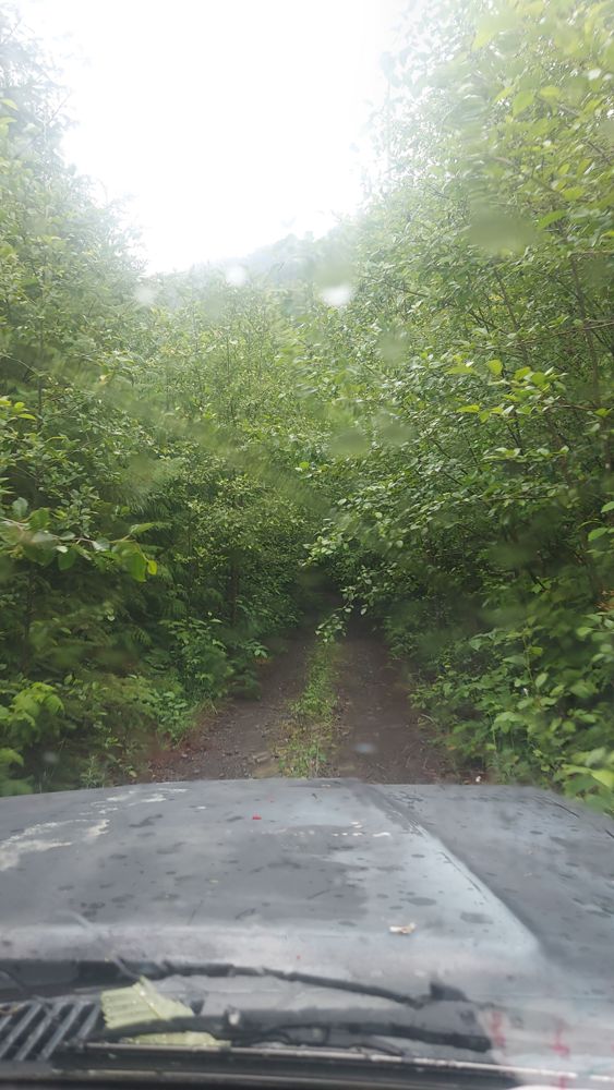
Made it all the way to the end. There is no gate on this portion. There is one though a ways south down the nitinat main. I'll post a report about it ...
Ben Soer - Jul 19, 2026Nitinat Main
1dAWD friendly. Honestly a wonderful drive, a ton of it is paved, to the quality and level you start wondering whether this is some public farmland road...
Ben Soer - Jul 19, 2026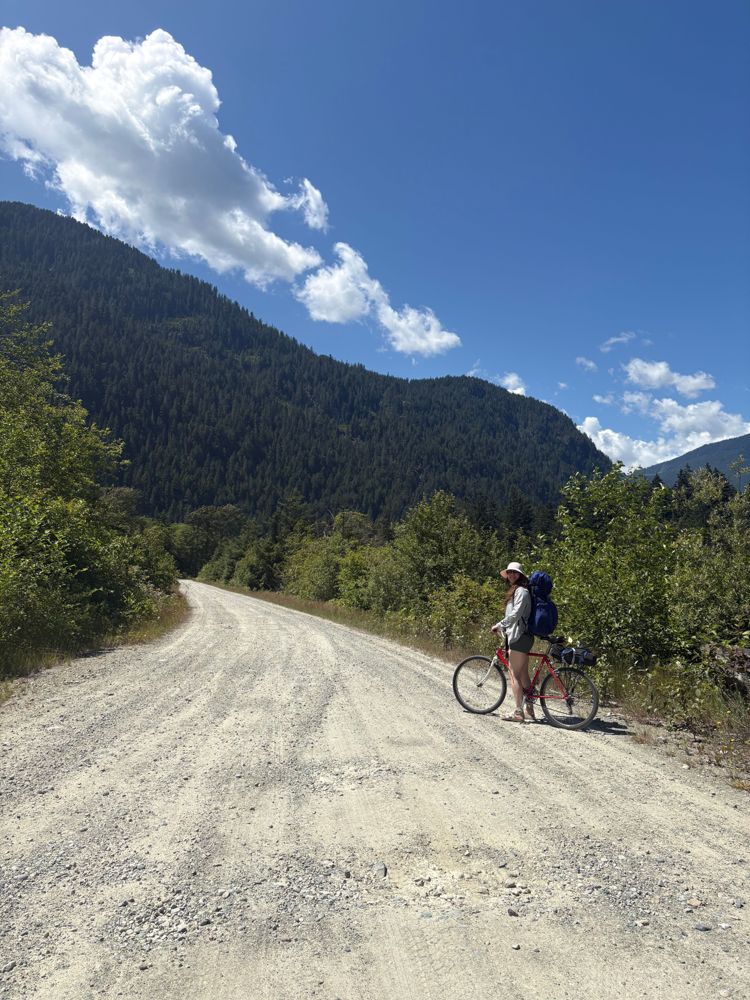
Very well maintained, lots of trucks parked at the dock and driving down the road. Many potholes but no washouts.
Andrea Tate - Jun 21, 2026SL1
1d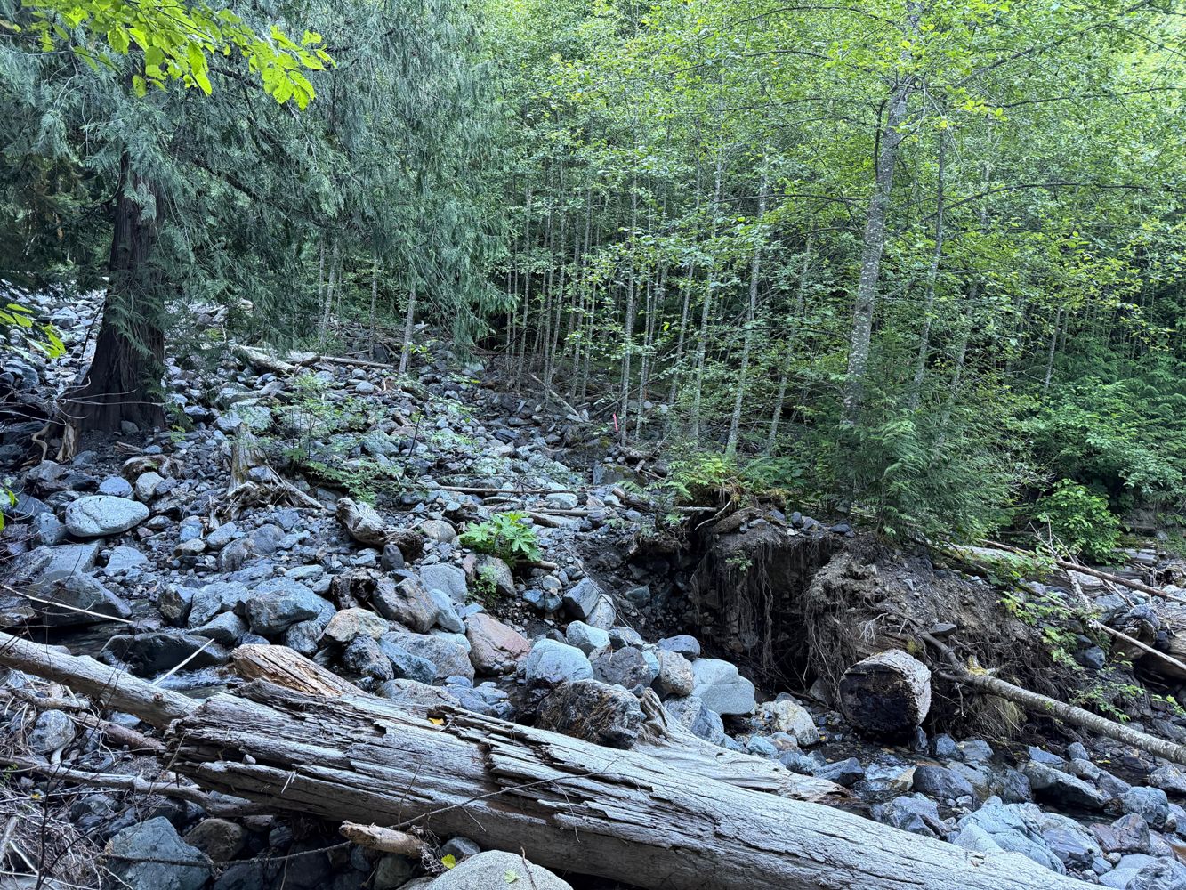
Only drove/biked/walked as far as SL-2 turnoff. The road is bikeable to the major washout at 1.6km. After that it's not worth it.
Francis Bailey - Jul 19, 202617.6.1
1dRemoved downed tree around 0.5 km. Decent shape and narrow, possible to turn around at a few spots.
Alex Harris - Apr 16, 2026Bridge Main
1dSurprisingly good condition and seemingly maintained all the way to the end.
Alex Harris - Oct 04, 2025SUKUNKA
2dActive industry road. Maintained and 2wd passable. Radio recommended.
Washout at 60km is only passable by ATV.
Nitinat Main
3d

Gate was locked - as per most weekends. Note: Actual gate location is slightly off on the map. Gate is located southside of bridge across Redbed Cre...
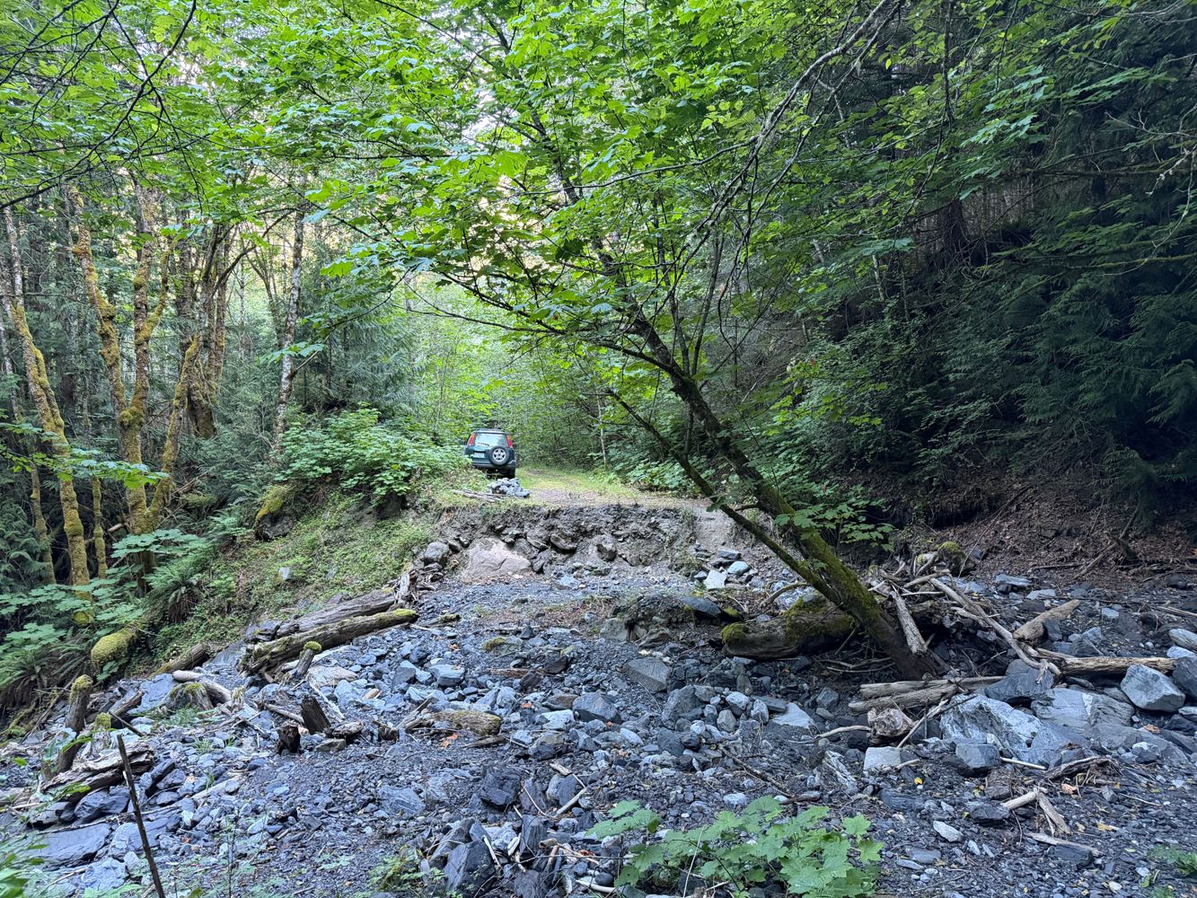
Mick Gillis - Jul 25, 2026Impassable, trench has been dug into the road in front of the bridge alongside cement barriers
Robert Jakes - Jul 28, 2026Road is rough from 11 km to highway, flooding at (I believe?) 15 km and 8 km. 15 km flooding would likely stop some lower-riding vehicles.
Bridge i...
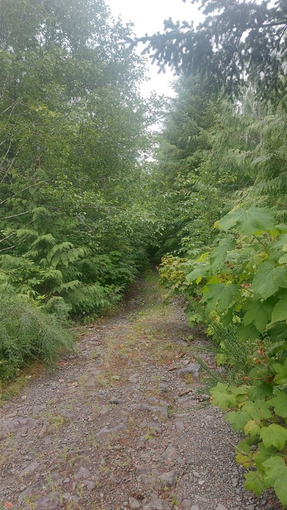
Drove along East Tahsis Main for 3.8km. Road surface generally in good condition, no waterbars. Very driveable, however road is overgrown with bushes ...
Joe John - Jul 11, 2026We biked through Little Elk Pass from Palliser-Albert rec (entered Cochran via obscured "Branch A", just beyond the first bridge in Cochran), and a la...
Adam Ess - Jul 18, 2026SILVER SANDS
6dCross ditched but drivable with 4x4 to power line. ATV only after powerline as road is deactivated and being used as access to snowmobile area.
Alan Smithee - Jul 15, 2026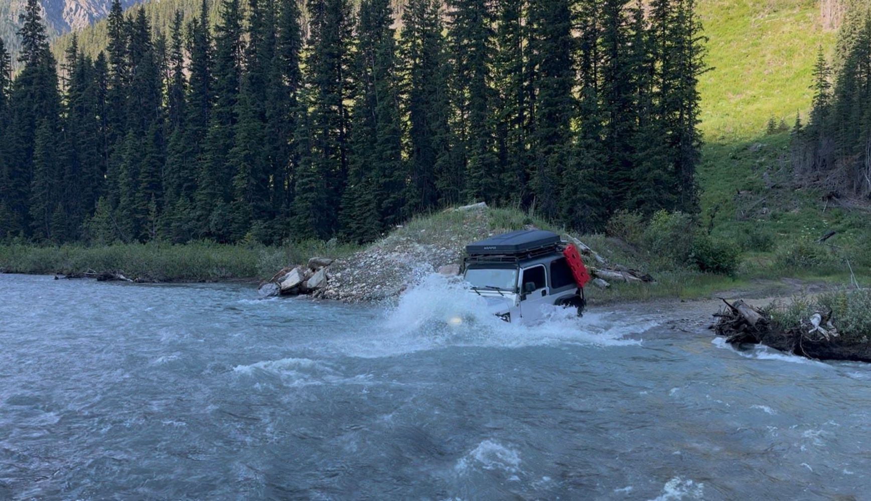
Road passes through a creek that has become quite deep, about 3.5-4.5ft deep. Snorkel recommended. Pic is of deepest part on the return
TJ Jeep - Jul 12, 2026Road Updates
SUKUNKA
New ![]() has been reported at 55.104, -121.896
has been reported at 55.104, -121.896
SUKUNKA
Road conditions have been updated to:
Nitinat Main
![]() has been verified at 48.95, -124.519
has been verified at 48.95, -124.519
Portage Canyon FSR
New ![]() has been reported at 53.899, -122.1
has been reported at 53.899, -122.1
Portage Canyon FSR
New ![]() has been reported at 53.899, -122.1
has been reported at 53.899, -122.1
Range Road 54ANew
Road added in the Alberta Resource District region
Township Road 204ANew
Road added in the Alberta Resource District region
ET-ML(EASTTAHSIS ML) EASTTAHSIS
Road conditions have been updated to:
Upper Cochran RoadNew
Road added in the Rocky Mountain Natural Resource District region
Little Elk Branch ANew
Road added in the Rocky Mountain Natural Resource District region
Signal Mountain Fire RoadNew
Road added in the Alberta Resource District region
SILVER SANDS
Road conditions have been updated to:
FOSTER CREEK 30
New ![]() has been reported at 50.481, -116.532
has been reported at 50.481, -116.532
Tretheway Creek BypassNew
Road added in the Chilliwack Natural Resource District region
Tretheway Powerline AccessNew
Road added in the Chilliwack Natural Resource District region
Tretheway Creek FSR
Road conditions have been updated to:
TRE100
Road conditions have been updated to:
TRE100
![]() has been removed at 49.685, -122.126
has been removed at 49.685, -122.126
Bremner Mainline
![]() has been removed at 49.672, -122.022
has been removed at 49.672, -122.022
Free to Use and Community Driven
Get up-to-date information about back country roads all over British Columbia, Alberta and the Yukon. Created by the community, for the community.
Detailed Reports
View road conditions broken down kilometer by kilometer and find the latest status on gates, bridges and washouts. Explore user submitted road reports and contribute your own with an easy-to-use road report system!
Explore the over 260,000 roads on the map and keep the community strong by sharing what you find on your adventures.


Toma Main
New ![]() has been reported at 49.514, -125.126
has been reported at 49.514, -125.126

Map Layers
Find cut block data, wildlife closure zones, recent satellite imagery and a host of base maps to make your planning a breeze.
Offline Road Data
Take service road information offline with your favourite mapping application. The Service Road Atlas supports road downloads and offline use in apps like Gaia, OSMAnd, Caltopo and more.


