HAYLMORE CREEK MAIN - "Haylmore Creek FSR"
Sea To Sky Natural Resource District
Distance
21.28 km
Last Road Report
Jul 13, 2026
Closures
No Posted Closures
Location
HAYLMORE CREEK MAIN
Permit Holder
District Manager Squamish (dsq)
Waypoints
Distance
21.28 km
Avg. Gradient
0%
Ascent
0m
Descent
0m
Last Road Report
Jul 13, 2026
Closures
No Posted Closures
Location
HAYLMORE CREEK MAIN
Permit Holder
District Manager Squamish (dsq)
Waypoints
Conditions
Start to 11.5 km
Good Condition
10d ago
11.5 to 12.5 km
Good Condition
39d ago
12.5 to 12.9 km
Good Condition
81d ago
12.9 to 13.3 km
Heavily Degraded
81d ago
13.3 to 16.5 km
Good Condition
326d ago
16.5 to 19.3 km
Good Condition
370d ago
19.3 to 21.3 km
Good Condition
676d ago
Description
No description.
Road Bulletins
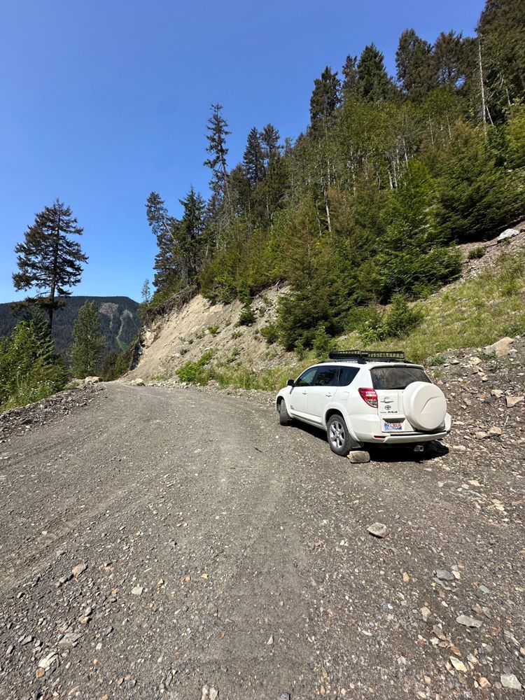
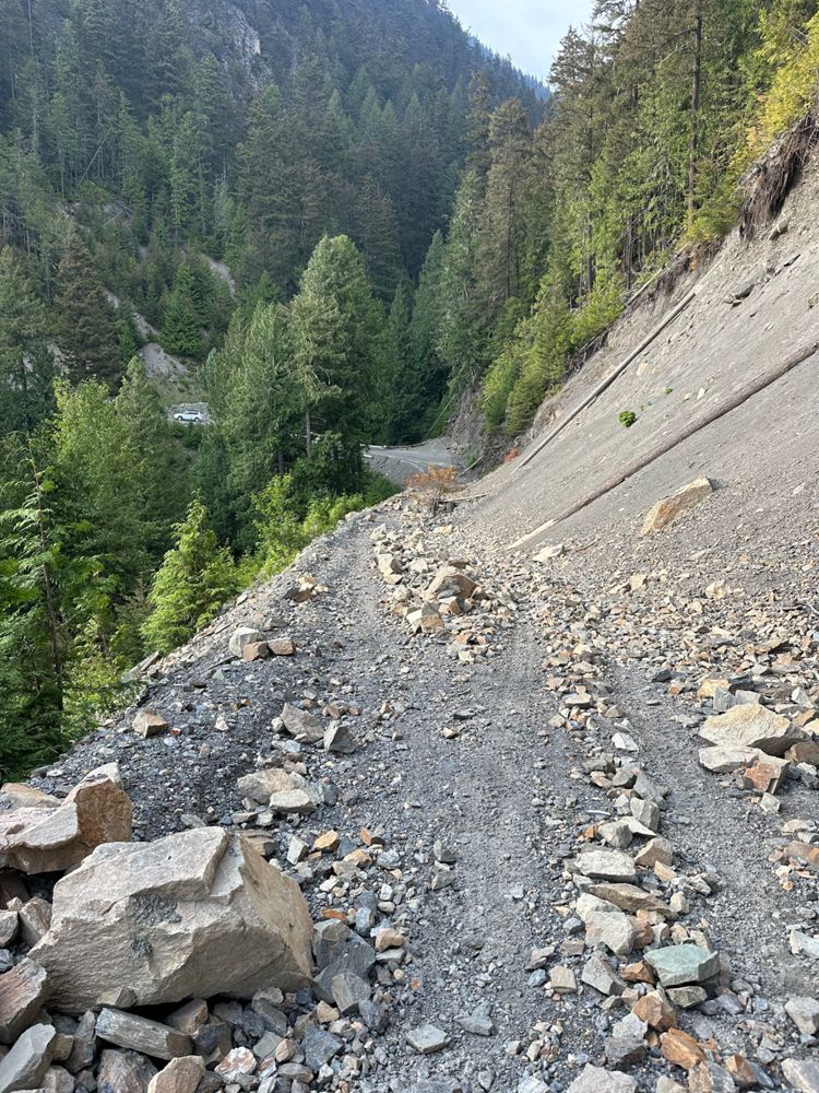
Not much has changed, some boulders have been moved to the side just before the bridge at 12km so you can park in a more open area.
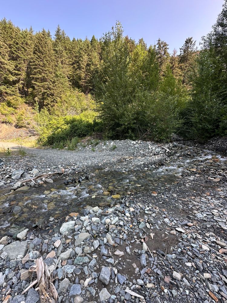
There was a small water runoff area that I was a bit worried about around the 6km mark, but my RAV4 made it over fine.
There was a small water runoff area that I was a bit worried about around the 6km mark, but my RAV4 made it over fine.
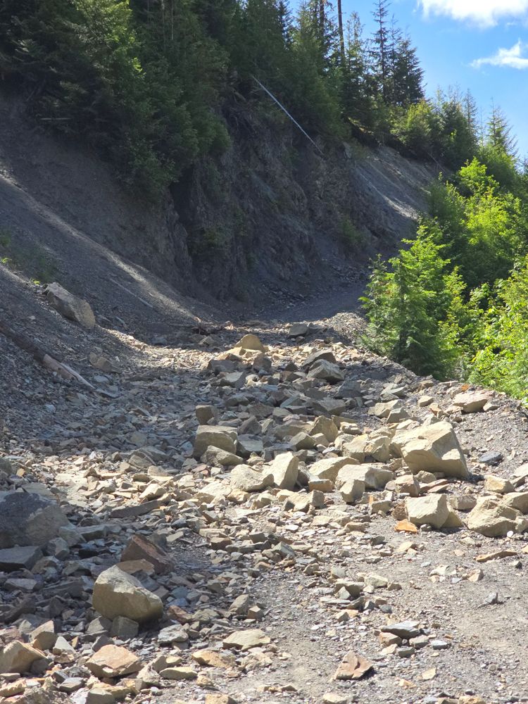
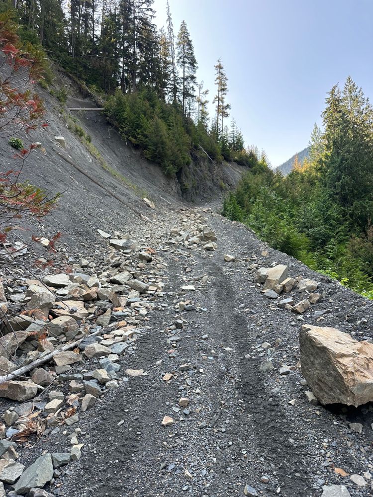
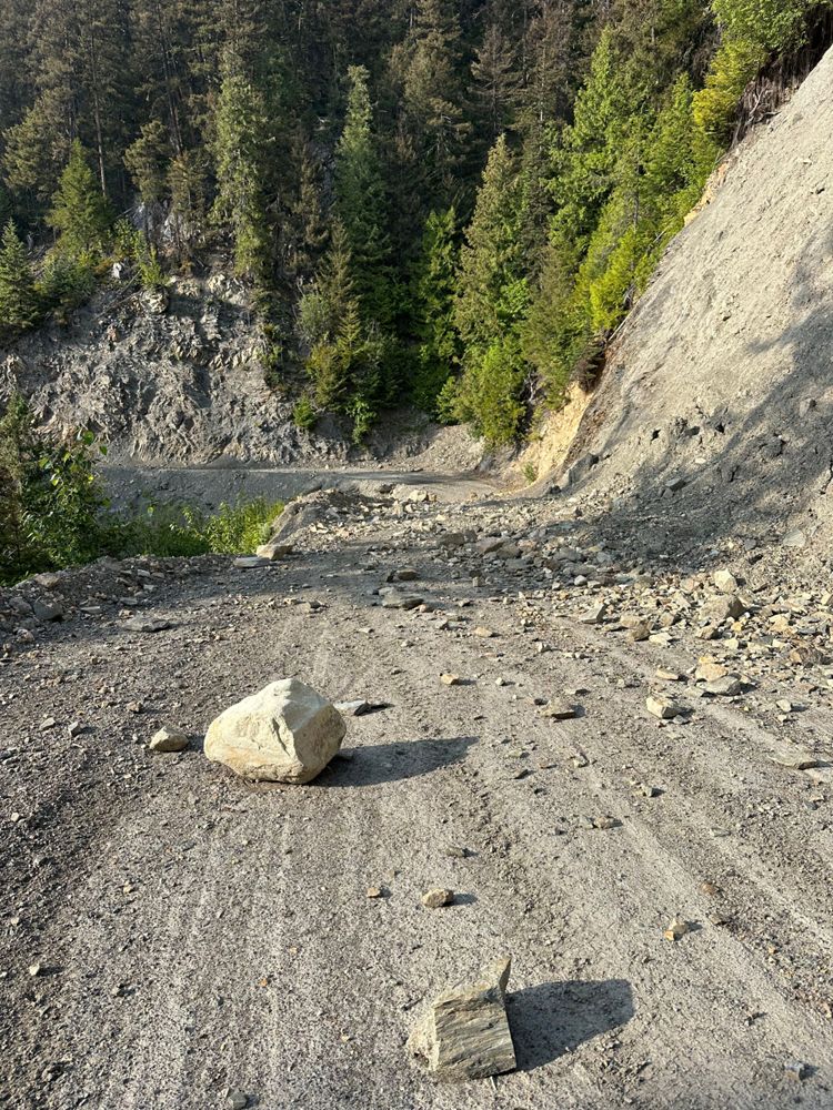
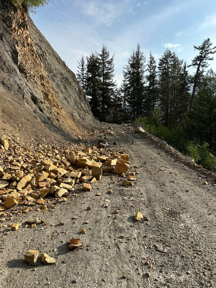
Road is still blocked at km12.5 up. One can see a line, but rocks are quite sharp and we aimed on the side of caution and walk the additional 2km to the trailhead.


Good 4WD condition most of the way, with a water crossing just after 8km. Completely blocked by rock fall on both sides of the major creek at 13km.
This will add a 2km walk to the Twin Lakes trailhead, with limited parking & turnaround space at the rockfall.
First time post - hopefully I marked the changes correctly! :-)
This will add a 2km walk to the Twin Lakes trailhead, with limited parking & turnaround space at the rockfall.
First time post - hopefully I marked the changes correctly! :-)

Good condition, drove over Common Johnny Creek bridge to the end of the current logging operation. Gate is present but was open.
Road is in good condition still. The waterbar at ~8.5km was doable in a Hyundai Santa Fe easily and i think any SUV can make it with no problem. I'm just not sure I'd bring my minivan past it
[From Paul R] - I have a Crosstrek. Easy peasy FSR. Just have to go ultra slow at the 8.5km washout, which has been expertly rock smoothed.
[From Lis M] - Quick condition update since there’s some decent info on the area. The road is in excellent conditions, any car can make it up there but note there’s a lot of small rocks so be careful of a puncture. (Drove up to Twin Lakes Trailhead only)


This road is in great condition and appears to have had recent road work done. We drove the Barkley Valley Trail in 2WD conditions. Further beyond, we could hear heavy machinery operation so I can't speak to the conditions after that.