Williamson Lake FSR
Chilliwack Natural Resource District
Distance
4.50 km
Last Road Report
Jun 14, 2026
Closures
No Posted Closures
Location
Williamson Lake FSR
Permit Holder
Western Canadian Timber Products Ltd.
Waypoints
Distance
4.50 km
Avg. Gradient
0%
Ascent
0m
Descent
0m
Last Road Report
Jun 14, 2026
Closures
No Posted Closures
Location
Williamson Lake FSR
Permit Holder
Western Canadian Timber Products Ltd.
Waypoints
Conditions
Start to 4.5 km
Heavily Degraded
39d ago
Description
No description.
Road Bulletins
Drove this to get to the Williamson lake trailhead
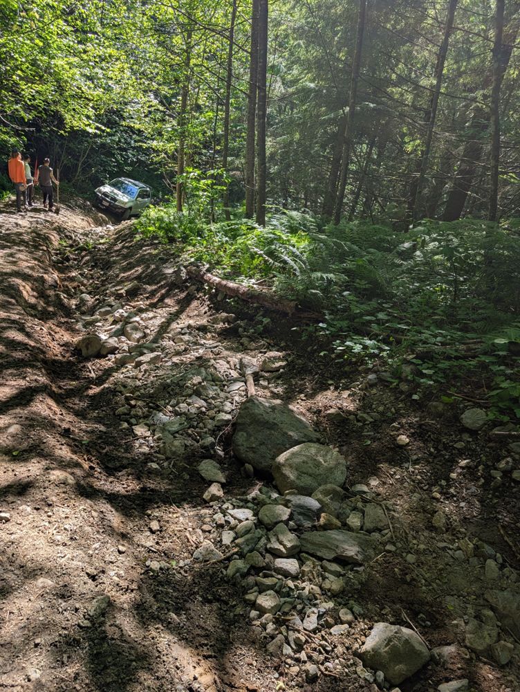
Took some work moving boulders and shoveling some dirt around to fill in the worst spots in some places. But eventually my 3rd gen grand Vitara with 30" tires and open diffs made it up, so can't call this impassable
Definitely a hi clearance 4x4 road and not for the faint of heart. Maybe not true for those with solid axles and lots of articulation but there were a lot of spots for me that required commiting and riding through features to avoid tipping. This is a high commitment drive with lots of big boulders that can cause damage. Some washouts are very steep and deep, one I stopped in the bottom when I shouldn't have and we needed to push to get enough power to get out with the hitch hanging up

Highly suggest you scout ahead each switchback if you choose to drive beyond my marker.
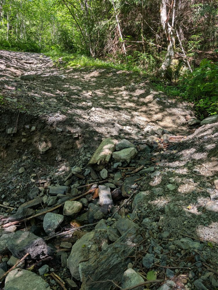
Severe road conditions and risks, new washout has run down the center of the FSR starting at the impasse mark creating a trench in the center, and very deep off camber trenches.
I've marked it entirely as an impasse, because vehicles will clear this on unique basis.
Erosion is quite sharp, the smaller washouts start at about three to four feet wide, and about a foot deep.
Several dead falls, probably more soon.
Large boulder in the center at about 3.25
Rapidly changing from previously pictured, aside from the final alder section, which now has faced several rock slides.
For those with ATVs and dirt bikes, it is doable. Dog sized rocks are out for blood, riders beware.


For reference; third gen longbox taco, 2inch lift on 33s
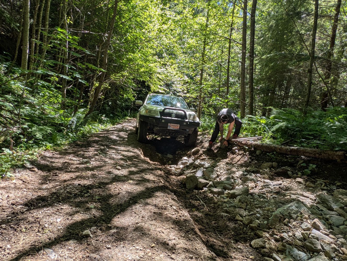
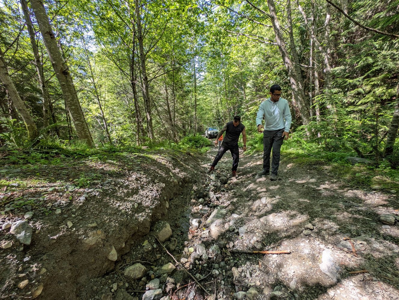
as others have said road heavily degraded and very overgrown. IMO 3 cruxes, initial washout that is off camber and steeper to exit than appears in photos, both up/down began to slide sideways, IMO worst section. Second is a hill that had two large boulders sticking out that looked like they wanted to snag underbelly, we removed one and took a line to the left. Final one is at the end and due to longbox had to go over the rocks W/ a ramp we built. Shorter wheelbase can zigzag this easily. ***key point*** there's a pullout just after first washout, after this there's no more turning around so you're stuck if you can't make it past something so keep that in mind if you felt you were already pushing yourself.
as others have said road heavily degraded and very overgrown. IMO 3 cruxes, initial washout that is off camber and steeper to exit than appears in photos, both up/down began to slide sideways, IMO worst section. Second is a hill that had two large boulders sticking out that looked like they wanted to snag underbelly, we removed one and took a line to the left. Final one is at the end and due to longbox had to go over the rocks W/ a ramp we built. Shorter wheelbase can zigzag this easily. ***key point*** there's a pullout just after first washout, after this there's no more turning around so you're stuck if you can't make it past something so keep that in mind if you felt you were already pushing yourself.


Super rocky & bumpy, may have gotten slightly worse compared to last year but still ok in HC 4x4 for now. The upper crux looks intimidating but was totally fine, I found the narrow off camber spot on Foley Lake FSR sketchier than anything on this road.
No major change from previous reports. Still very rough and bushy. HC 4x4 definitely required. One cross ditch about half way up has possibly gotten worse -- seemed very eroded and quite spicy. But made it to trailhead in my FJ Cruiser without issue.
High clearance 4wd could go a bit up this road but quickly becomes steep with big loose rocks. ATV tracks noted in the snow pretty much to the top though.
Mostly the same condition as Seans report, just covered in a layer of snow. Snow coverage was thin on the road due to tree cover as well as water running down the road. (If it gets well below freezing for a few days I would expect this road to be an ice rink.) After approximately KM 2 there was less water and the snow started to build up. We were able to make it up to the trailhead, but the final crux in Seans report was particularly difficult. Roughly 40CM of snow at the trailhead. The cross ditch at 49.13290° N, 121.57390° W has definitely become deeper since I was last up here. Scraped the hitch really good on the way up and had to fill in part of the ditch on the way down to get across.


Not as bad as I expected, no major issues reaching Williamson Lake trailhead. I stopped to assess my line twice, once around ~850m where there was a large pointy rock in the middle of the road at a waterbar & again somewhere higher up (around 1,000m maybe?). No damage taken, didn't bottom out at any point. Still, this road is steep, rocky & narrow, no AWDs need apply, HC4x4 only. Alders were not that bad at all so don't know if someone has done some trimming? Ford Mountain FSR alders were 10x worse for reference.


Not a ton to add on top of Anton's nice report. The road is quite rough with TONS of alder. It is seriously bad, I really think this road will be lost in just a few years without maintenance. I tried to drive to the sides an run over some alder but it is so healthy it just springs back up. Seriously looking into a brush cutter and doing some work. On the road side of things I found it quite steep and rough leaving it in 4L and 1st gear at just putted the whole way up. Washout at ~800m which Francis describes could definitely stop people that need to drive their vehicle to work the next day. Past 2.5km I hope you painted your vehicle with a rattle can like I did because the alder gets real scratchy. Nice parking up top with room for 4-5 vehicles.
The road hasn't deteriorated since the last update in 2022, but it remains in very poor condition. A high-clearance 4x4 vehicle is essential to reach the Williamson Lake trailhead. We managed to make it to the end in a Tacoma without issues, though the pinstriping was severe. Had to exit the vehicle several times to assess the best route across water bars and large rocks in the road.


I found the road was in rough shape with a few very deep and narrow cross ditches that were impossible to avoid scraping on. Higher up I had to park after nearly getting high centered in my Tacoma at around 800m. Two vehicles did make it to the trail head though, so it's likely that more skilled drivers can make it the whole way.