BULL/QUINN CK
Rocky Mountain Natural Resource District
Distance
28.97 km
Last Road Report
Sep 01, 2026
Closures
No Posted Closures
Location
BULL/QUINN CK
Permit Holder
District Manager Rocky Mountain (drm)
Waypoints
Conditions
Start to 0.1 km
Heavily Degraded
82d ago
0.1 to 8.9 km
Somewhat Degraded
82d ago
8.9 to 18.6 km
Heavily Degraded
82d ago
18.6 to 20.7 km
Heavily Degraded
1896d ago
20.7 to 21.3 km
Impassable
57d ago
21.3 to 25.0 km
Heavily Degraded
1896d ago
25.0 to 29.0 km
Somewhat Degraded
27d ago
Description
No description.
Road Bulletins
Distance Travelled
10.10km
Came from the north via the Blackfoot FSR. Better than we expected. A few rougher spots where moderate clearance is required. Seems like it can be soft at times. The bridge over the creek draining from the Delta Wing-Haynes Cirque is out and requires clearance and likely 4WD, but we decided to just walk the last 500m.
Distance Travelled:
4.02 km
Modes of Travel
Distance Travelled
10.10km
Km 20.5 to 21.5 Quinn Creek is now running on what used to be the road. Somewhat difficult to pass on a motorcycle, SxS could be challenging.
Modes of Travel:
Distance Travelled:
0.62 km
Distance Travelled
10.10km
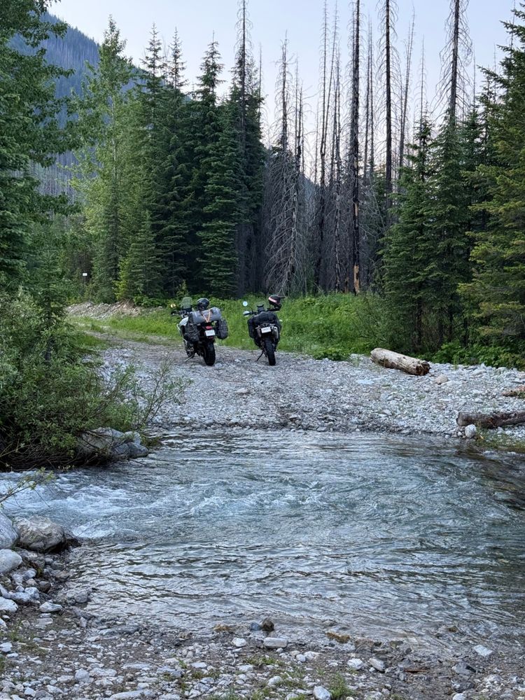
Totally impassable for cars. Took the motorcycles up to explore, crossed through the river at several points where the bridges washed out but eventually the road became totally impassable for any kind of vehicles. Completely washed out.
Distance Travelled:
18.62 km
Distance Travelled
10.10km
I drove this road through to the Blackfoot FSR in 2016, but this video in 2021 suggests it is not driveable at what I believe is the 9 km mark.
https://www.youtube.com/watch?v=iG0g7inVZTc&t=540s
https://www.youtube.com/watch?v=iG0g7inVZTc&t=540s