Blowdown Pass Connector
Cascades Natural Resource District
Distance
4.89 km
Last Road Report
Jul 04, 2026
Closures
No Posted Closures
Location
Blowdown Pass Connector
Permit Holder
Interwest Timber Ltd.
Waypoints
Conditions
Start to 0.6 km
Good Condition
101d ago
0.6 to 0.6 km
Good Condition
412d ago
0.6 to 4.9 km
Heavily Degraded
443d ago
Description
No description.
Road Bulletins
Distance Travelled
10.10km
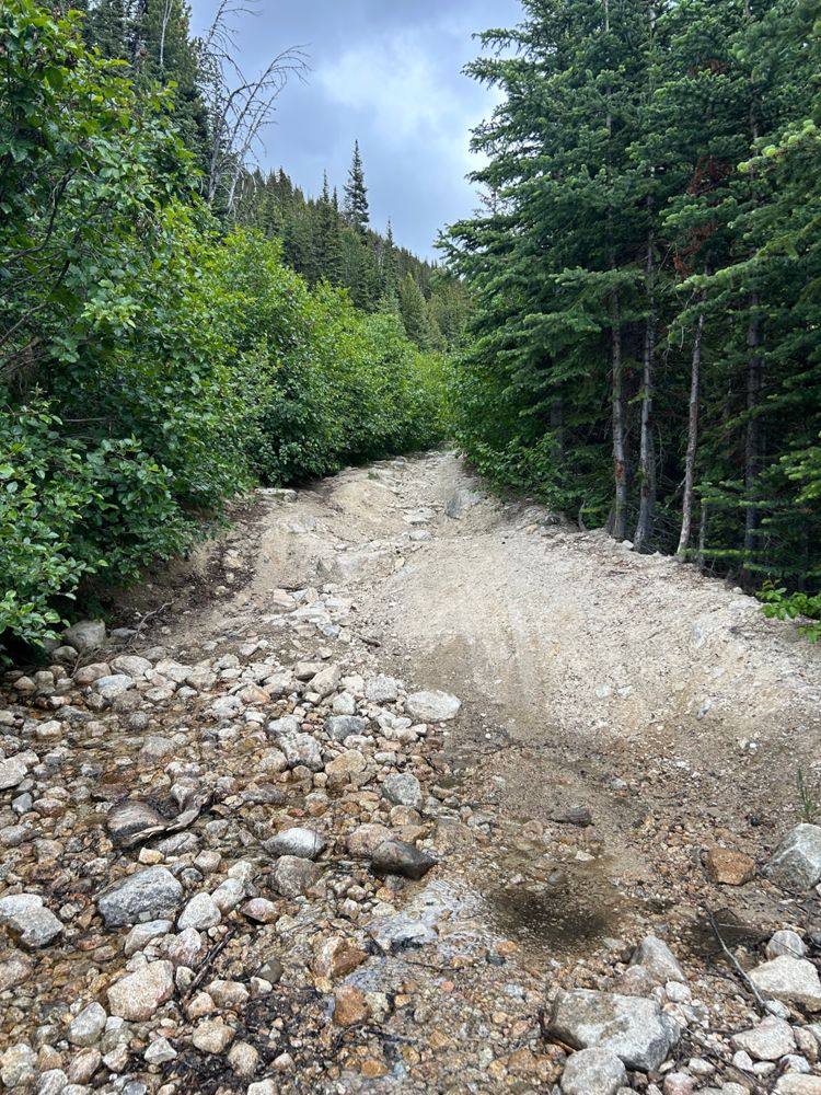
Just wanted to update that it was the same as described before. Went up with Forester. This photo I've included is representative of some water bars on the road beyond the typical stopping point. A truck did get up higher, but I couldn't tell make/model.
Distance Travelled:
0.56 km
Distance Travelled
10.10km
I was easily able to drive the first c. 600m in a stock, gas RAV4 to where there were several vehicles parked. Beyond this, the road bends to the left, and becomes very overgrown and rough. There are a couple of small water bars in first c. 600m. I think you could take any SUV to this point, except if very wet. Beyond this, you would need a proper 4x4, and be a skilled driver.
Distance Travelled
10.10km
Didn't drive this section at all but have hiked it a few times, including recently. A capable high clearance 4x4 could make it but would involve quite a bit of effort. We decided just to leave our Xterra Pro4x at the trailhead and walk it. Some recent evidence of alder clearing in the first few hundred m but someone must have stopped. No major turnaround areas until you get to around 2000m just before the pass opens up.
Distance Travelled
10.10km
Previous reports are still valid. Pretty heavy pin stripping at the beginning, no options to turn around. The worst section is the first 200m so you can always walk there to evaluate things (gets better beyond that). Saw a Wrangler parked a few meters below the Gott-Gotcha col.
Distance Travelled
10.10km
As others reported, heavy pinstriping and at least one challenging washout section requiring high clearance 4x4. Passable in a stock Jeep Wrangler. Almost no pullouts so hopefully you don't meet anyone going the other way.
Distance Travelled
10.10km
Drove all the way to the pass (Stein closure signage). Road was extremely narrow with lots of bad pinstriping. Some small/moderate washout sections but same condition as previous years. Alder is the main problem here. Snow free road to the pass.


Distance Travelled
10.10km
The lower section is extremely grown in and you are all but certain to get pin striping here. There are only a handful of spots where you can pull over/park until you reach the clearing at ~1970m of elevation. There is one crux section that I found quite challenging in a Tacoma and had to resort to locking my diffs to get through it. After that is another narrow off-camber section but you can drive slow. Overall, not super worth it to drive in my opinion as it's not a far walk from the normal trail head. After the road opens up again, the condition improves drastically and one could easily drive all the way to the pass.
Distance Travelled
10.10km
Driveable to the pass with 4x4 HC, road is narrow and very grown in - pinstripes guaranteed. Something smaller like the Suzuki Samurai we saw make it up is advisable. We walked from the turnoff as it's only a few kms and I didn't want to thrash my truck. MTB would work and save time over walking.