Tim K
Status: Maintainer
Join Date: Feb 14, 2024
Location: Squamish, BC
Contribution Points: 408
(6 points each)
(2 points each)
Recent Contributions
ARROWSTONE
27d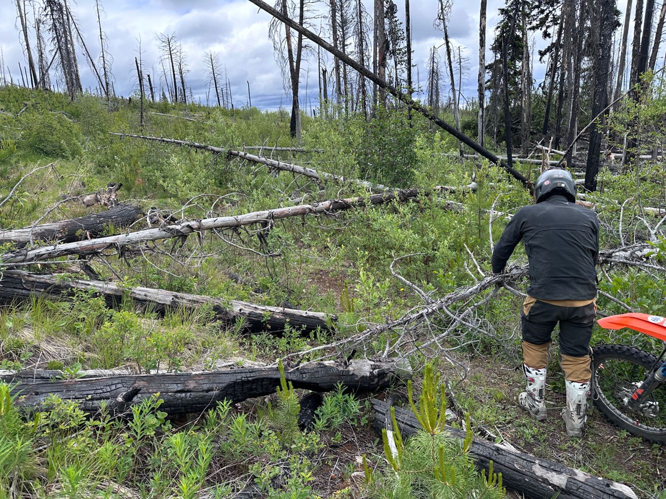
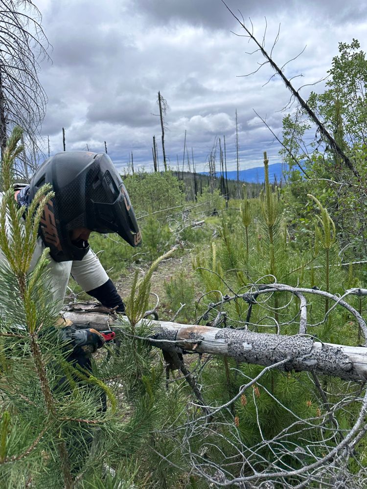
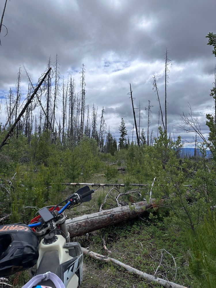
Traveled south on dirtbikes. Total deadfall rodeo. Gave up at around km 5. A HC Samurai armed with patience and a chainsaw could restore this worthy l...
Tim K - Jun 20, 2026Battle Creek FSR
28dTraveled south on dirtbikes. Decent overall condition with a mix of ruts and rocky sections.
We poked our heads in to the section south of Deadman's ...
METEROR MINE RD. 5A
285d
Starts out just south of "heavily degraded" and gets worse the higher you go. Rocks, loose rocks, embedded rocks, small rocks, and other assorted rock...
Tim K - Sep 18, 2025Reco Cody Connector
285dIn sections narrow, overgrown, loose, with tight corners that never seem to end. Likely only for SxS, ATV, dirt bikes etc.
Tim K - Sep 17, 2025Reco Pass Connector
285d
High clearance only. Super duper rough. Rocky and loose throughout with steeper sections. Worth it.
Tim K - Sep 17, 2025
In parts rocky, steep, loose, with water bars, overgrowth, tight corners, and a couple of boulders that block almost the full width. Significantly wor...
Tim K - Sep 15, 2025

SECTION_FOUR 4
285dAfter leaving Shannon Caribou, this section gets immediately degraded. Shallow water bars with 2-3 shallow water crossings.
Tim K - Sep 15, 2025

Rough but passable till after 4.5km then it gets variably steep, loose, and rocky until "The Intersection" at 7km. The ridge road itself is a narrow d...
Tim K - Sep 15, 2025Elaho West Main
395dRough going up to the bridge, which is IN, and a large log across the road just beyond the bridge.
Tim K - Jun 22, 2025
DEADEYE MAIN H
543dDisused FSR section. A varied buffet of pot holes, shallow water bars, and encroaching alders.
Tim K - Sep 21, 2024Travelled west to east. More overgrown and tighter than Deadeye K. Gets super tight and shrubby in the final 50m before spitting you out on to BR 4800...
Tim K - Sep 21, 2024Levette Lake FSR
568dSection from Evans Lake gate to Upper Levette Lake Parking has been graveled and graded and seems 2WD compatible all the way. The "EVO DESTROYER Hill"...
Tim K - Dec 31, 2024
MUD LAKES 28-Y10-01
648dDouble-track all the way. Lots of waterbars, some sneakier than others. Some rock debris here and there.
Tim K - Oct 12, 2024Description only for section west of 12km intersection.
From the Gorman Bros cutblock eastbound to 12km, road has innumerable waterbars and tank trap...
CORNWALL CREEK
663dTraveled eastbound. Starts as a rough doubletrack that weaves its way through cattle country. Plenty of ruts and cattle guards. Starts to open up and ...
Tim K - Sep 19, 2024Simem Creek ATV Spur
663dTravelled eastbound. Well-defined ATV trail. At approx 1.6km, stay right to avoid private property.
At approx 1.7km (1286m) trail becomes very steep...
ATV trail that crosses the Siwash Creek (marked as Bridge Out). Creek is shallow and crossing is at grade (no embankments). Trail is fairly rough in m...
Tim K - Sep 20, 2024East Tulameen FSR
701dRoad is in decent shape but bridge over Britton Creek is likely out. As you leave town a sign reads "Road Closed Ahead" but gives no further info. I'l...
Tim K - Aug 17, 2024Rode this from north to south. Bridge over Tulameen River is good. Bridge over Hines Creek at ~985m is dangerously degraded but could be crossed by Sx...
Tim K - Aug 17, 2024LONG LAKE MAIN
767dThis Main services a number of rec sites and trailheads so it sees traffic and seems to be somewhat maintained. Solidly ok condition.
Tim K - Jun 03, 2024HOOK-UP TO 146MAIN
767dFrom east to west this road section goes from tight overgrown double track to somewhat ok double track with a 30ish meter water crossing.
Tim K - Jun 03, 2024OLD ATLUCK
771dTank traps at north and west end of this corner section. Atluck Main rerouted into active cutblock.
Tim K - Jun 04, 2024City of Paris Road
810dRough ATV track. Loose, rocky, narrow, and steep in parts. Skirts past some residences.
Tim K - Sep 16, 2023

This is a hydro road that connects Maryland and Dodge creek FSR networks. It's steep, loose, chunky, and can be dusty. Some compact areas.
Tim K - Sep 17, 2023Lawless-Britton FSR
811d

Strictly speaking this road is impassable due to washouts and the concrete barricades at 2.9 and ~7.5km. Between these barricades are a handful of sma...
Tim K - Sep 15, 2023DODGE CREEK
812d

Good condition road giving excellent views of the Creston Valley and Moyie Range.
Tim K - Sep 17, 2023MARYLAND SYSTEM
812dWell bedded logging road. Very good and clear up to the Boundary Lake Rec Site but east of that we find occasional forestry debris on the road.
Tim K - Sep 17, 2023High Bar Road
812d


Paying attention to the road can be challenging due to the obtrusive views. Some steep and loose sandy sections on the switchbacks at the south end of...
Tim K - May 26, 2023Old Cascade Highway
816d
Hey, you like views, low traffic, random rec sites, and babbling brooks? Well this is the road for you. Seems to be semi-regularly graded. Double gree...
Tim K - Sep 17, 2023THOMPSON CR. R
825d
Easy 4WD or tough 2WD, easy moto. Loose n loamy single track rising NE above the end of the road may or may not link up with Russell Creek FSR to the ...
Tim K - Sep 18, 2023
Mamquam Branch 2
859dDegraded, loose, and overgrown. Bordering on the impassable. Not remotely pleasant, which will entice some.
Nice views from the top of Mamquam, Nch'...
Levette Lake FSR
859dGate above Levette Lake parking is occasionally open, but most often closed. Road to Hut Lake is bad (fun):
https://www.youtube.com/watch?v=jZ2weLH...
Norton Lake FSR
861dHopefully gives a clear impression of road condition on June 24, 2023:
https://www.youtube.com/watch?v=L-HHJQOwjqc