Roe Creek FSR
Sea To Sky Natural Resource District
Distance
9.03 km
Last Road Report
May 31, 2026
Closures
No Posted Closures
Location
Roe Creek FSR
Permit Holder
Black Mount Logging Inc.
Waypoints
Distance
9.03 km
Avg. Gradient
0%
Ascent
0m
Descent
0m
Last Road Report
May 31, 2026
Closures
No Posted Closures
Location
Roe Creek FSR
Permit Holder
Black Mount Logging Inc.
Waypoints
Conditions
Start to 1.5 km
Good Condition
53d ago
1.5 to 2.8 km
Somewhat Degraded
53d ago
2.8 to 3.5 km
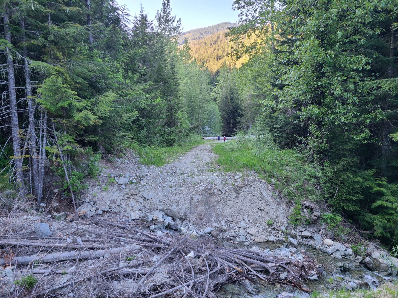
Impassable
53d ago
3.5 to 9.0 km
Impassable
632d ago
Description
No description.
Road Bulletins
No major changes from last update. Road is snow free and had no issues driving in a midsize SUV with average ground clearance and AWD (Nissan X-Trail). There were two areas with a dip in the road that might stop lower clearance vehicles. A Subaru Crosstrek also made it to the parking area by the washout.
The washout is pretty deep and impassible for any vehicle.
The washout is pretty deep and impassible for any vehicle.
Condition remains the same as Thomas's report in August. I will add that it's possible to hike a pedal/E bike up the majority of the Fsr switchbacks. There are 2 big obstacles you'd have to carry and/or lift your bike through that are already marked with X on map. Some of the road beyond is getting grown in for a few hundred meters but still very manageable. I mention this mostly for the skiers looking to access this in the coming season.
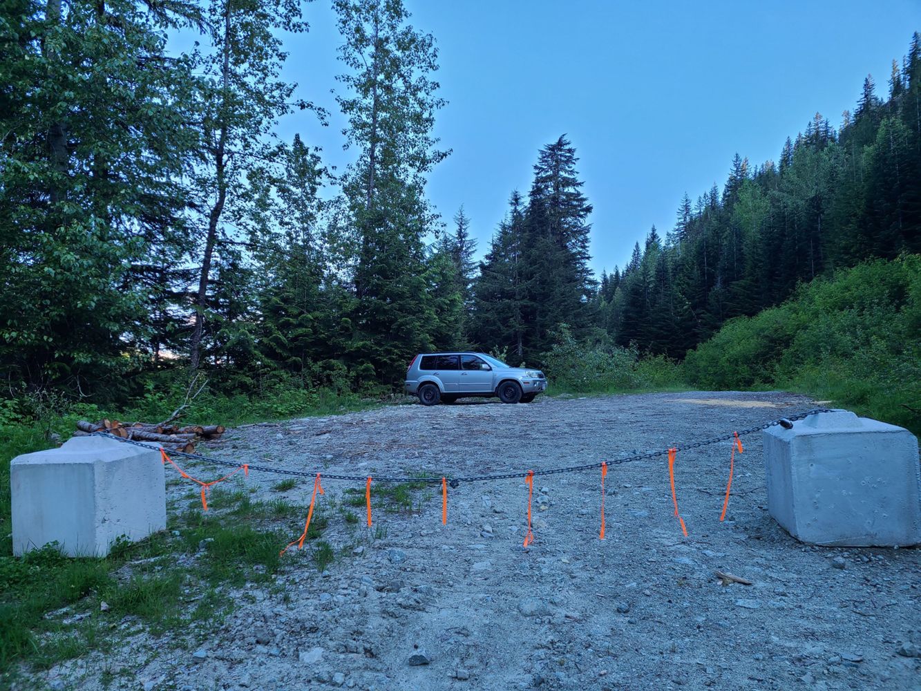
Early road up to gated split is in typical good condition, after that a little rougher but even a casual SUV will make it to the main impasse washout. Blocked off with a locked chain between concrete blocks to prevent people from attempting to cross the large washout.
Road is in good shape upto the large washout at around 3km. A few small cross ditches and a bit rocky. Any AWD vehicle should make it up and likely some 2wd (to 3km). Large concrete barriers have been installed just before the washout. Washout will stop even the most rugged 4x4 i think.


DateStamp 20250426: The cross ditch at 2.9km has become even deeper this year (around 1-1.2 meter in depth), and the large log shown in Leonardo Iezzi’s report from August 10, 2023 — previously might be usable as a vehicle "ramp" — has been completely removed.
Large patch of snow and ice at 700m elevation, thereafter mostly snow free to where the Brew summer trail branches off at 900m elevation

Snowy starting from the beginning this morning but by the evening only the last driveable km had snow. Road is otherwise in the same condition as Gavin reported
Good condition up to 1.5 km where cross ditches started. Seems doable in my Pilot Trailsport, but turned around because sun was setting.


Up to the washout at roughly 2.8km the road is fine with a couple easily passable cross ditches. After the washout to R200 there are some deeper cross ditches but passable on bike. The washout is worse than any of the ditches to follow on Roe Creek FSR. R200 has a couple massive perpendicular logs blocking the road at the turn, I didn’t go that way but I assume on bike/foot you can make your way around. Continuing on from R200 the road gets very overgrown, has a couple open sections but also has some sections that looked fully closed in some cross ditches as well and creek crossings but nothing worth noting.
[From Dan Cudlip] - We E-biked from the bridge at roe creek, and then hit patchy snow shortly after the spur road for Brew.
The road is in kind of mediocre shape… it’s mostly on… but there are a LOT of aggressive water bars, and the second half is moderately overgrown.
The road is in kind of mediocre shape… it’s mostly on… but there are a LOT of aggressive water bars, and the second half is moderately overgrown.

Drove the road to 2.9km, fully snow covered. We used chains but good snow tires would be fine still as it isn’t too steep or deep snow. As previously mentioned there is a huge ditch at 2.9km and with the snow now it definitely would not be drivable for anyone.


[From Graham Kelly] - The cross-ditch previously reported before the R-100 branch is now a massive impasse with a deactivation sign. Stock 4x4 HC vehicles are not likely to make it, but specialized vehicles may be able to. This impasse adds another 4.4 km to the Brew Mountain trail head.
