Recent Bulletins
If coming from Sloquet Side there’s a large hill with some very sharp rocks and some pretty big ruts at the crest of the hill, MDX with street tires m...
Taylor Barndt - Jul 04, 2026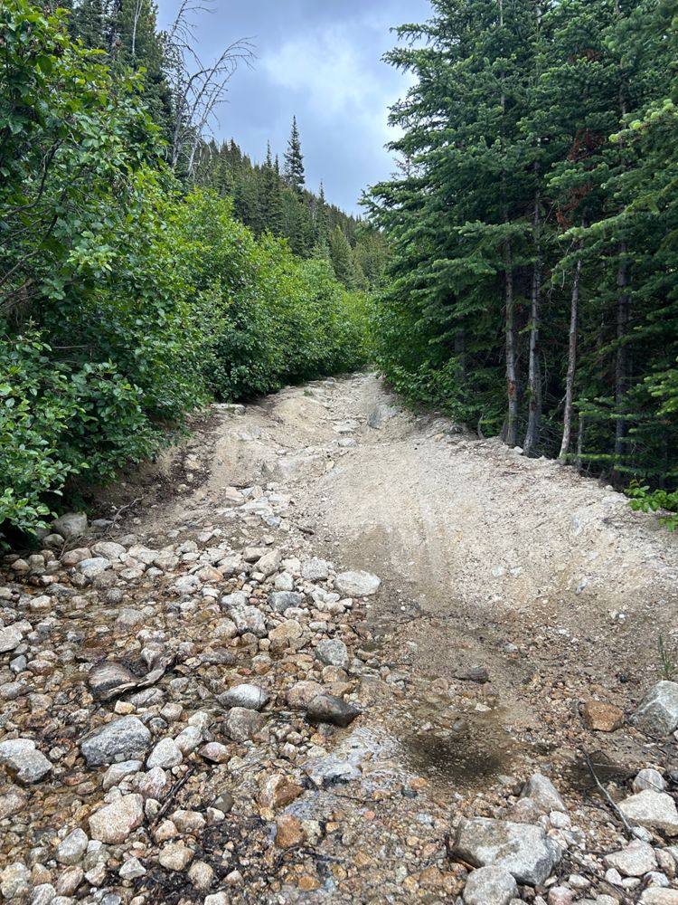
Just wanted to update that it was the same as described before. Went up with Forester. This photo I've included is representative of some water bars o...
Ashley Bronwyn - Jul 04, 2026Road condition is still manageable for a stock crossover. I made it up there with crosstrek.
There are 2 water bars that I had to cross very carefull...
Miller Bench FSR
11h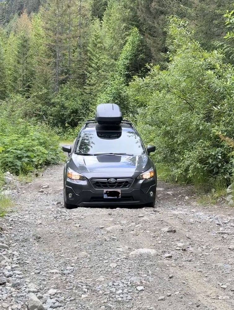
I made with a Crosstrek Stock. Even with a smaller car, I had a lot of scratching from overgrown vegetation.
Water bars were in the limit of depth ...
Great condition, AWD friendly. Mountain pass area from 33-36km is pretty spectacular. Turned around because I didn't fillup the tank before starting t...
Ben Soer - Jul 04, 2026Goat Lake Main
15hGreat condition until the 45.5km mark at the Dianne Lake Main. Logging traffic expected up until 41km mark, BR-1B seems to be active again. Two short ...
Stefan Feldmann - Jul 04, 2026EIGHT MILE
16h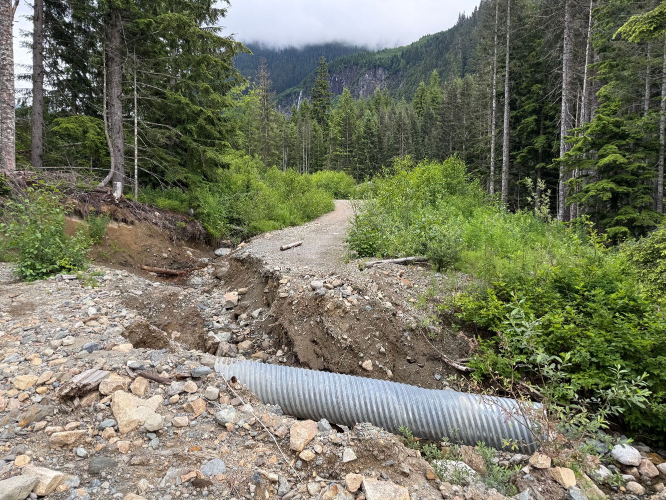
Great condition until 8km, small washout followed by an impassable one for all but ATVs. Following the washout, there are many smaller ones, and very ...
Geoff Doherty - Jul 04, 2026Very uneven, small slides and washouts. Narrow in some places. Passable in dirtbike with some technical riding.
Geoff Doherty - Jul 04, 2026Many washouts and small slides. Passable in dirtbike with a bit of technical riding.
Geoff Doherty - Jul 04, 2026EM2380
16hEIGHT MILE 6200
16h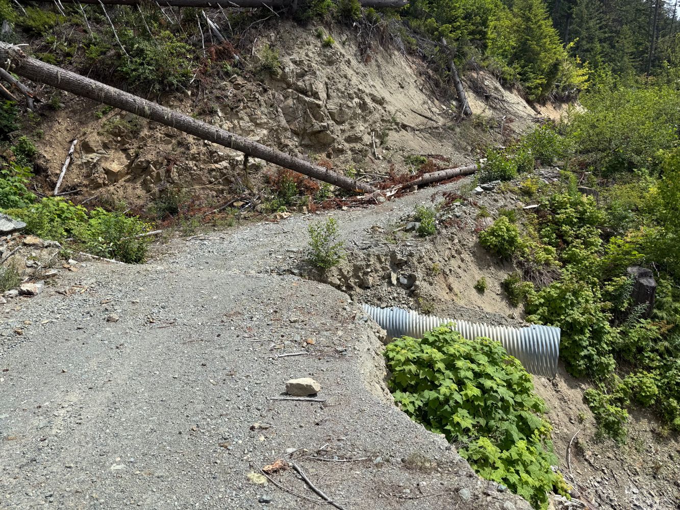
Good shape with some crossditches until 3km, road narrows and has lots of loose rock with some spots that would be quite tight in a full vehicle. Fair...
Geoff Doherty - Jul 04, 2026Road Updates
EIGHT MILE
Road conditions have been updated to:
EIGHT MILE
Road conditions have been updated to:
EIGHT MILE 6200
Road conditions have been updated to:
EIGHT MILE 6200
Road conditions have been updated to:
TERRACE LOOKOUT
Road conditions have been updated to:
CP847, BLOCK ROADS
Road conditions have been updated to:
Blue Grouse Mountain Road
Road conditions have been updated to:
Free to Use and Community Driven
Get up-to-date information about back country roads all over British Columbia, Alberta and the Yukon. Created by the community, for the community.
Detailed Reports
View road conditions broken down kilometer by kilometer and find the latest status on gates, bridges and washouts. Explore user submitted road reports and contribute your own with an easy-to-use road report system!
Explore the over 260,000 roads on the map and keep the community strong by sharing what you find on your adventures.


Toma Main
New ![]() has been reported at 49.514, -125.126
has been reported at 49.514, -125.126

Map Layers
Find cut block data, wildlife closure zones, recent satellite imagery and a host of base maps to make your planning a breeze.
Offline Road Data
Take service road information offline with your favourite mapping application. The Service Road Atlas supports road downloads and offline use in apps like Gaia, OSMAnd, Caltopo and more.


