Elaho Main
Sea To Sky Natural Resource District
Distance
41.66 km
Last Road Report
Jul 23, 2026
Closures
No Posted Closures
Location
Elaho Main
Permit Holder
Northwest Squamish Forestry Ltd.
Waypoints
Distance
41.66 km
Avg. Gradient
0%
Ascent
0m
Descent
0m
Last Road Report
Jul 23, 2026
Closures
No Posted Closures
Location
Elaho Main
Permit Holder
Northwest Squamish Forestry Ltd.
Waypoints
Conditions
Start to 13.5 km
Good Condition
2d ago
13.5 to 14.0 km
Somewhat Degraded
2d ago
14.0 to 16.1 km
Good Condition
2d ago
16.1 to 16.2 km
Heavily Degraded
2d ago
16.2 to 16.3 km
Heavily Degraded
34d ago
16.3 to 25.5 km
Somewhat Degraded
493d ago
25.5 to 34.9 km
Somewhat Degraded
652d ago
34.9 to 41.7 km
Somewhat Degraded
691d ago
Description
No description.
Road Bulletins
All post below hold their truth. That second washout is not the worst and a high clearance AWD could make it. made it all the way to here for a camp in a forth gen Rav 4. Fun times!
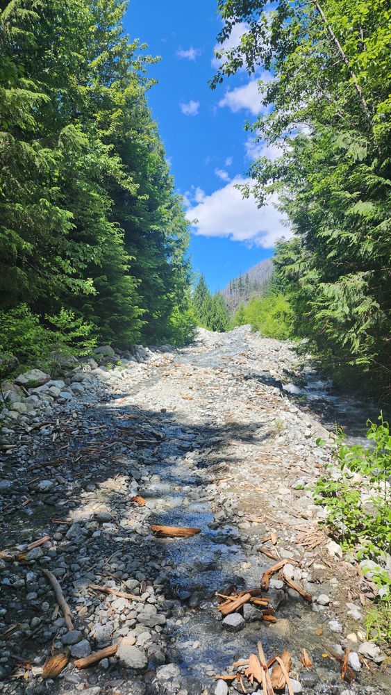
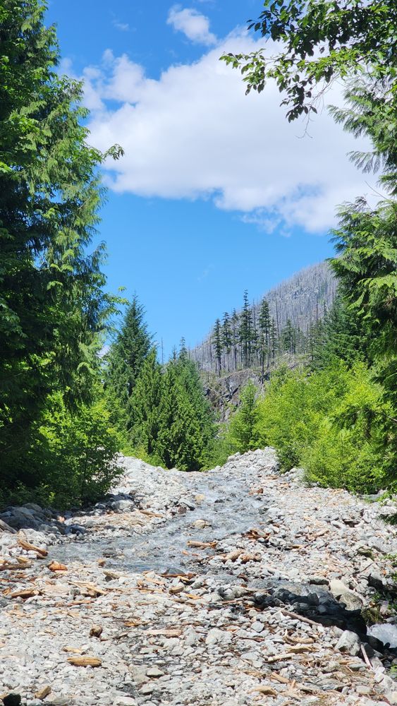
Navigated through the washout described in the bulletin below - it is definetly drivable in a HC 4x4. Past the washout, there are numerous trees on the road... guessing around the 20km mark. The cliff above is littered with dead trees and widowmakers from a fire a few years back. One of the trees across the road is a huge monster hung up about 7 feet above the road. It's shattered internally and cracked in half. Cutting it with a chainsaw would most likely result in death... the tree would slide down the hill from above, taking out everything in it's path. Based on the number of dead trees, this is likely to be a frequent problem.
Bridge at start was in ok condition. Deck showing some signs of degradation, but still good.
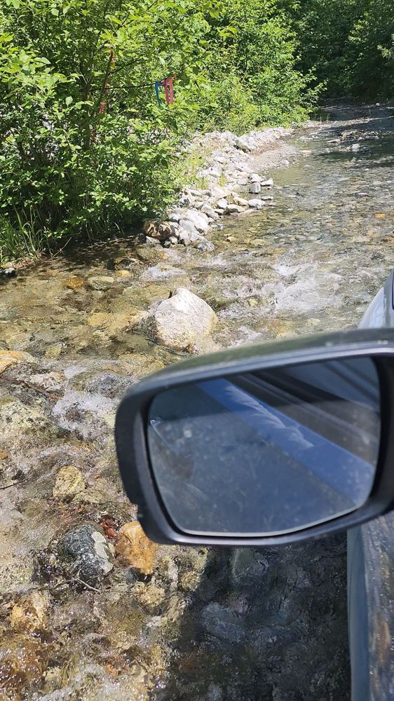
Road was ok condition to 13.5 km washout where creek was washing over road pretty fast. Left creek at upside down Y on map. Water wasn't too deep and my Pilot had no issues crossing.
2nd washout at 14 km is dry and just a bit rocky like a creek bed. No issues.
Back to good condition until 16.25 km washout. Creek is flowing down center of road. Might be passable in 4x4 HC. Needless to say, I did not attempt in my Pilot.
Easy driving until the E-300 branch. We were relieved to be back on this road at the end of the day!


We drove up to the fork with E700. The road is gradually degrading. In quite a few places the road was flooded due to failed creek crossings.


Previous bulletins are still accurate. Good condition.
Bridge CLOSED at 63km - sign states. Didn't drive that far to see.
Bridge CLOSED at 63km - sign states. Didn't drive that far to see.
Pretty much the same conditions as the Squamish Valley Road up to where you turn off.


Snow starts around 34km mark. Just had enough clearance in a stock Tacoma with skid plates, any lower and you'll be high centred on the snow between the tire ruts. No one has broken tracks past 53km. There's a couple smooth sections but I imagine the road might get pretty rough after the snow melts. Overall not horrible currently if you take it slow in the snow and use good line choice!

Good condition up to G-Main. Snow started around the 7km mark near the Maude Frickert falls. Very tracked out and easily driven though. Didn’t get beyond the turn off for G-Main but tracks did seem to continue on
Road appears to be in normal condition according to Oleg: https://www.alltrails.com/explore/recording/activity-october-14-2024-c7502c5

Good condition until the G-main branch turnoff at 9.5km. There is a sign from BC wildfire saying not to go past 60km on this road.
I lost a Honda key at the Elaho River, around the 60 km mark
If anyone finds it, please let me know
Thanks!
If anyone finds it, please let me know
Thanks!


[From Chaisson C Kroeker] - Didnt make it to Lava Camp, Elaho West Mainline was snowed in halfway, and Elaho Mainline had multiple small trees blocking the road.
So Since I couldnt get down, I went up the spur to get a view. Totally worth it.
Made it to ~37.5 km down Elaho Main before running into trees.
See: https://www.facebook.com/groups/4wdabc/permalink/10160083990346009/
So Since I couldnt get down, I went up the spur to get a view. Totally worth it.
Made it to ~37.5 km down Elaho Main before running into trees.
See: https://www.facebook.com/groups/4wdabc/permalink/10160083990346009/

Road is pretty rough from Squamish River FSR to the bridge at G-Main. >>CAUTION at 50° 11' 16.01" N, 123° 22' 23.25" W , theres a pile of snow that looks like a bank, its blocking a hole in the ground just behind it.<< easy bypass beside it, but shouldn't fly up there. I didnt have marking tape with me to make it any more obvious.

Made it up to the 20K or so. Some snowy spots, but no problem in 4x4. Surprised to see recent plowing just before and then past the falls. Not sure why?


Drove about 1km past the E-200 branch. Snow starts immediately after the bridge and the road is not plowed. However, most of the snow is melted out. We only stopped because we didn’t feel like putting chains on a second time.

[From Tyler Ervs 4WDBC] - Able to drive up Elaho Mainline as far as 50°11'06.2"N 123°31'49.5"W before running into an excavator clearing out a washout. Large rocks and uneven surfaces were too much risk for clearance, even under my 1 ton on 35’s.