Cogburn Creek Branch 2510 - "Charles Creek FSR"
Chilliwack Natural Resource District
Distance
3.46 km
Last Road Report
Jun 14, 2026
Closures
No Posted Closures
Location
Cogburn Creek Branch 2510
Permit Holder
Hillcore Lakeside Pacific Forest Products Ltd.
Waypoints
Distance
3.46 km
Avg. Gradient
0%
Ascent
0m
Descent
0m
Last Road Report
Jun 14, 2026
Closures
No Posted Closures
Location
Cogburn Creek Branch 2510
Permit Holder
Hillcore Lakeside Pacific Forest Products Ltd.
Waypoints
Conditions
Start to 0.1 km
Somewhat Degraded
403d ago
0.1 to 1.6 km
Somewhat Degraded
403d ago
1.6 to 1.8 km
Heavily Degraded
403d ago
1.8 to 2.9 km
Good Condition
403d ago
2.9 to 3.5 km
Impassable
403d ago
Description
No description.
Road Bulletins
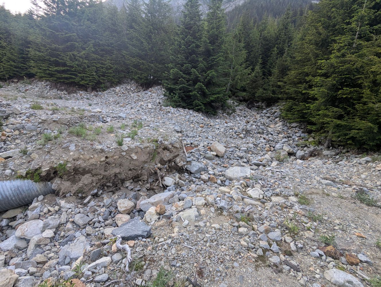
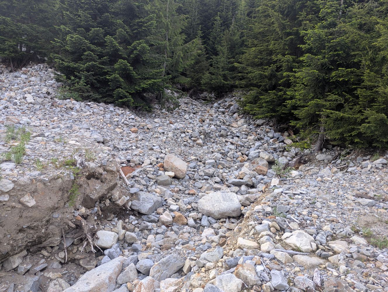
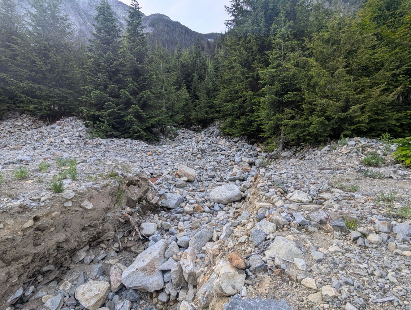
We checked out this road on Sunday, June 14, 2026. The road is in decent condition but we did not drive our Pontiac Vibe down this road. A 4x4 / high clearance vehicle would be fine (until the washout). We took our e-bikes to the end of the road - up to the point where it gets very bushwhacky. There is a washout about 2km from the end of the road (49°36.443N, 121°37.454W). Our bikes made it across but not sure that a vehicle would.
The gate is now locked again right at the bottom. Sign says "gate locked at 2:30pm" however, it was locked in the morning when we arrived. Not a dummy locked, we tried everything to get it open. Note: there is no space on the sides of the gate to pass it with a dirt bike. One could lift a regular bike over the gate.


Road was easily driveable in an SUV with medium clearance (with some caution over a couple creeks and rock beds), until the washout at 1.7km. I didn’t think anyone could get by, but a Bronco with a lot of clearance somehow made it through! Looks like they went over some medium size boulders to the right side of the road to do it, but I can’t confirm. After that, the road is in great condition and easily driveable until 2.8km where it’s just bush and a walking trail. (Would be too overgrown for bikes as well, not that you’d need one).

Not a ton to add on top of the other reports. Road is in generally decent condition besides the minor washout by Fraser Valley standards. Not a ton of room to park or turn around at the trailhead. Everyone will have to park off to one side of the road to allow others in and out. The road becomes a sudden wall of alder at 49.60608, -121.63816


Easily drove to the end, did not find the washouts to be particularly challenging or sketchy. Maybe they have been improved since previous reports? SUV should be able make it all the way.

Road generally okay. A few small creeks/washes that must be driven through over fairly level stones. Any SUV or Truck will be fine.
Significant deactivation ditches at 49.607306, -121.624486. It is possible but sketchy to drive around on the right.
The road ceases to exist at 49.60578, -121.63906
Significant deactivation ditches at 49.607306, -121.624486. It is possible but sketchy to drive around on the right.
The road ceases to exist at 49.60578, -121.63906
[From Andrew Ens] - He was able to drive within 1.6 KM of the end of the driveable portion of Branch 2510. Driving in a Toyota RAV4. Was stopped by a small rockslide at 49°36'23.27"N 121°37'12.23"W. A high clearance or lifted 4x4 could make it beyond this and a few other smaller washouts to the end of the driveable portion 1.6 KM later, which gets you within 100 meters of the approximate route up Urquhart.


[From Steven Song] - road was bikeable to the end and appears to be in good condition.