2026 Service Road Atlas Survey
Want to request a new feature or change to the site? Help shape the future of this site by filling out this two question survey.
Recent Bulletins
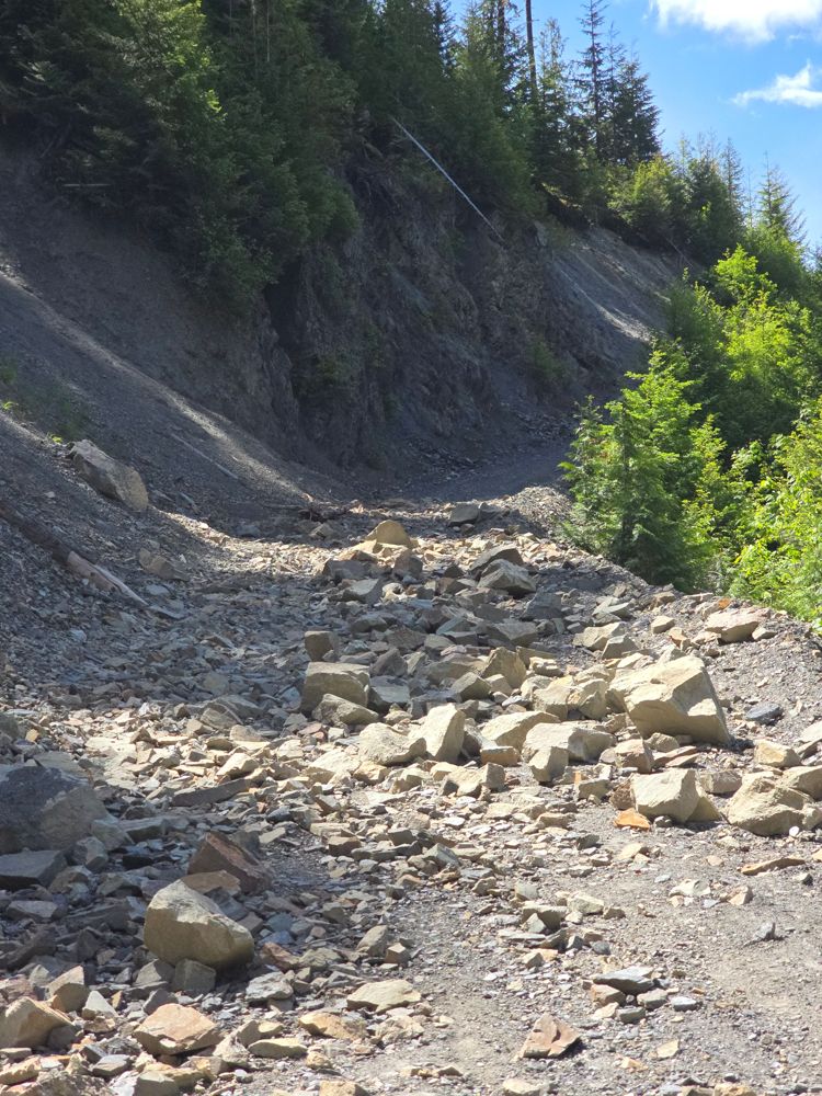
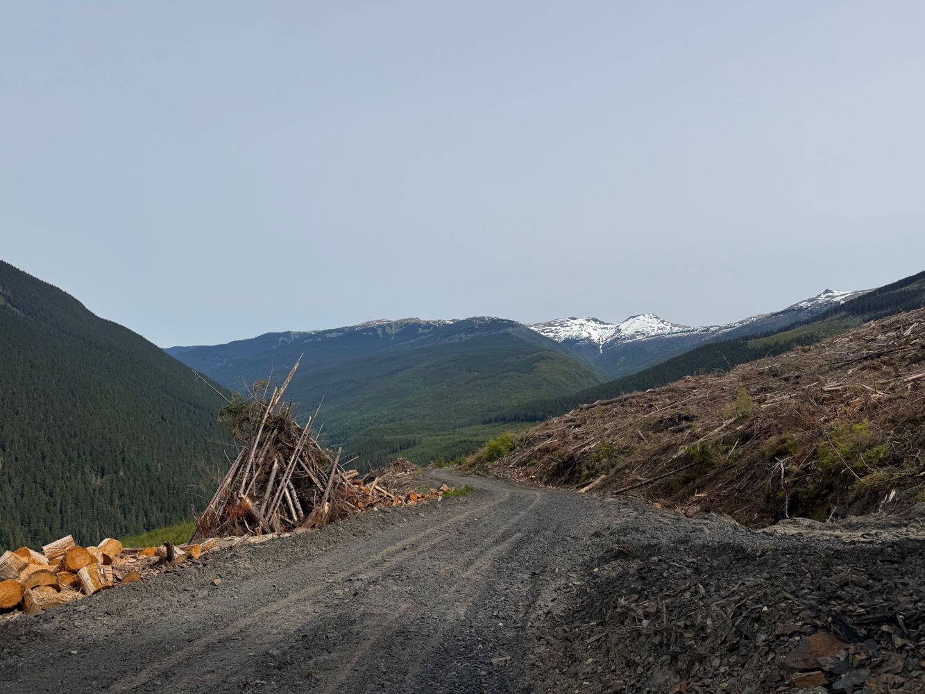
Road is still blocked at km12.5 up. One can see a line, but rocks are quite sharp and we aimed on the side of caution and walk the additional 2km to t...
Simon Mayer - Jun 14, 2026MISTYMAIN
2hThe short section I drove it was in okay condition. Doesn’t appear to be frequently maintained but I was able to drive it in a low clearance car witho...
Heath Anderson - May 30, 2026
Road was in great condition for the short distance I drove. Gate across the river was open at the time, no signage stating open/close times/dates.
Heath Anderson - May 30, 2026Road is in great condition and seems to be frequently graded at least for the short distance I drove. Gated at the start by Mosaic, open 8am-8pm.
Heath Anderson - May 30, 2026Road is in pretty good shape, just some sections with potholes and ruts which are easily avoidable or taken slowly. Nothing at all to worry about in a...
Heath Anderson - May 30, 2026Some nice person cleaned up all the trees across the road. I parked at 2.8 km due to increasing pinstriping.
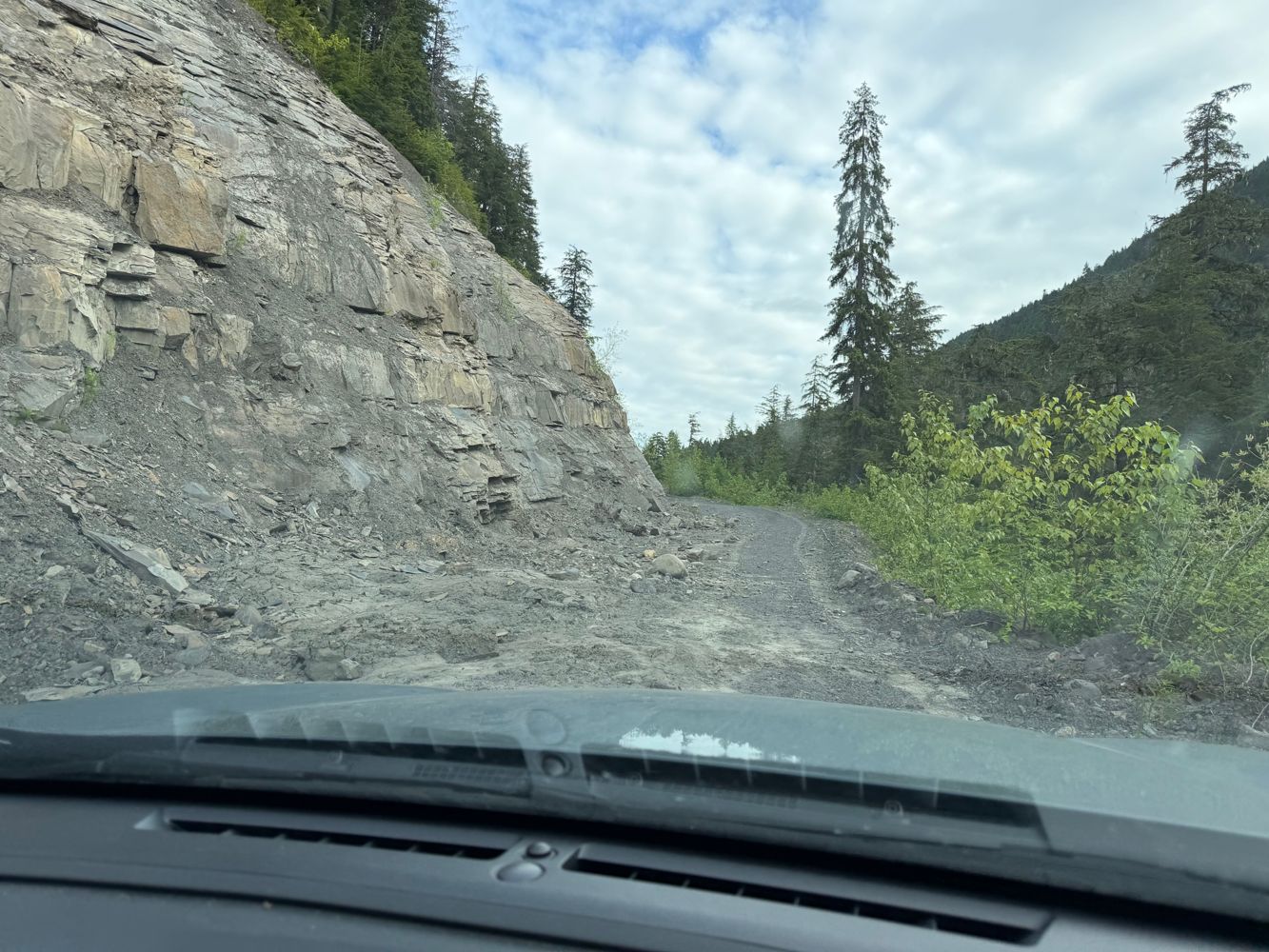
Stu Morris - Jun 13, 2026Made it past the washout at ~7.5km in a crosstrek. It was close but in the end made it without any issues or scraping. Someone has also cleaned up all...
Stu Morris - Jun 13, 2026R07823-F
15h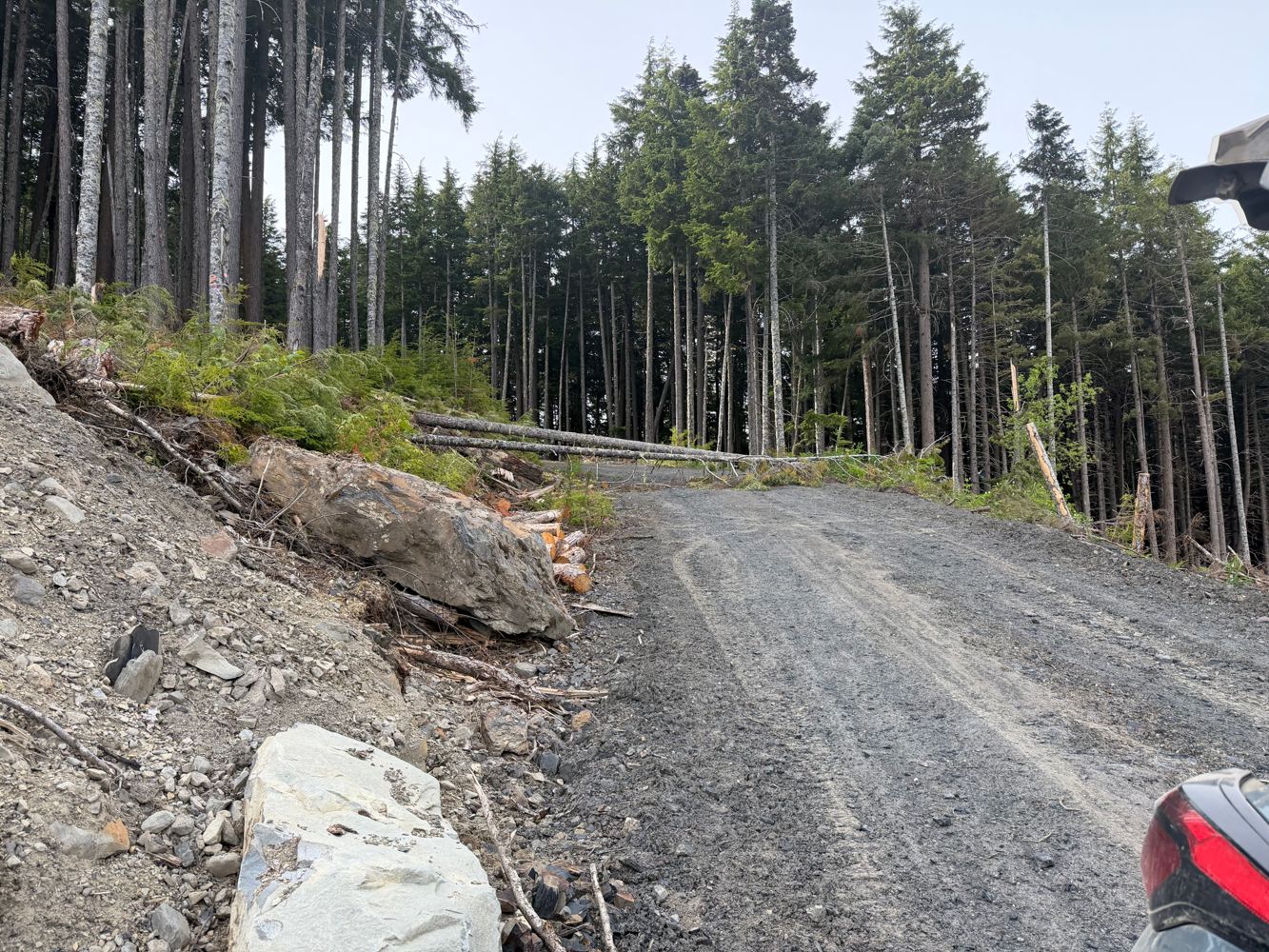
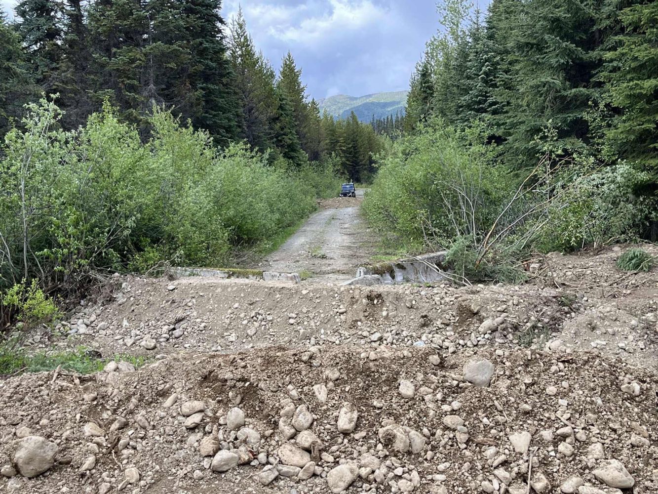
Nearly drivable to the very end but that last part after the new cut blocks at 29km was overgrown. 27-29km has a lot of rock fall, mud slides and fall...
Francis Bailey - Jun 13, 2026BIG CEDAR
16hYeah I'm on the edge of medium due to water bars but I'll keep it as is for now
Tareef Dedhar - Jun 13, 2026Somewhat deeper than avg water bars. Good crossover or better.
The 4x4 bypass for the bridge is real tho so *effectively* it's a 4x4 road now. 30"...
Biked and hiked to 11.8km at the junction of Cummings Creek North FSR. The supports of the first quad bridge have been washed out and a makeshift sign...
Ryan Winter - Jun 13, 2026Bridge Road FSR
23hCulvert removal and road deactivation scheduled for July 2026 according to PGATV Social Facebook post (https://www.facebook.com/share/p/18Ny7VM8ix/)
Sven Freitag - Jun 13, 2026CP 768 AMEND 2
23h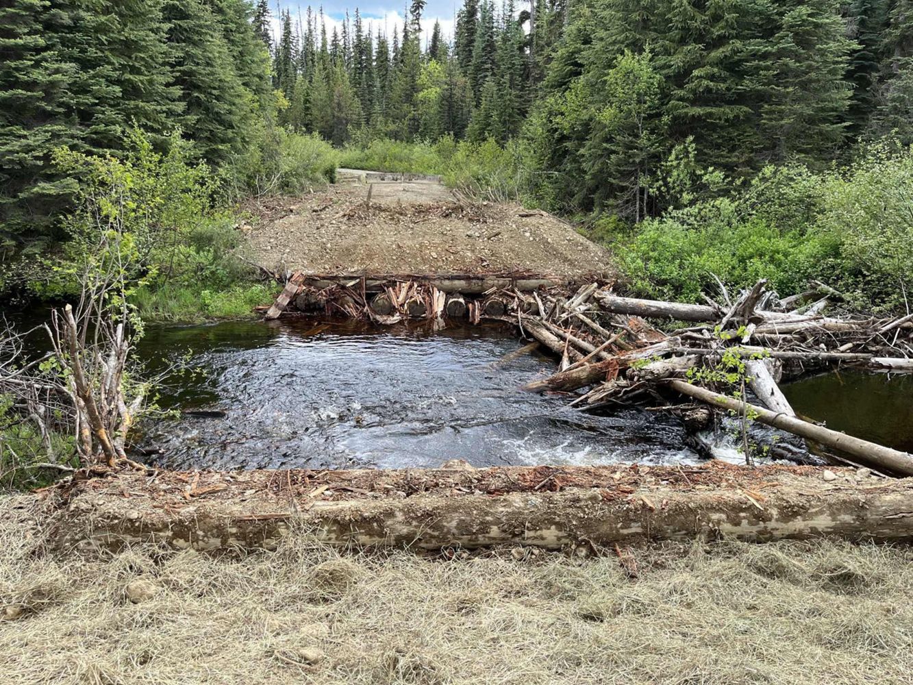
Bridges across Rond Creek and Stephanie Creek were removed according to PGATV Social Facebook post on June 13, 2026 (https://www.facebook.com/share/p/...
Sven Freitag - Jun 13, 2026Road is cleared and back to it's existing condition. No problem driving over the pass to Seton lake
Ben Eby - May 31, 2026Road Updates
SOUTH KITEEN M/L A
New ![]() has been reported at 55.277, -128.671
has been reported at 55.277, -128.671
SOUTH KITEEN M/L A
New ![]() has been reported at 55.302, -128.656
has been reported at 55.302, -128.656
SOUTH KITEEN M/L A
New ![]() has been reported at 55.328, -128.654
has been reported at 55.328, -128.654
SOUTH KITEEN M/L A
New ![]() has been reported at 55.349, -128.657
has been reported at 55.349, -128.657
Gaspard-Mud Lake ConnectorNew
Road added in the Cascades Natural Resource District region
RUPERT MAIN RUPMAIN
Road conditions have been updated to:
Duncan Bay Mainline
Road conditions have been updated to:
Duncan Bay Mainline
![]() has been verified at 49.884, -125.275
has been verified at 49.884, -125.275
Oyster River Main
![]() has been changed to
has been changed to ![]() at 49.894, -125.276
at 49.894, -125.276
SOUTH KITEEN M/L A
Road conditions have been updated to:
VAN HORLICK CREEK 28-VH21-1
Road conditions have been updated to:
Bridge Road FSR
![]() has been verified at 53.319, -121.743
has been verified at 53.319, -121.743
CP 768 AMEND 2
New ![]() has been reported at 53.365, -121.767
has been reported at 53.365, -121.767
CP 768 AMEND 2
New ![]() has been reported at 53.39, -121.832
has been reported at 53.39, -121.832
Seton-Retask Road
![]() has been removed at 50.631, -122.099
has been removed at 50.631, -122.099
Free to Use and Community Driven
Get up-to-date information about back country roads all over British Columbia, Alberta and the Yukon. Created by the community, for the community.
Detailed Reports
View road conditions broken down kilometer by kilometer and find the latest status on gates, bridges and washouts. Explore user submitted road reports and contribute your own with an easy-to-use road report system!
Explore the over 260,000 roads on the map and keep the community strong by sharing what you find on your adventures.


Toma Main
New ![]() has been reported at 49.514, -125.126
has been reported at 49.514, -125.126

Map Layers
Find cut block data, wildlife closure zones, recent satellite imagery and a host of base maps to make your planning a breeze.
Offline Road Data
Take service road information offline with your favourite mapping application. The Service Road Atlas supports road downloads and offline use in apps like Gaia, OSMAnd, Caltopo and more.


