2026 Service Road Atlas Survey
Want to request a new feature or change to the site? Help shape the future of this site by filling out this two question survey.
Recent Bulletins
Showh Lakes FSR
12hLargely unchanged. Keep an eye open for SxS's and quads as the company that runs the tours at the base of the trail is in operation.
Stephen Bunyak - Jun 06, 2026COUGAR1
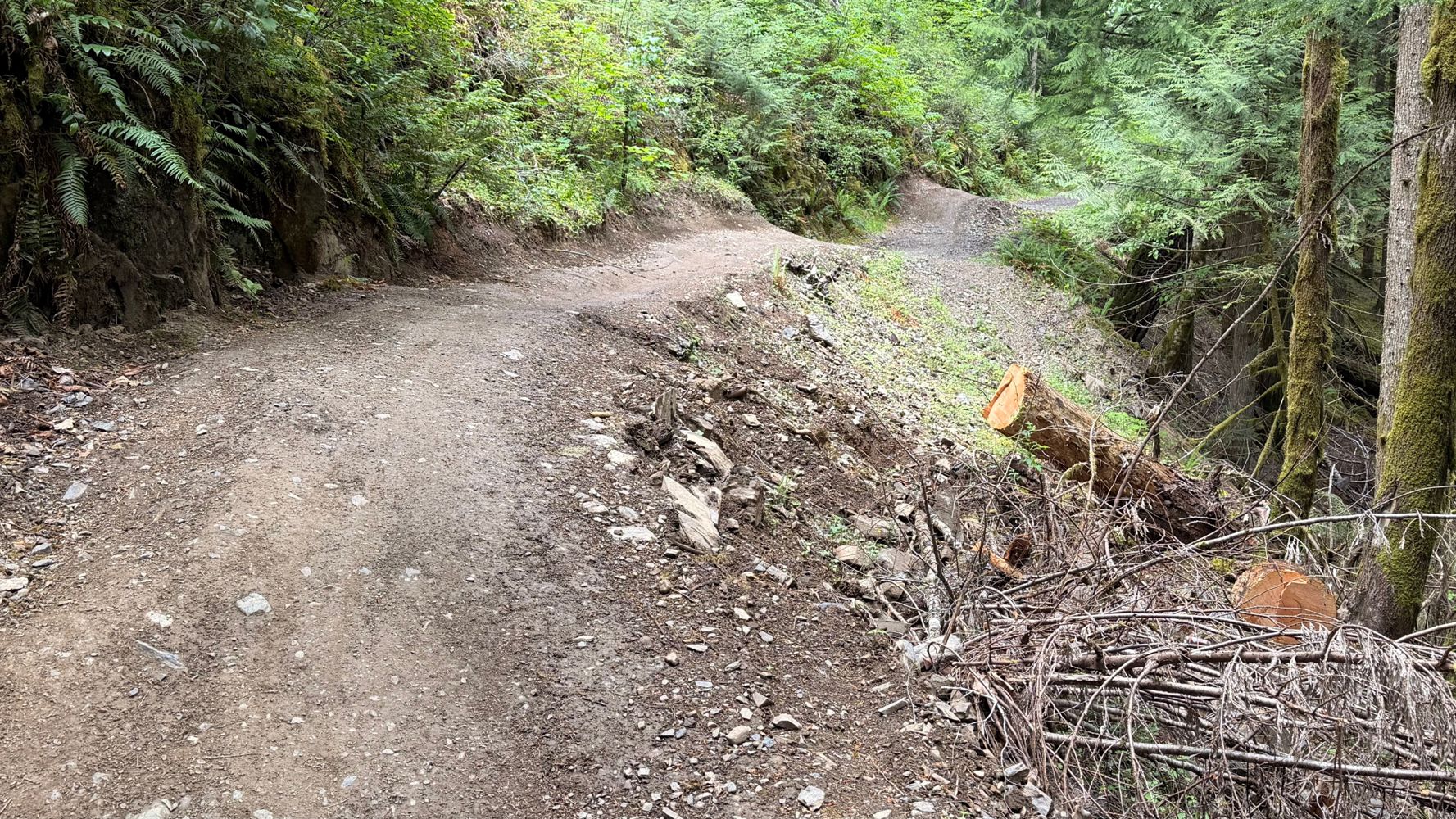
12hCame up from SooRiver602 1.47>0.83km. Sides of road is littered with pallets for some reason, and not all of them appear to be that old. A little bit ...
Stephen Bunyak - Jun 06, 2026Soo River 602
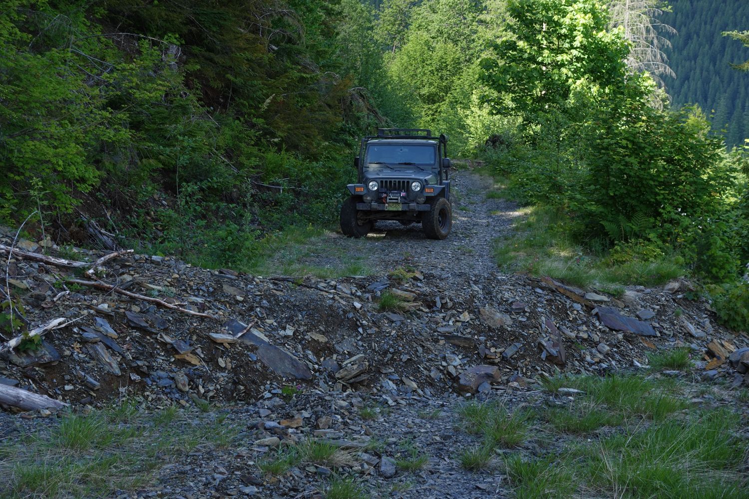
12hA little spicy, but a very fun trail to go up. I went in my stock Rubicon in 4Low and had no issues. There is a bit of growth, but the road remains un...
Stephen Bunyak - Jun 06, 2026SOO RIVER SOUTH
12hHeaps of over growth, most of it is soft bush, but road still easily visible. Theres a few washouts that are nice little "rock gardens" to drive throu...
Stephen Bunyak - Jun 06, 2026MA BR40000
13h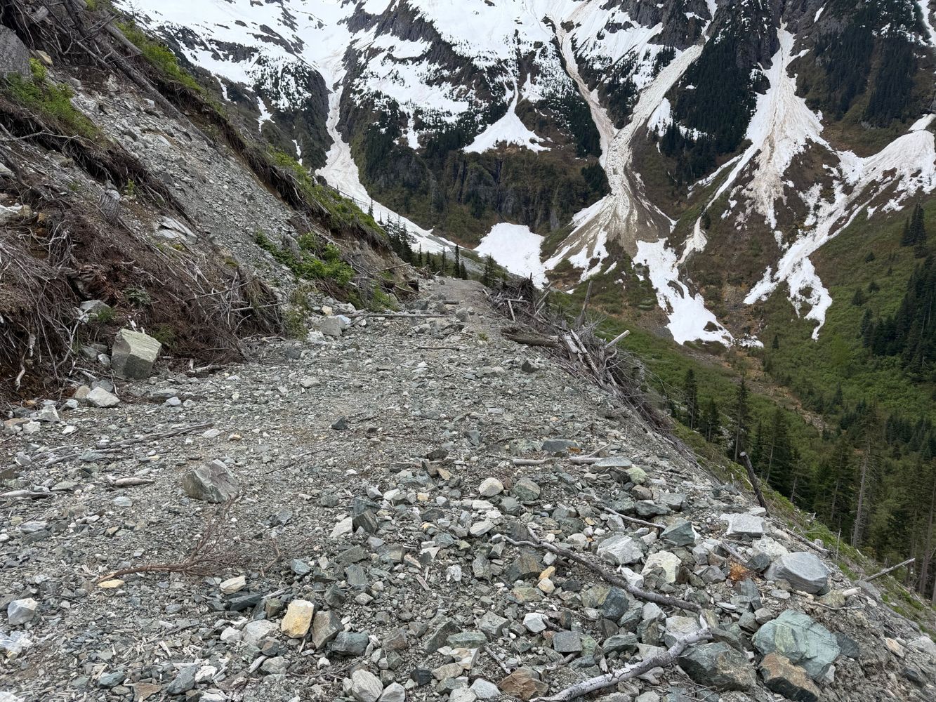
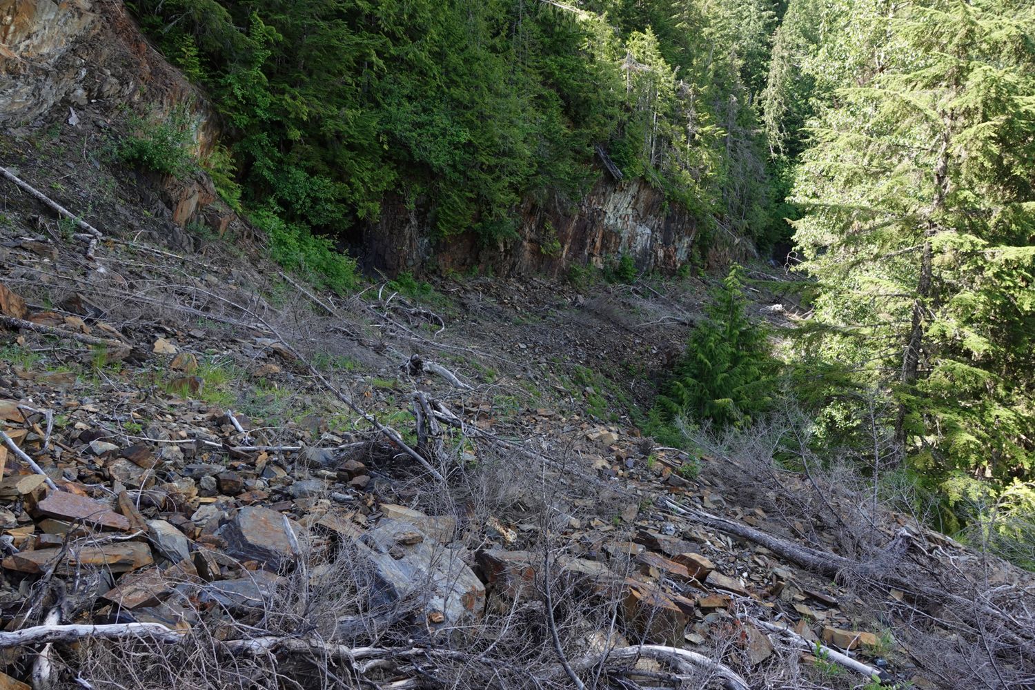
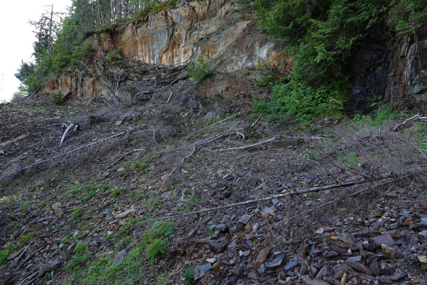
If you could reach this spur the first half would be drivable up to a section of road that’s sliding down the slope
Francis Bailey - Jun 06, 2026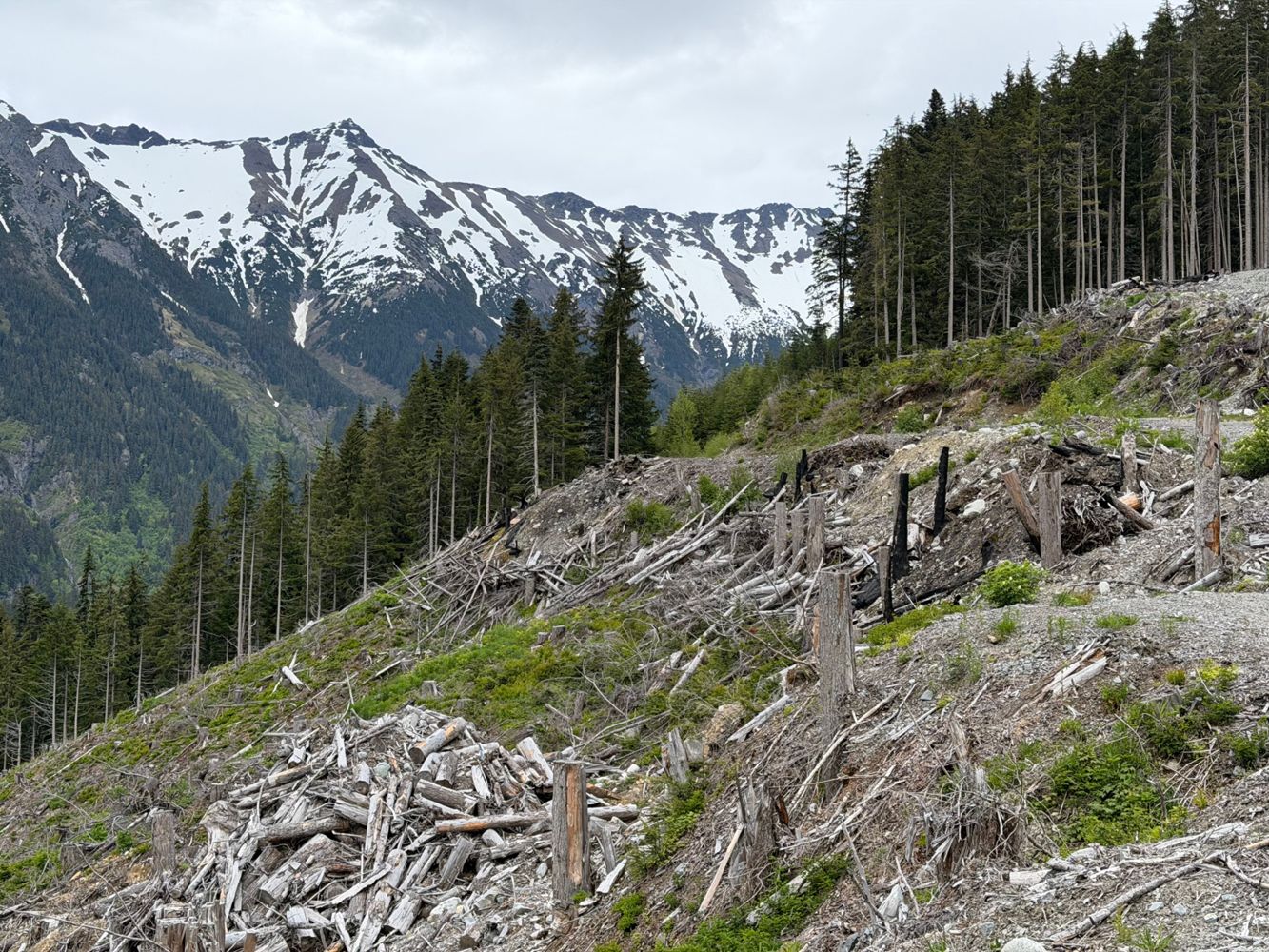
A few sections lower down are getting some water runnels, but generally good condition to the 10km mark. Here the slopes have slid onto to the road in...
Francis Bailey - Jun 06, 2026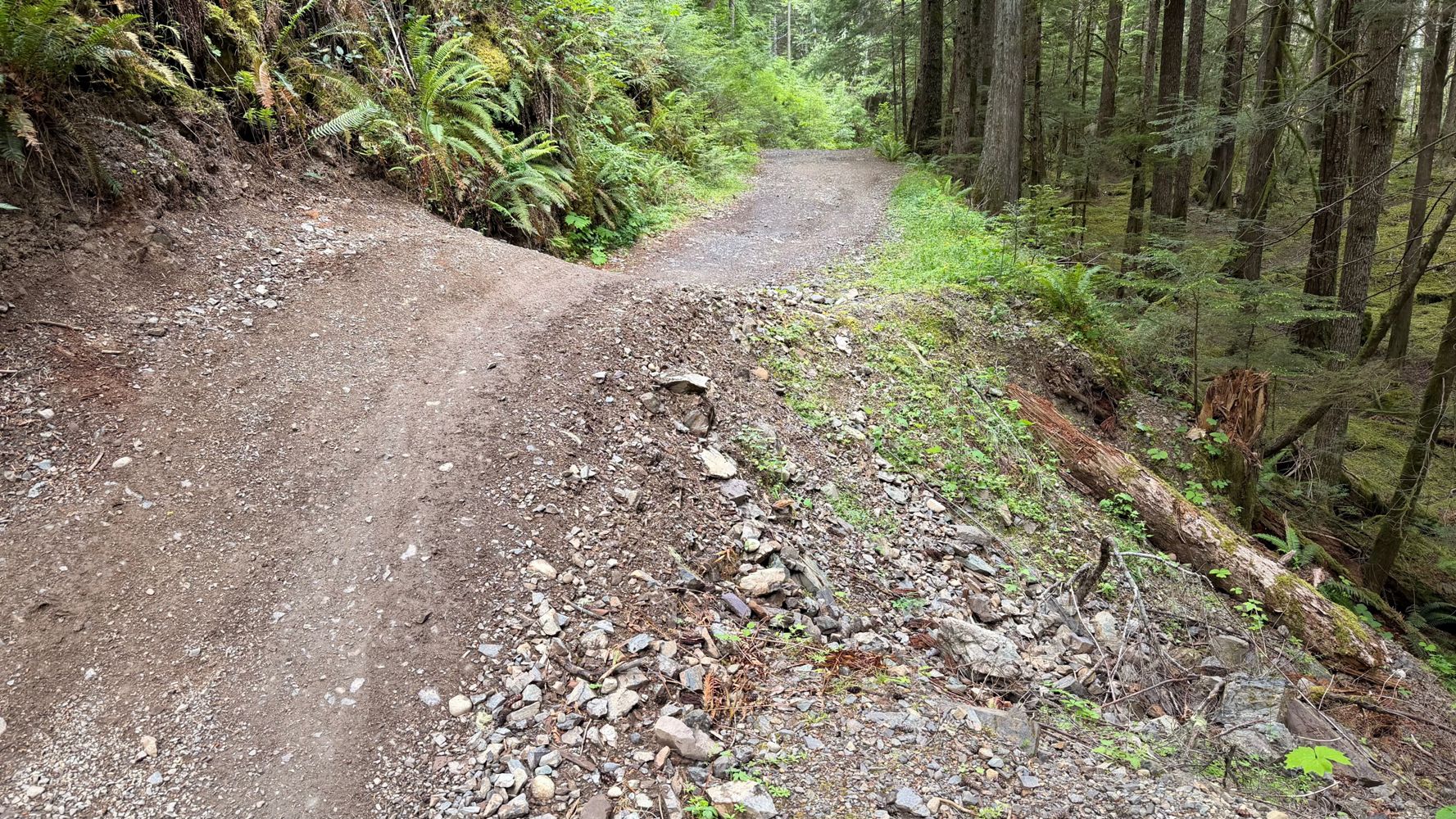

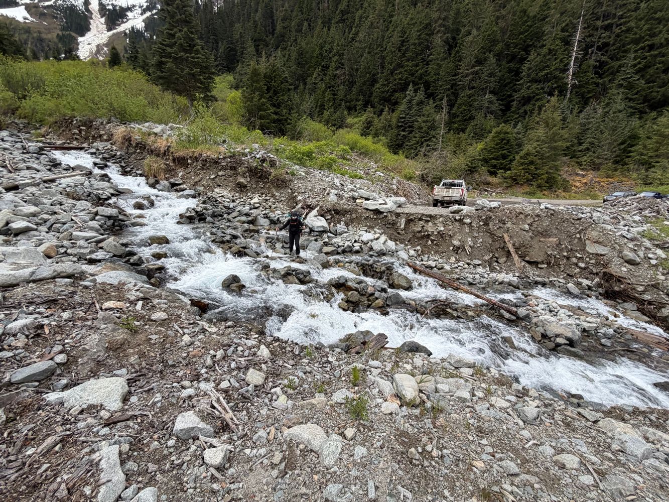
The August 1 storm caused several washouts that have degraded the road above the river ford where the bridge used to be. The worst section was the lar...
Edwina Podemski - Aug 01, 2025

Kookipi closed for road repairs until approximately August. Details at https://www.facebook.com/share/p/1AE5KyjAE3/
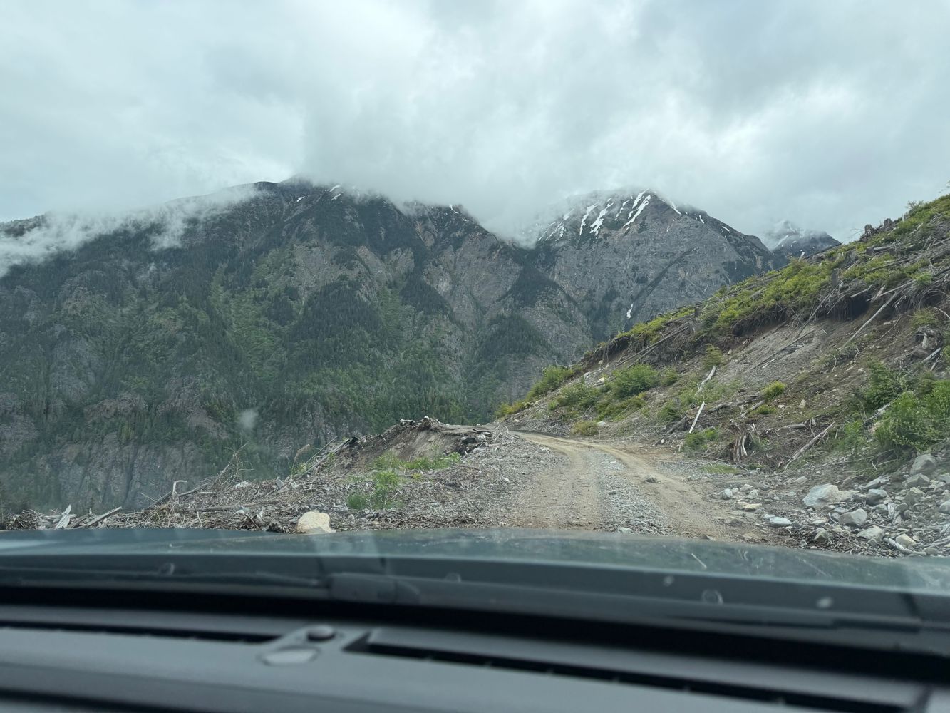
Matt Ion - Jun 05, 2026Easily drivable in a Subaru to ~6.5 km where a landslide blocks further access. Bridge to the west side of the creek beyond 7 km is intact but only do...
Steven Song - May 27, 2026Talked to a worker a the blockade around the 21km mark on May 31st and he said could be 1-2 weeks before it opens. If anyone has any updates this wee...
Jeff Colter - May 31, 2026Very overgrown and a bit rocky in some places. Paint job will take a beating.
Paul Lezica - Jun 02, 2026LC112
2d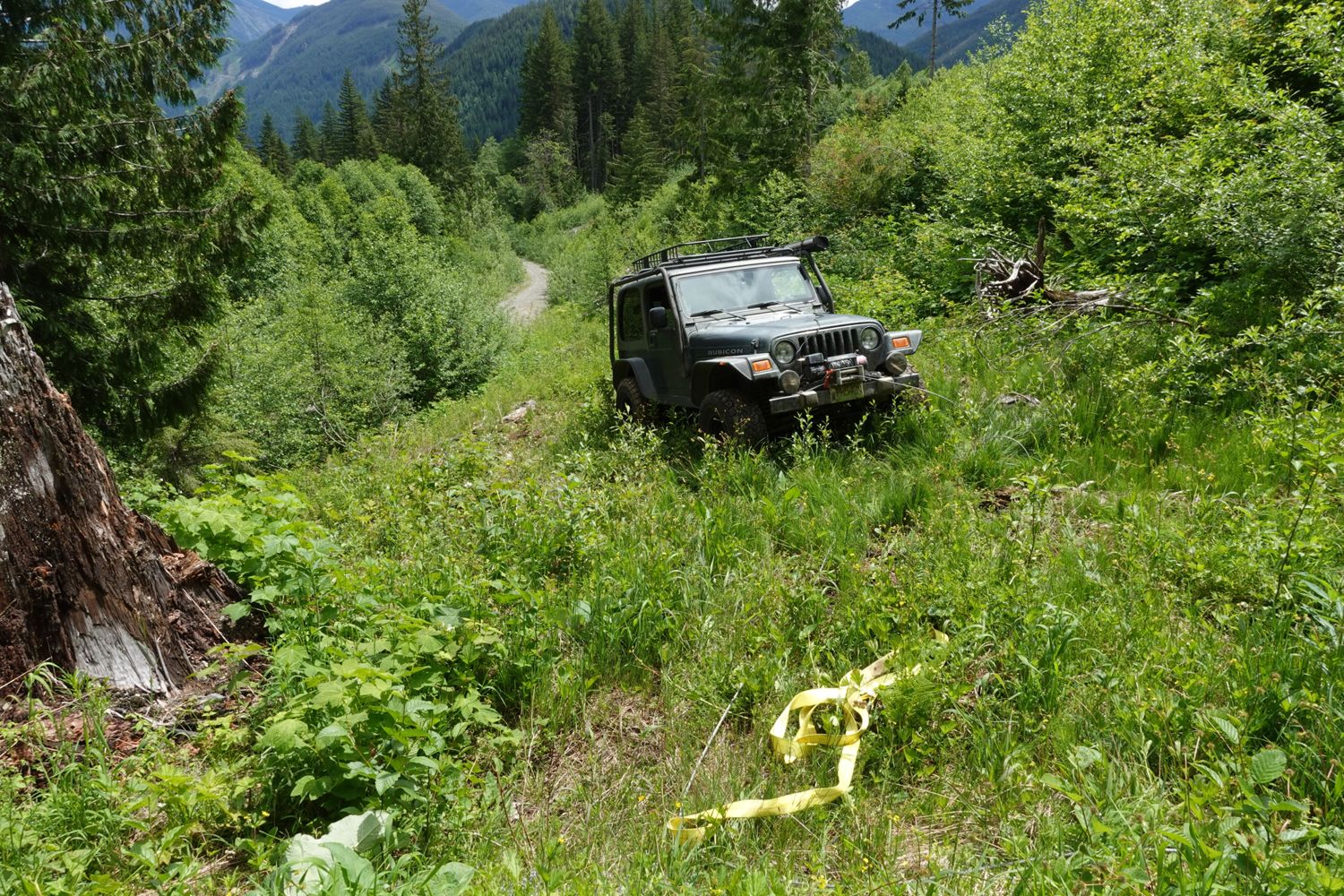
The start of this road was torn up and logs dropped across it for deactivation but I was able to push through. After around the 0.5km mark there is no...
Paul Lezica - Jun 04, 2026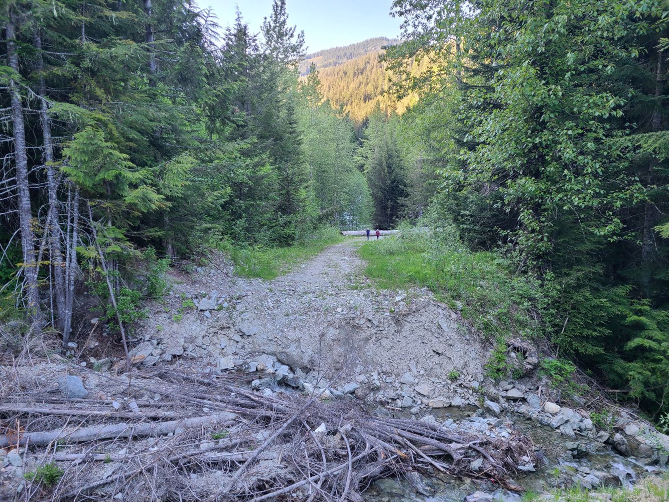
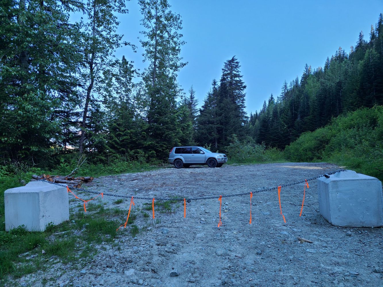
No major changes from last update. Road is snow free and had no issues driving in a midsize SUV with average ground clearance and AWD (Nissan X-Trail)...
Jesse Listoen - May 31, 2026Road in nice condition, easily made it to the gate in a crosstrek. Went through traffic control during construction hours and had no problems or waits...
Stu Morris - Jun 02, 2026NH600
5dN600 spur is driveable with a Subaru up to 700m. there is a small parking lot probably can fit aroun 5 vehicles. No waterbars up to this point.
Teng Pasion - May 30, 2026Road Updates
COUGAR1
Road conditions have been updated to:
SOO RIVER SOUTH
Road conditions have been updated to:
Rutherford Creek West FSR
Road conditions have been updated to:
MA BR40000
Road conditions have been updated to:
Rutherford Creek West FSR
![]() has been changed to
has been changed to ![]() at 50.282, -123.013
at 50.282, -123.013
MA BR40000New
Road added in the Skeena Stikine Natural Resource District region
MAROON CREEK M/L A
New ![]() has been reported at 54.757, -128.68
has been reported at 54.757, -128.68
MAROON CREEK M/L A
Road conditions have been updated to:
Lacy Lake Road
Road conditions have been updated to:
Farnham Creek FSR
Road conditions have been updated to:
Mount Harry Davis RoadNew
Road added in the Skeena Stikine Natural Resource District region
Grouse Mountain RoadNew
Road added in the Skeena Stikine Natural Resource District region
Red Rose Creek RoadNew
Road added in the Skeena Stikine Natural Resource District region
Boulder Creek RoadNew
Road added in the Skeena Stikine Natural Resource District region
Roe Creek FSR
Road conditions have been updated to:
E-200 Branch
Road conditions have been updated to:
E-200 Branch
![]() has been verified at 50.114, -123.43
has been verified at 50.114, -123.43
E-200 Branch
Road conditions have been updated to:
Squamish River FSR
![]() has been removed at 50.071, -123.343
has been removed at 50.071, -123.343
BLUE MOUNTAIN 300
New ![]() has been reported at 49.237, -122.462
has been reported at 49.237, -122.462
WKANAKA-MAIN
New ![]() has been reported at 49.25, -122.478
has been reported at 49.25, -122.478
Free to Use and Community Driven
Get up-to-date information about back country roads all over British Columbia, Alberta and the Yukon. Created by the community, for the community.
Detailed Reports
View road conditions broken down kilometer by kilometer and find the latest status on gates, bridges and washouts. Explore user submitted road reports and contribute your own with an easy-to-use road report system!
Explore the over 260,000 roads on the map and keep the community strong by sharing what you find on your adventures.


Toma Main
New ![]() has been reported at 49.514, -125.126
has been reported at 49.514, -125.126

Map Layers
Find cut block data, wildlife closure zones, recent satellite imagery and a host of base maps to make your planning a breeze.
Offline Road Data
Take service road information offline with your favourite mapping application. The Service Road Atlas supports road downloads and offline use in apps like Gaia, OSMAnd, Caltopo and more.


