Recent Bulletins


CRISS CREEK
34m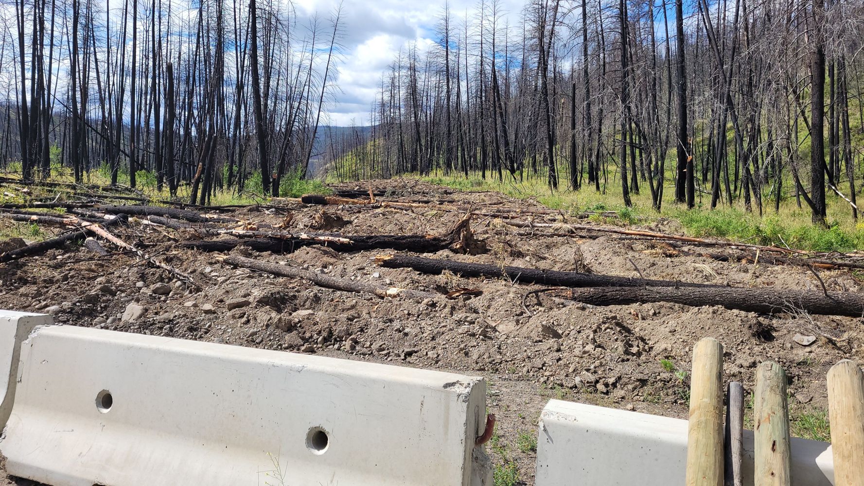
Basically what others have said but:
- rly only one sloped part that wasn't bad
- the "impasse" is not impassable. 3rd gen grand Vitara on 30" tires...
Crossovers should be okay. Rocks on the road are fairly small, but taller than a sedan prob
Tareef Dedhar - Jun 27, 2026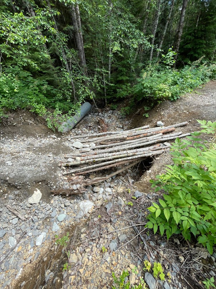
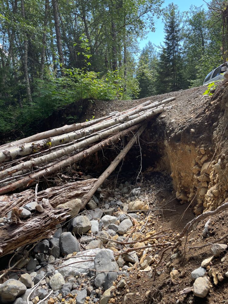
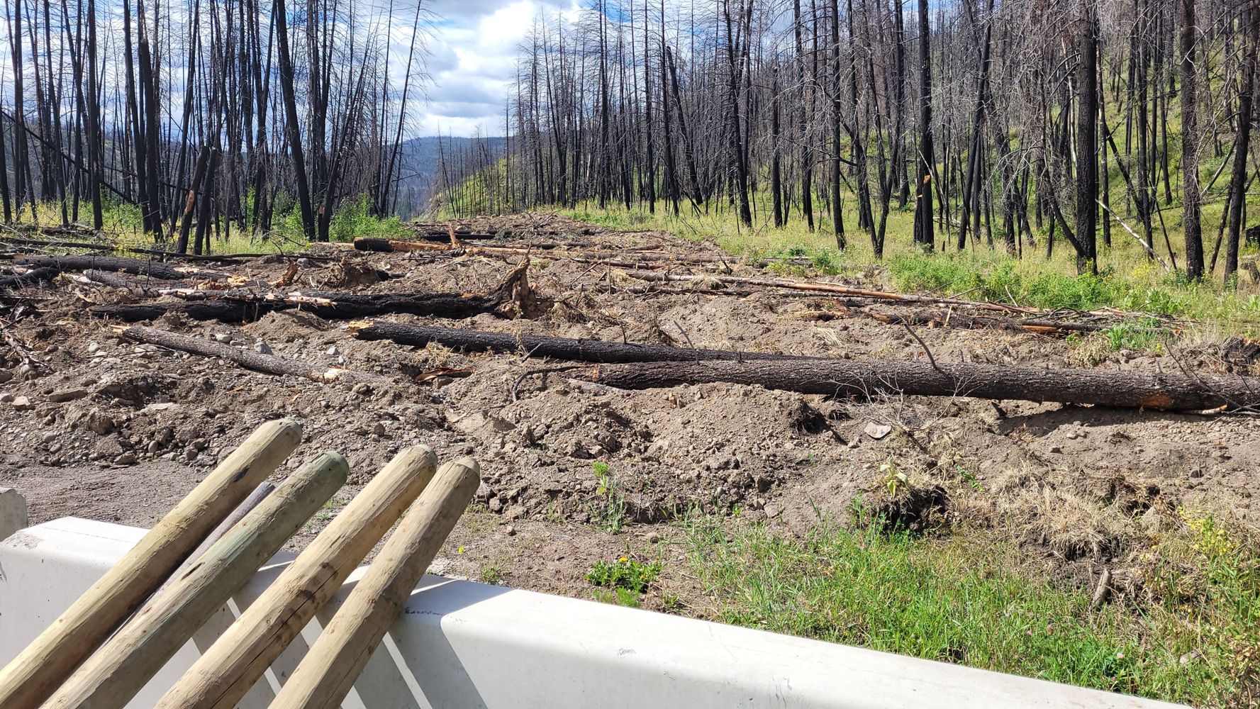
The washout is still here, and some more logs were added for a more stable footbridge but aren't safe to drive over. The damage is pretty bad (~6ft d...
Mark WN - Jun 27, 2026CRISS CREEK
1d

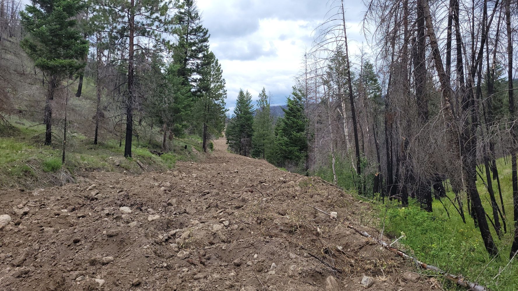
Deactivated - ripped up to impassible to not worth the effort condition. Don't know how far it is ripped as I could only see 200 meters or so
Steve McAbee - Jun 27, 2026CRISS CREEK
1d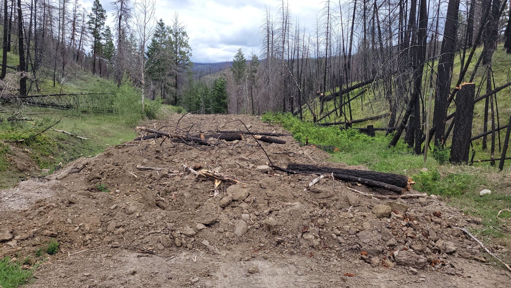
KA R20023.06
1dGoing West from McLeod Rd, the road starts with some easily passed ditches but turns completely impassable around 1km in. A motorcycle might be able t...
Steve Staley - Jun 27, 2026CRAZY CREEK
2dWas headed up to Eagle Pass Trail. Road is in good condition all the way to 9km. New active logging at 7km
Leif Mathis - Jun 26, 2026This road needs to be split into 2 sections:
Segment 1: 0-7.5km
Segment 2: 7.5km -13km a.k.a the actual climb to Jesmond Lookout
I drove bot...
Distances are approximate. In good shape with some potholes until it starts to descend where it becomes more rough/loose with some small cross ditches...
Kelly Wilson - Jun 20, 2026ARROWSTONE
3d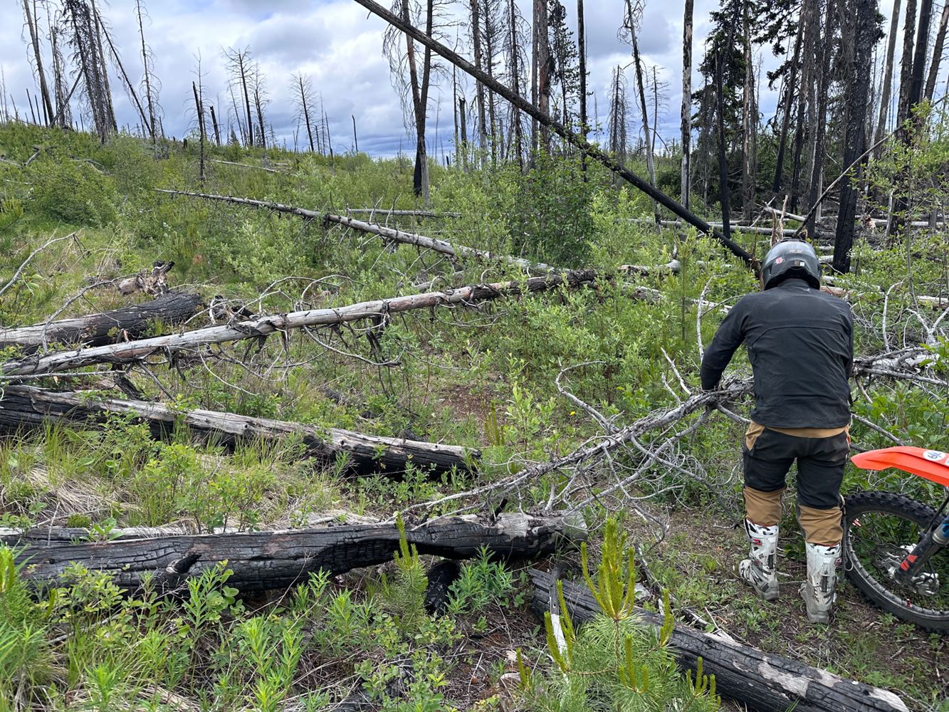
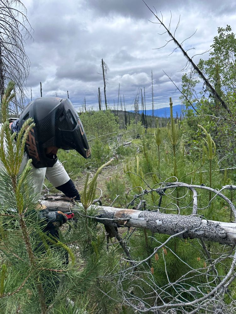
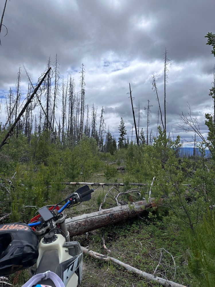
Traveled south on dirtbikes. Total deadfall rodeo. Gave up at around km 5. A HC Samurai armed with patience and a chainsaw could restore this worthy l...
Tim K - Jun 20, 2026Traveled south on dirtbikes. Decent overall condition with a mix of ruts and rocky sections.
We poked our heads in to the section south of Deadman's ...
Road Updates
GREYBACK
Road conditions have been updated to:
CRISS CREEK
New ![]() has been reported at 50.938, -120.889
has been reported at 50.938, -120.889
K Branch
New ![]() has been reported at 49.037, -124.373
has been reported at 49.037, -124.373
K26
Road conditions have been updated to:
PYE100
New ![]() has been reported at 49.195, -122.078
has been reported at 49.195, -122.078
Ore Creek FSR
Road conditions have been updated to:
Squamish River Branch 250
Road conditions have been updated to:
Squamish River Branch 250
New ![]() has been reported at 49.962, -123.26
has been reported at 49.962, -123.26
CRISS CREEK
Road conditions have been updated to:
CRISS CREEK
New ![]() has been reported at 50.931, -120.891
has been reported at 50.931, -120.891
TEXADA ISLAND
Road conditions have been updated to:
Squamish River Upper FSR
New ![]() has been reported at 50.128, -123.395
has been reported at 50.128, -123.395
Free to Use and Community Driven
Get up-to-date information about back country roads all over British Columbia, Alberta and the Yukon. Created by the community, for the community.
Detailed Reports
View road conditions broken down kilometer by kilometer and find the latest status on gates, bridges and washouts. Explore user submitted road reports and contribute your own with an easy-to-use road report system!
Explore the over 260,000 roads on the map and keep the community strong by sharing what you find on your adventures.


Toma Main
New ![]() has been reported at 49.514, -125.126
has been reported at 49.514, -125.126

Map Layers
Find cut block data, wildlife closure zones, recent satellite imagery and a host of base maps to make your planning a breeze.
Offline Road Data
Take service road information offline with your favourite mapping application. The Service Road Atlas supports road downloads and offline use in apps like Gaia, OSMAnd, Caltopo and more.


