2026 Service Road Atlas Survey
Want to request a new feature or change to the site? Help shape the future of this site by filling out this two question survey.
Recent Bulletins
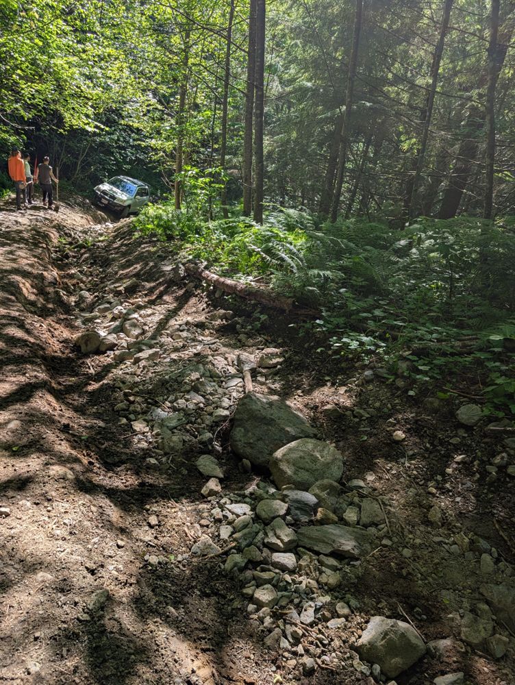
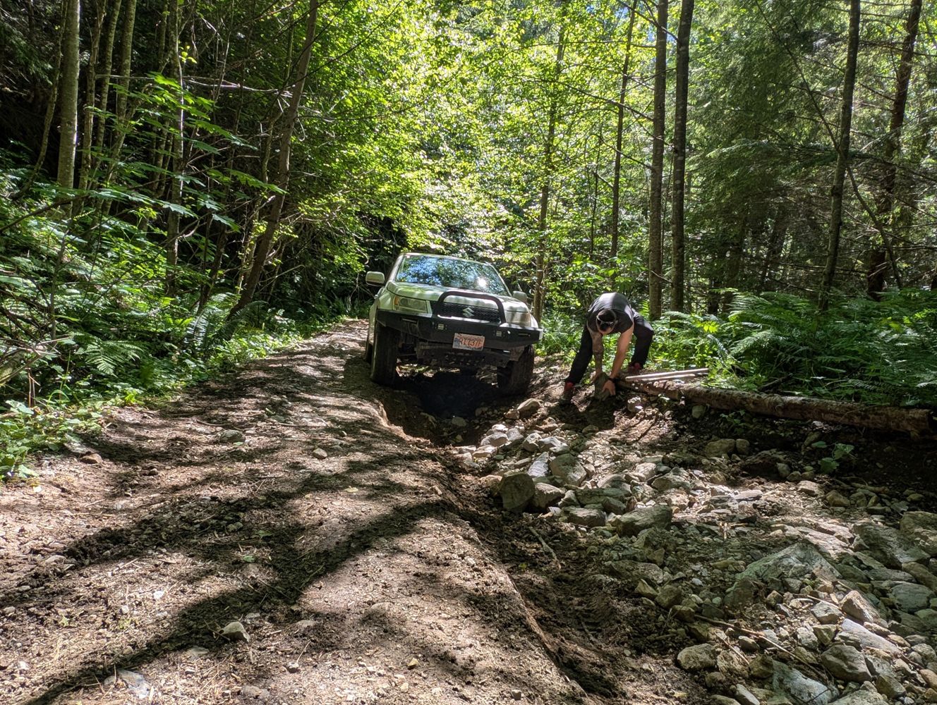
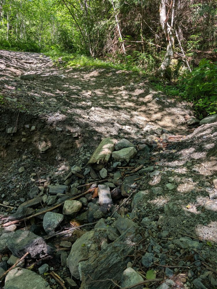
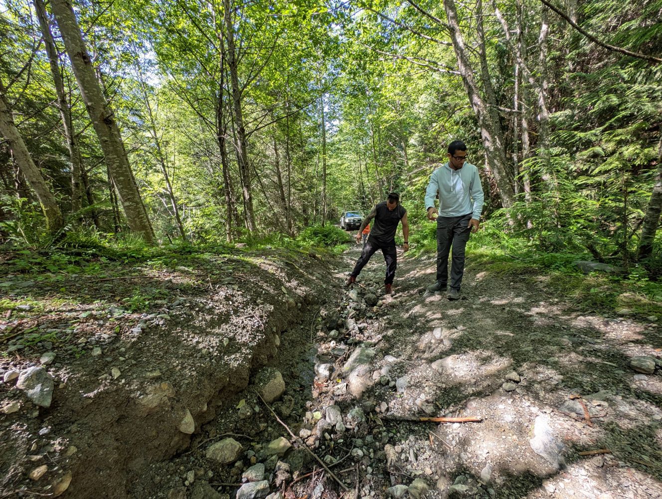
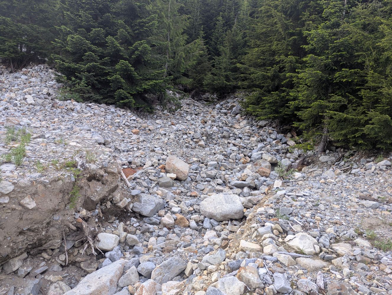
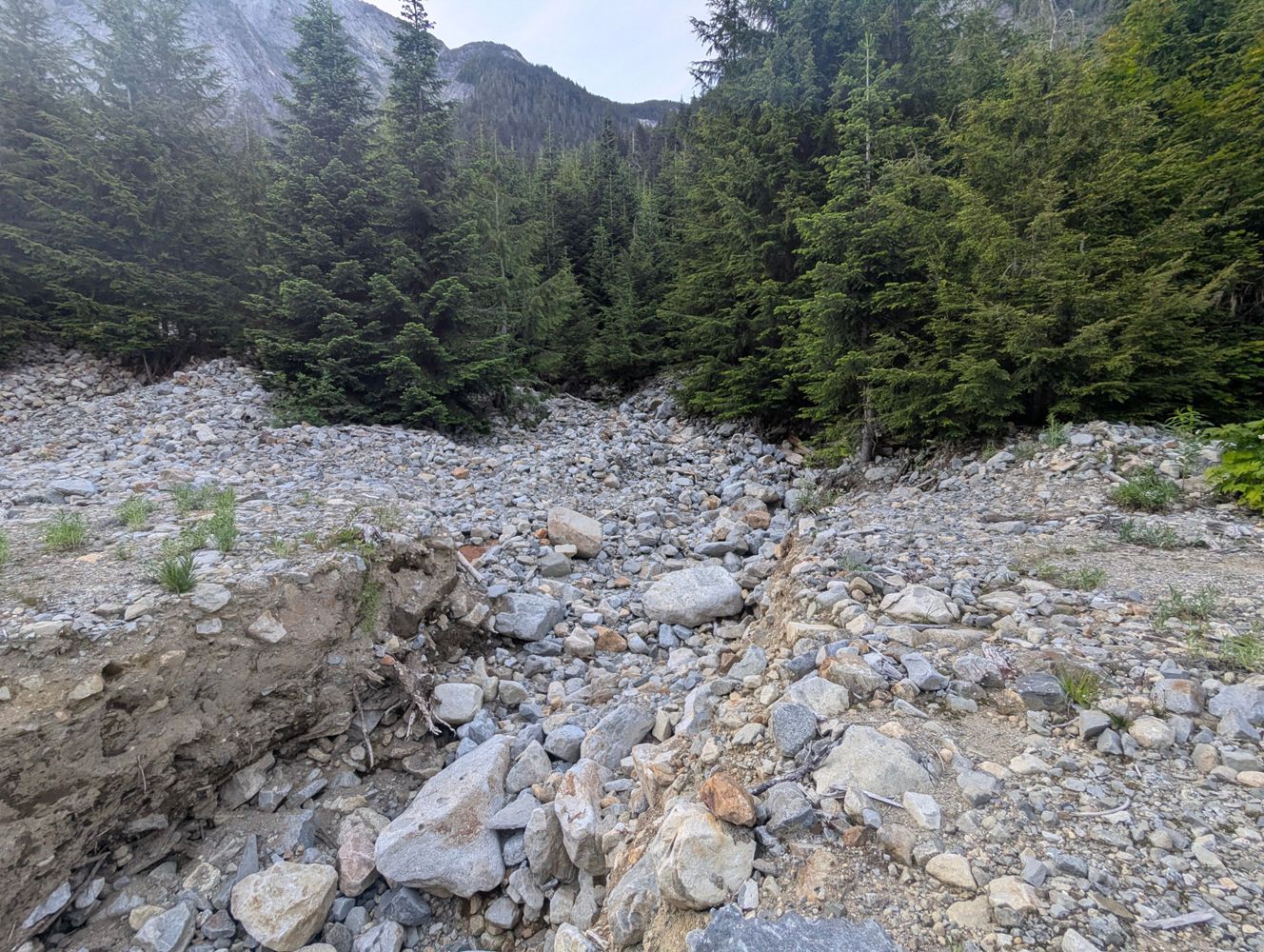
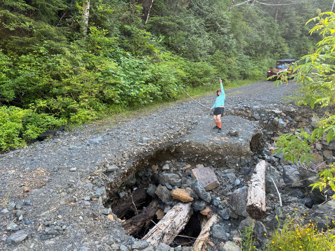
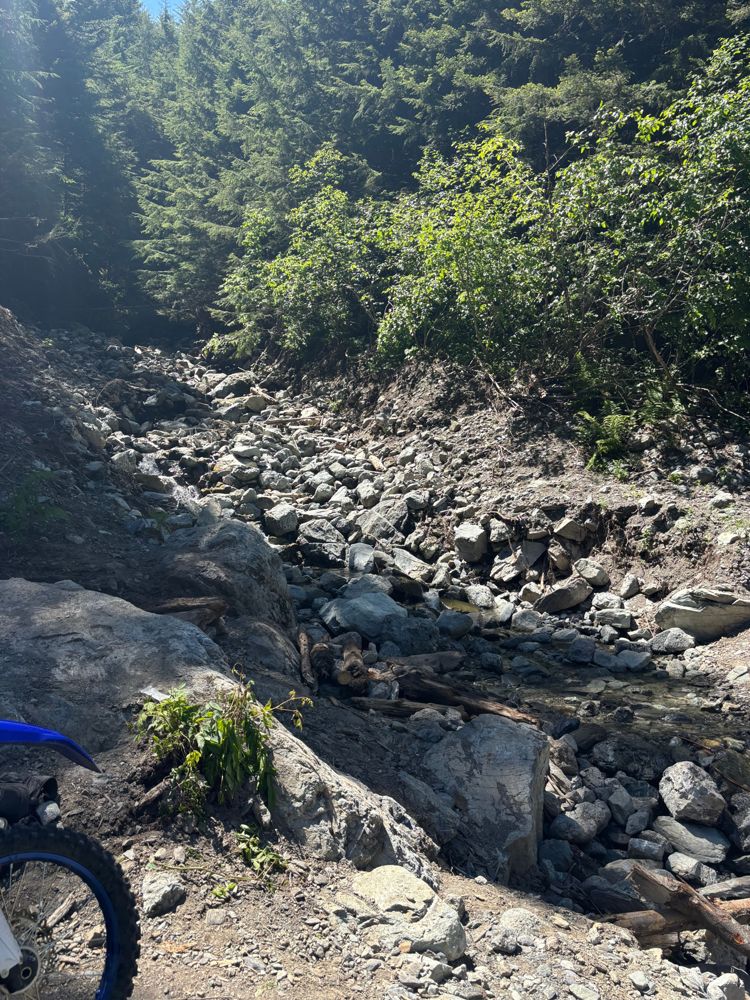
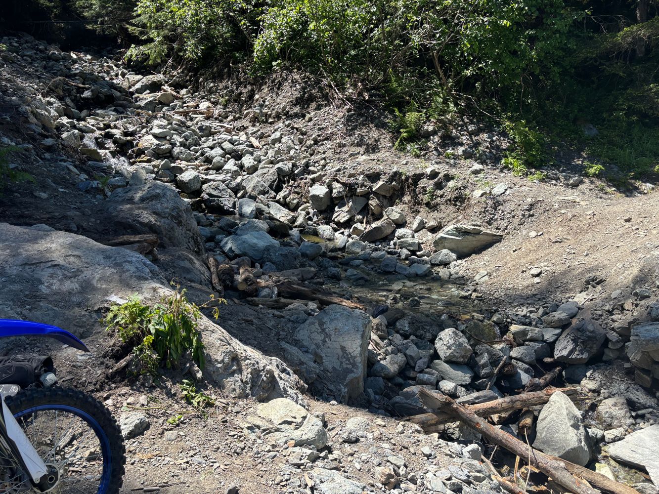
Adding a few photos re Tareef's post. Unsurprisingly, photos don't do it justice as to how difficult/technical this FSR is.
June Tai - Jun 14, 2026Reported as open on FB today. Possibly only temporary through the summer.
https://m.facebook.com/story.php?story_fbid=10163016457831009&id=17581...
Drove this to get to the Williamson lake trailhead
Took some work moving boulders and shoveling some dirt around to fill in the worst spots in some...
Mamquam FSR
8h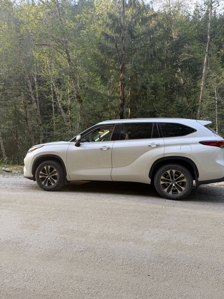
went up to the 16km mark, smooth surface most of the way. few potholes, very manageable. 50+ km/h is very possible. some loose rocks after 13km. done ...
Michael Kendrick - Jun 14, 2026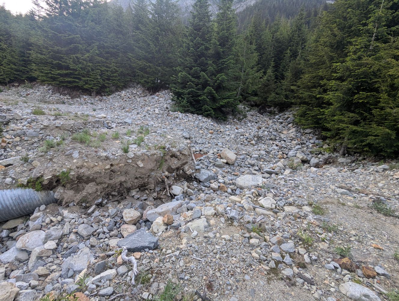
We checked out this road on Sunday, June 14, 2026. The road is in decent condition but we did not drive our Pontiac Vibe down this road. A 4x4 / high ...
Yumi Imai - Jun 14, 2026We drove up on Sunday, June 14, 2026. Our Pontiac Vibe made it up to the gate at the junction of BR2500 and BR2510. That gate is locked. The road is i...
Yumi Imai - Jun 14, 2026Some talus slumps across the road on the switchbacks at the southern end (need a grader to clear) but still drive-able with high clearance 4x4 or adve...
Steve LaCourse - Jun 11, 2026We drove up on Sunday, June 14, 2026. The gate to Cogburn looked closed & locked but if you go up to it, it opens. We opened it and closed it behind u...
Yumi Imai - Jun 14, 2026Washed out (3 feet deep, 4 feet wide with vertical sides) @ 0.5 km, then a large tree down, and multiple other even larger washouts further along. We...
Evan Crawford - Jun 12, 2026HEATERMAIN
19hWaterbars the whole length; passable in a stock 4runner with mild hitch dragging. Little bushy, expect a little west coast pin striping.
Evan Crawford - Jun 12, 2026KLASKINO MAIN
19h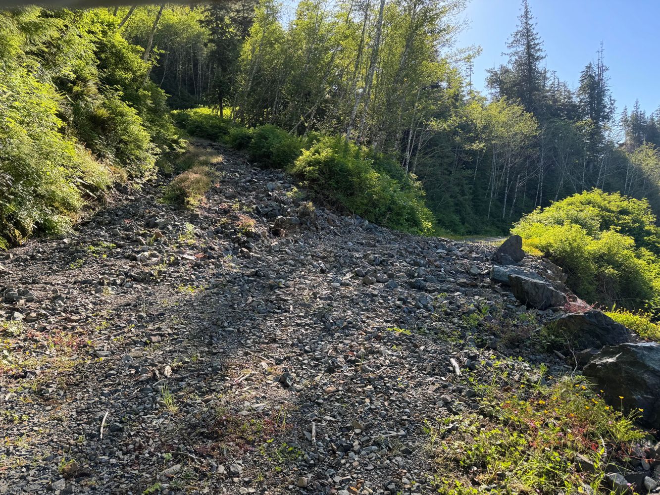
Confirm completely blocked at 33. Can access @ km 34 via Klaskish / Caycuse, but there is another washout at ~35.5 (we drove a 4runner across, but we...
Evan Crawford - Jun 12, 2026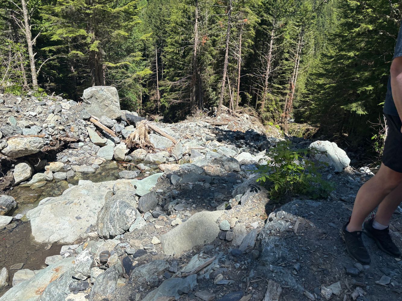
Large washout with very tricky bypass requiring short wheelbase and bug tires/lift
Steve Parkinson - Jun 14, 2026Road is in excellent condition, even a low clearance 2WD can probably make it currently. One rutted section where you may need to pick the right line,...
Andrew Knapman - Jun 12, 2026Similar condition to previous report. The road is narrow and loose with numerous small, sharp water bars for the majority, but anything with clearance...
Andrew Knapman - Jun 13, 2026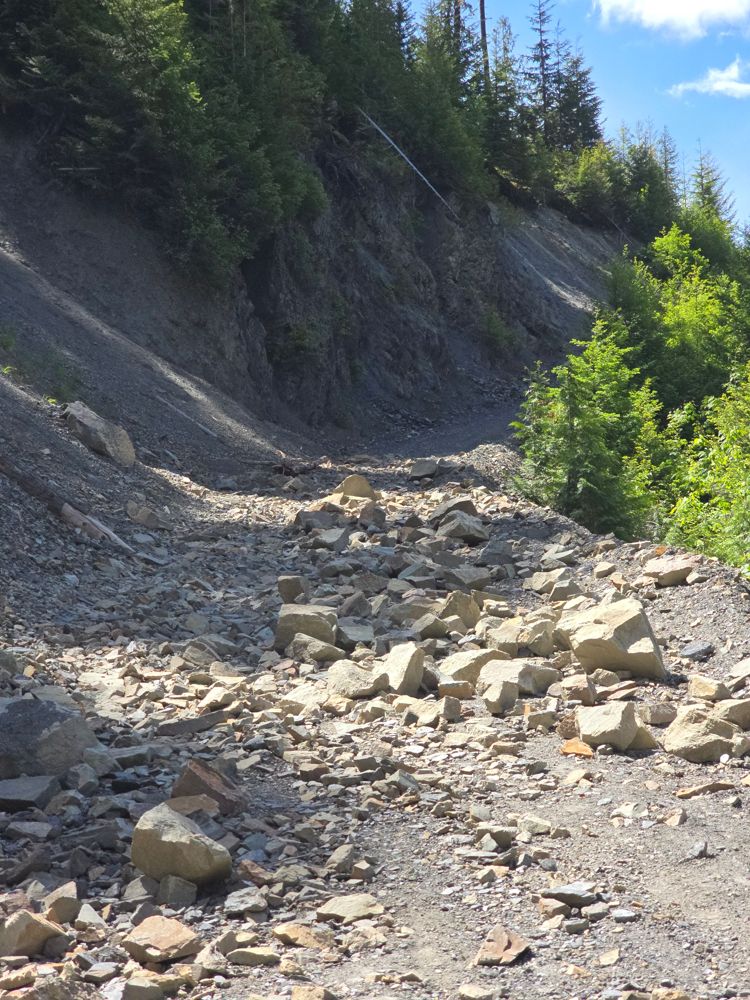
Road is still blocked at km12.5 up. One can see a line, but rocks are quite sharp and we aimed on the side of caution and walk the additional 2km to t...
Simon Mayer - Jun 14, 2026MISTYMAIN
1dThe short section I drove it was in okay condition. Doesn’t appear to be frequently maintained but I was able to drive it in a low clearance car witho...
Heath Anderson - May 30, 2026
Road Updates
Williamson Lake FSR
![]() has been removed at 49.136, -121.577
has been removed at 49.136, -121.577
Cogburn Creek Branch 2500
New ![]() has been reported at 49.599, -121.606
has been reported at 49.599, -121.606
KLASKINO MAIN
Road conditions have been updated to:
Chipmunk Creek FSR
![]() has been removed at 49.116, -121.658
has been removed at 49.116, -121.658
SOUTH KITEEN M/L A
New ![]() has been reported at 55.277, -128.671
has been reported at 55.277, -128.671
SOUTH KITEEN M/L A
New ![]() has been reported at 55.302, -128.656
has been reported at 55.302, -128.656
SOUTH KITEEN M/L A
New ![]() has been reported at 55.328, -128.654
has been reported at 55.328, -128.654
SOUTH KITEEN M/L A
New ![]() has been reported at 55.349, -128.657
has been reported at 55.349, -128.657
Gaspard-Mud Lake ConnectorNew
Road added in the Cascades Natural Resource District region
RUPERT MAIN RUPMAIN
Road conditions have been updated to:
Duncan Bay Mainline
Road conditions have been updated to:
Duncan Bay Mainline
![]() has been verified at 49.884, -125.275
has been verified at 49.884, -125.275
Oyster River Main
![]() has been changed to
has been changed to ![]() at 49.894, -125.276
at 49.894, -125.276
Free to Use and Community Driven
Get up-to-date information about back country roads all over British Columbia, Alberta and the Yukon. Created by the community, for the community.
Detailed Reports
View road conditions broken down kilometer by kilometer and find the latest status on gates, bridges and washouts. Explore user submitted road reports and contribute your own with an easy-to-use road report system!
Explore the over 260,000 roads on the map and keep the community strong by sharing what you find on your adventures.


Toma Main
New ![]() has been reported at 49.514, -125.126
has been reported at 49.514, -125.126

Map Layers
Find cut block data, wildlife closure zones, recent satellite imagery and a host of base maps to make your planning a breeze.
Offline Road Data
Take service road information offline with your favourite mapping application. The Service Road Atlas supports road downloads and offline use in apps like Gaia, OSMAnd, Caltopo and more.


