Road Bulletins
Same conditions as last post. A little rough and steep at the beginning, otherwise fair all the way up.
Stephen Bunyak - Jul 03, 2026SUGAR-CAMPSITE
30dEasily 2wd to the rec site. A newer mazda 3 drove past me in the opposite direction.
Stephen Bunyak - Jul 02, 2026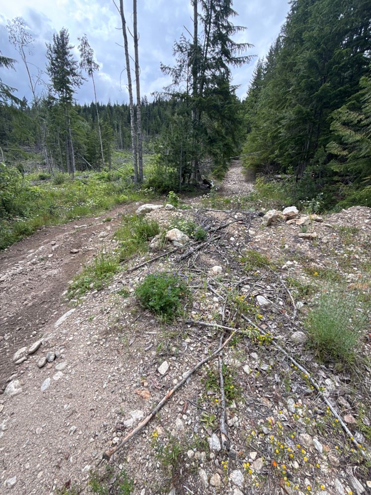
Oddly smooth up to what looks like a gatekeeper at the split at 0.55 km. There’s a bypass, but looks too rough for a solo trip up. Maybe better for a ...
Stephen Bunyak - Jul 02, 2026KATE CREEK
30dRoad was pretty dry going up today. My first piece of advice is to NOT go up when it’s wet/thawing. The road is pretty heavily rutted from vehicles go...
Stephen Bunyak - Jul 02, 2026MAINLINE 375005
30d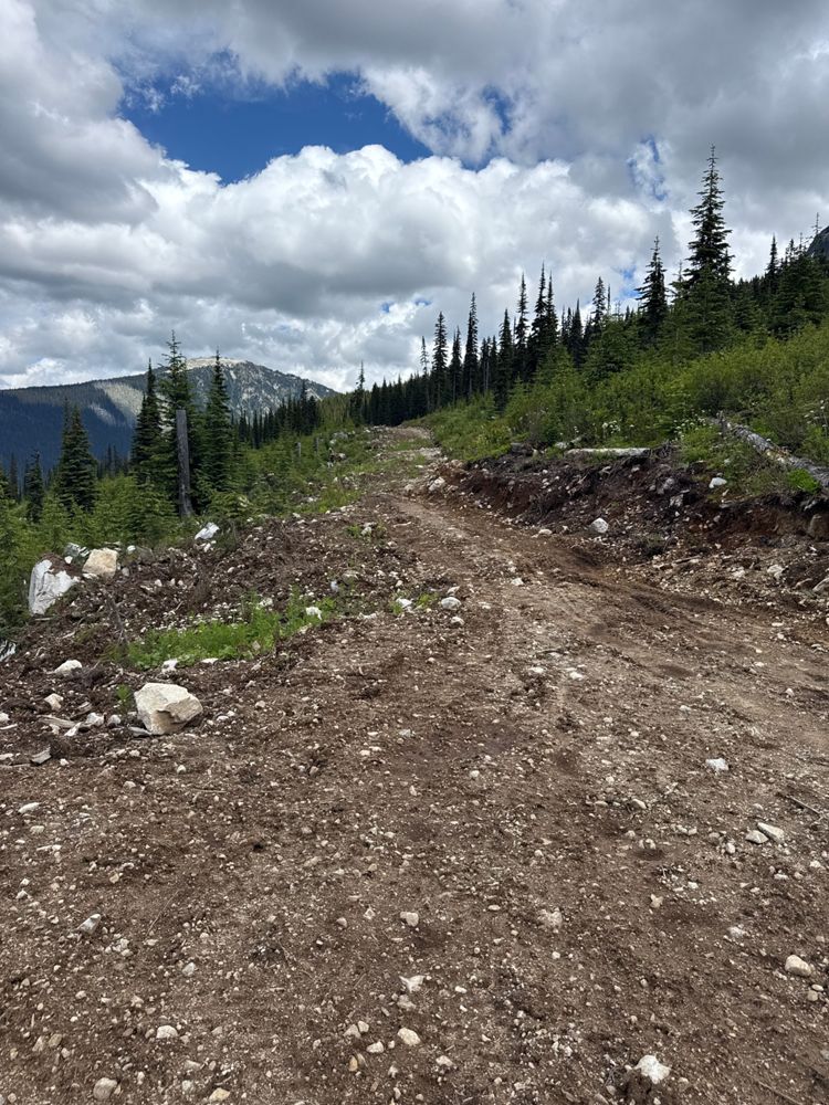
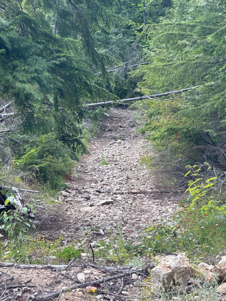
I don’t know what that impasse is, it should be taken down. I was able to drive to 0.55 km, and then the road HEAVILY narrows for a short bit. Probabl...
Stephen Bunyak - Jul 02, 2026266.506.04
30dRoad is in generally good condition. The odd shallow cross ditch and potholes. I could get a 2wd up here.
Rob Pargee - Jul 02, 2026ME7573.08
30dRoad is in generally good condition. The odd shallow cross ditch and potholes. I could get a 2wd up here.
Rob Pargee - Jul 02, 2026ME7573.12
30dDrove to the end of the road in Subaru Outback. 2wd might struggle on these last couple kms. Bit rough and shallow water bars.
Rob Pargee - Jul 02, 2026ME R24327.03
30dDrove to the end of the road in Subaru Outback. 2wd might struggle on these last couple kms. Bit rough and shallow water bars.
Rob Pargee - Jul 02, 2026ME7573.11
30dLooks like new bridge infrastructure. Not sure what it looked like before but the bridge is in great shape. Probably 2wd to this point. AWD likely nee...
Rob Pargee - Jul 02, 2026Manning Spur
30d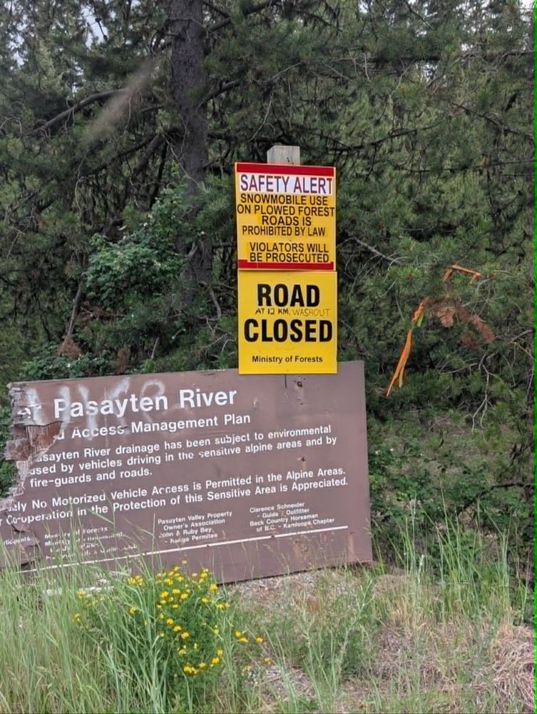
Road is in great shape. Road closed sign seems to be for Pasayten River FSR. Initially scared us. 2wd access. Spurs off of this are worse.
Rob Pargee - Jul 02, 2026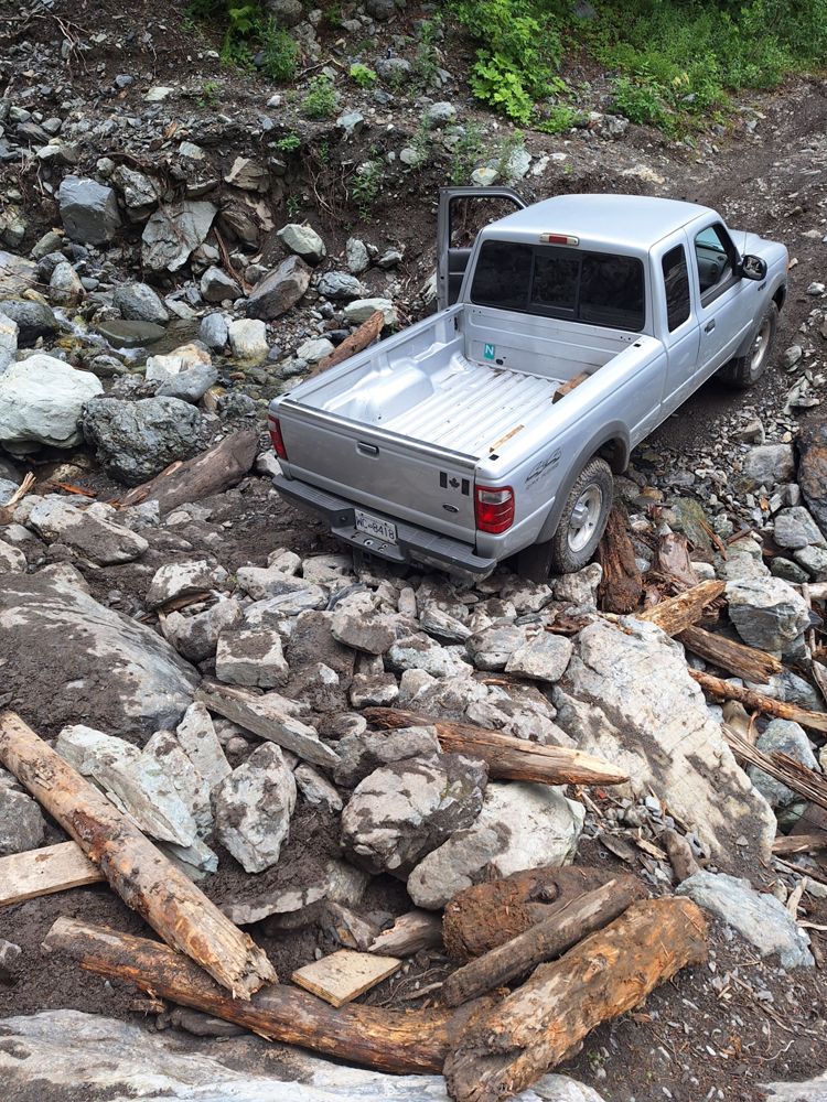
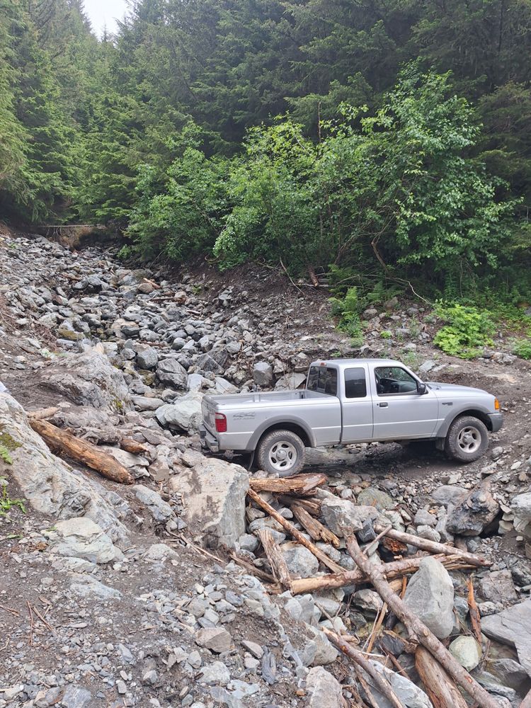
Large washout still present. I was able to cross it very carefully in a stock 2001 Ranger 4wd. I'd recommend a little bit more clearance.
Cam Soo - Jul 01, 20265300.00
30dGood condition, the last ~500m crosses a slightly boggy area but was still firm enough to pass easily
Sean Caulfield - Jul 01, 20265440.00
30dGood condition, continues all the way under south side of Mount Fadear. Gets a bit narrow, slightly bushy & was a bit wet from recent rains near the e...
Sean Caulfield - Jul 01, 20265430.00
30d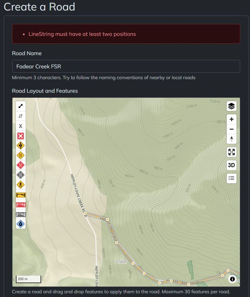
Think this is still Fadear Creek FSR, or at least an extension of it that I accessed from that road. Good condition, fine for crossover type vehicle.
Sean Caulfield - Jul 01, 20262100.00
30d2100.00
30dMOUNT LOLO 1100
30dGood condition, should be fine in a crossover type vehicle. Road goes all the way to the antenna at the summit
Sean Caulfield - Jul 01, 2026Easy travel for any vehicle until approx. KM4, thereafter gets a bit steeper & some small loose rocks which you will probably want at least a crossove...
Sean Caulfield - Jun 30, 2026SOWAQUA
30dRoad is open per https://www2.gov.bc.ca/gov/content/industry/natural-resource-use/resource-roads/local-road-safety-information/chilliwack-natural-reso...
Sean Caulfield - Jul 02, 2026