Road Bulletins
Bear Creek FSR
53d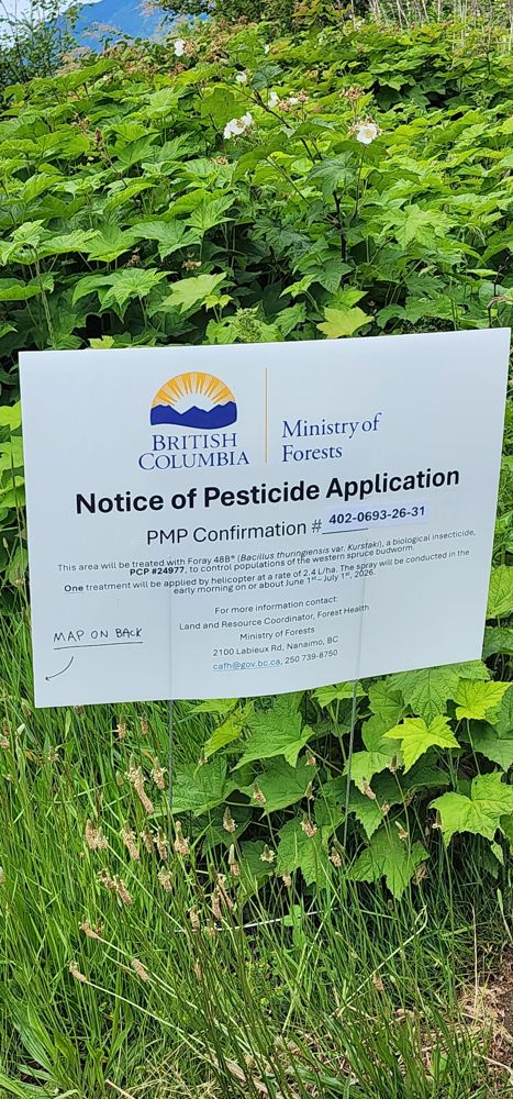
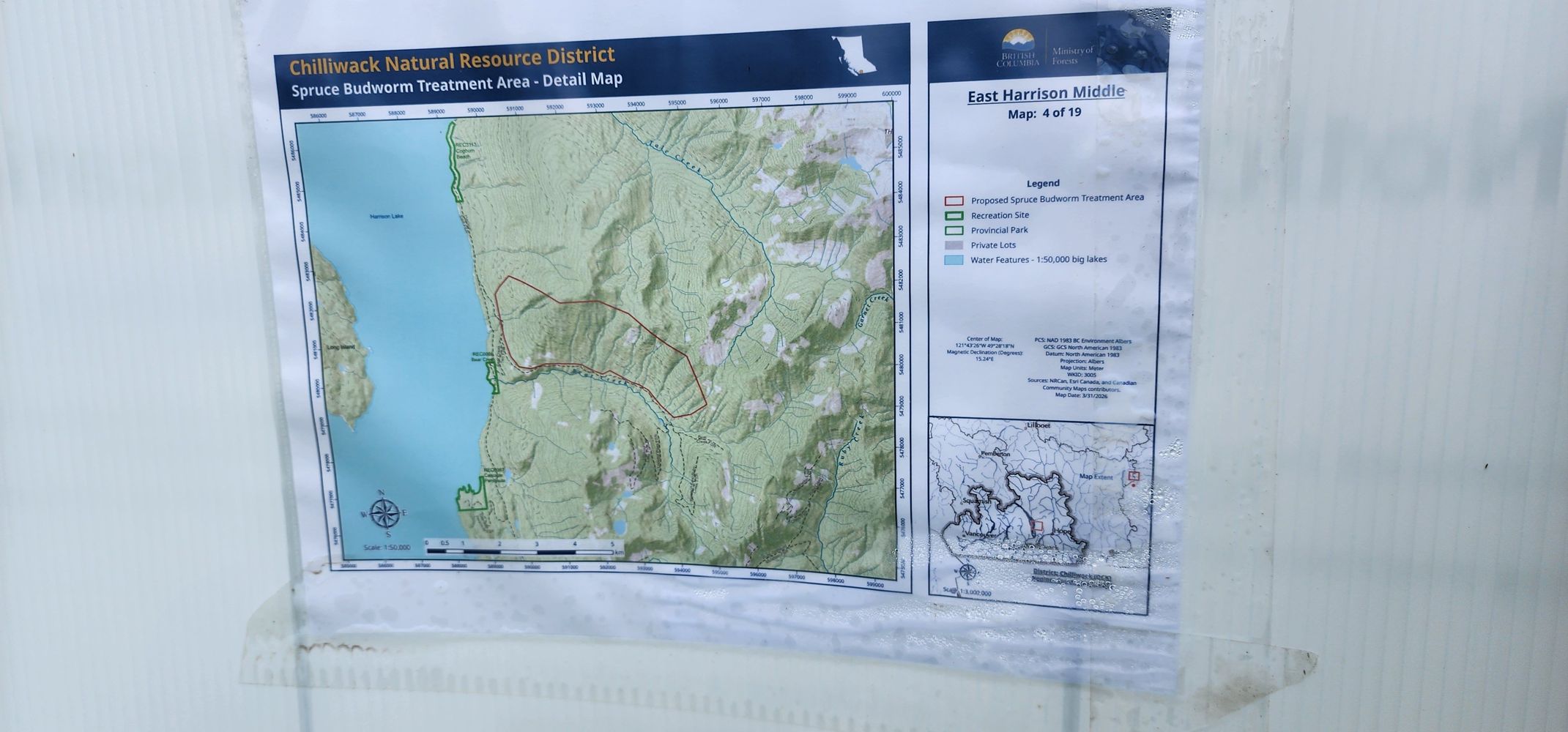
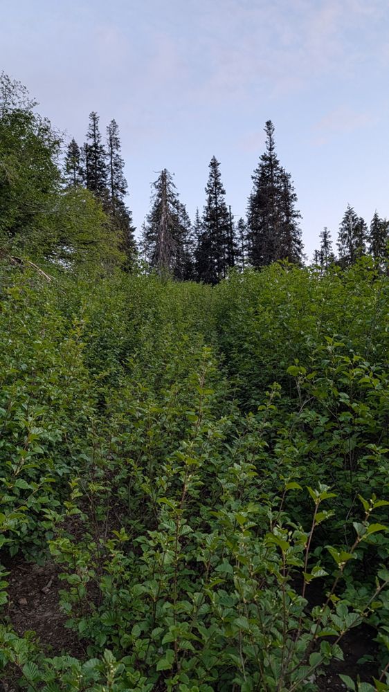
One treatment of insecticide application by helicopter to control populations of the western spruce budworm. Spray will be conducted in the early morn...
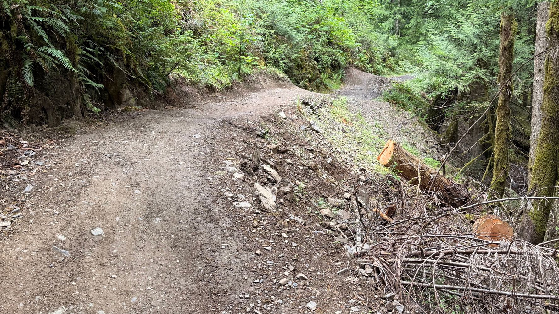
Gavin - Jun 08, 2026Decent condition to 4 km. Only 1 cross ditch just after the BLKS C328. C327 junction. Surprisingly I took it head on in my Pilot TrailSport without an...
Gavin - Jun 07, 2026
Sure some potholes but a sedan could get to the turnoff for upper parking
No idea how it is past there tho
BW12-1
55dSame as usual. Crossover should do it. Bad approach angles may scrape a bit on the upper water bars. You'll want AWD. Nothing crazy tho. Snowline is (...
Tareef Dedhar - Jun 07, 2026HORSETHIEF CREEK
55d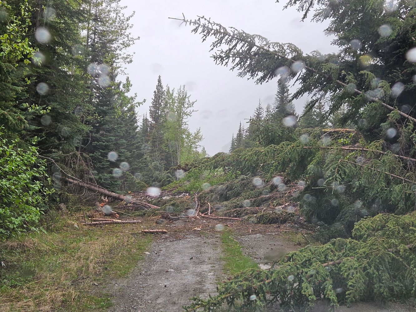
Buried in avalanche debris. May be passable once snow melts, and trees are cut away with chainsaws.
scott baker - Jun 05, 2026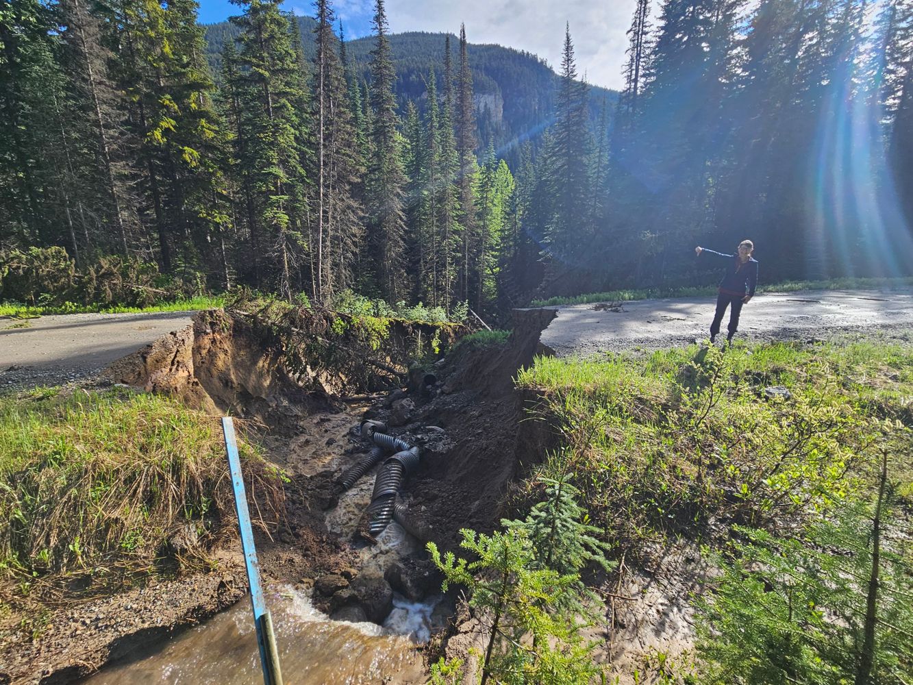
Road fully washed out by creek; not passable by any vehicle, needs to be rebuilt.
scott baker - Jun 06, 2026Showh Lakes FSR
56dLargely unchanged. Keep an eye open for SxS's and quads as the company that runs the tours at the base of the trail is in operation.
Stephen Bunyak - Jun 06, 2026COUGAR1
56dCame up from SooRiver602 1.47>0.83km. Sides of road is littered with pallets for some reason, and not all of them appear to be that old. A little bit ...
Stephen Bunyak - Jun 06, 2026Soo River 602
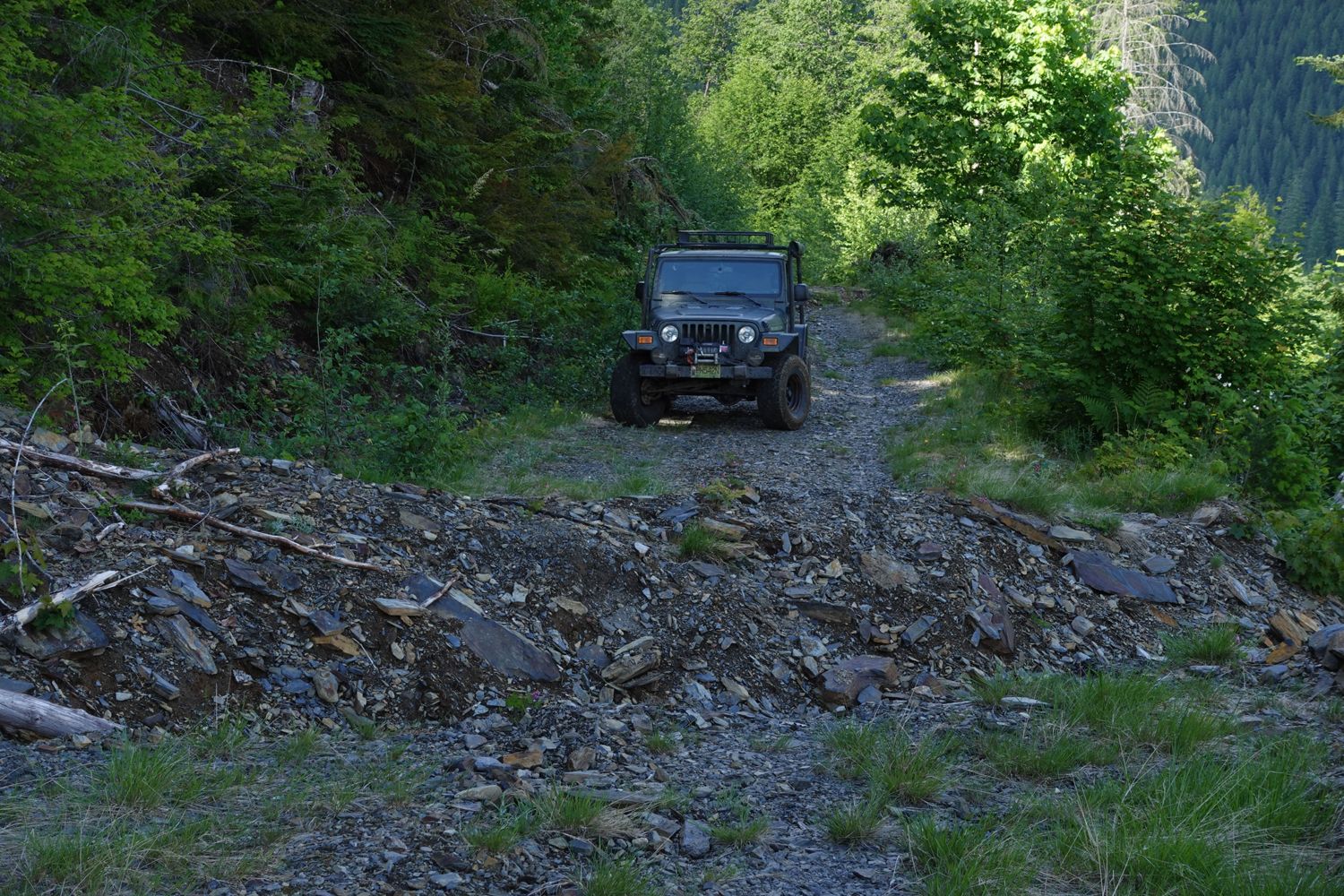
56dA little spicy, but a very fun trail to go up. I went in my stock Rubicon in 4Low and had no issues. There is a bit of growth, but the road remains un...
Stephen Bunyak - Jun 06, 2026SOO RIVER SOUTH
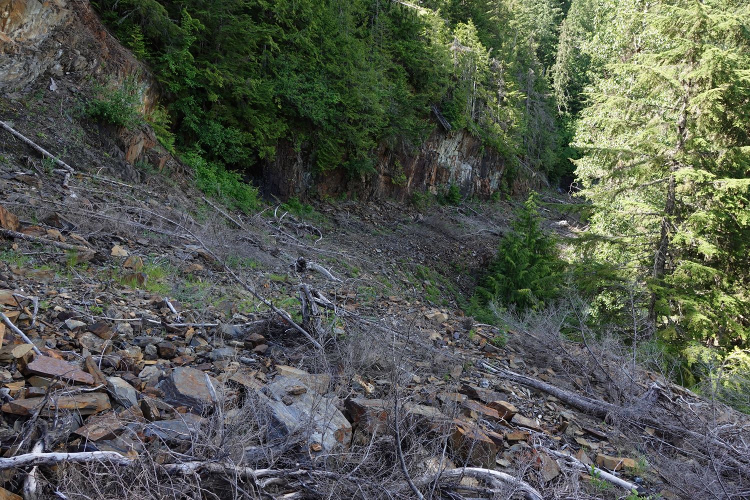
56dHeaps of over growth, most of it is soft bush, but road still easily visible. Theres a few washouts that are nice little "rock gardens" to drive throu...
Stephen Bunyak - Jun 06, 2026MA BR40000
56d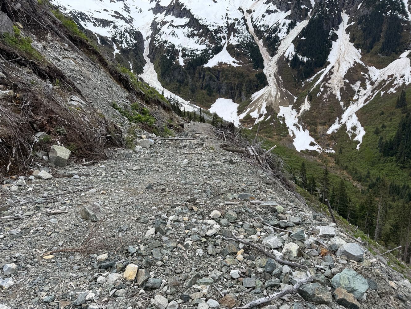
If you could reach this spur the first half would be drivable up to a section of road that’s sliding down the slope
Francis Bailey - Jun 06, 2026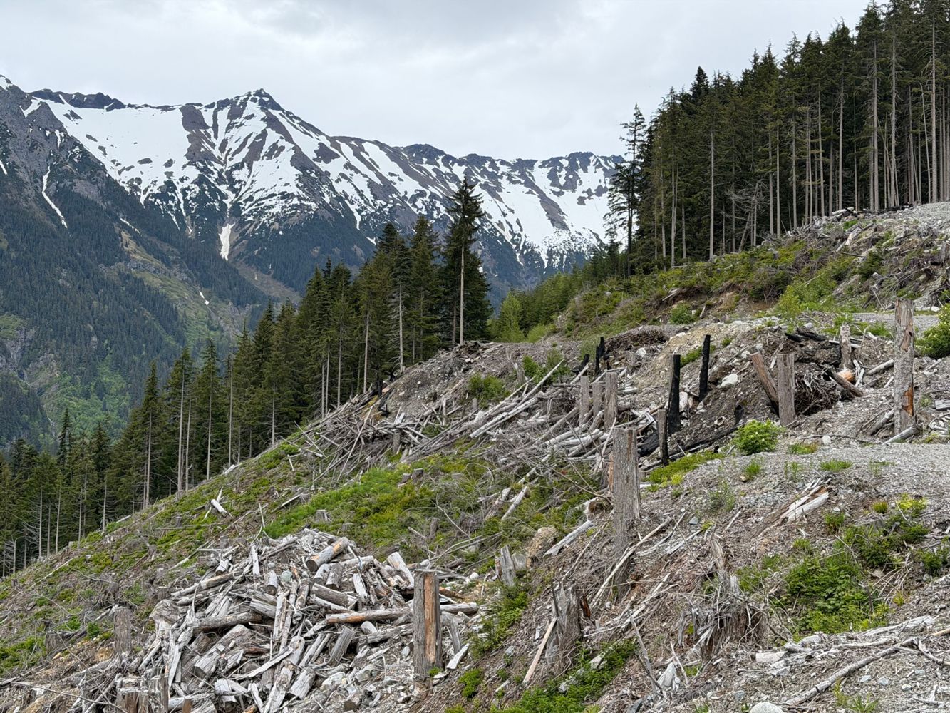
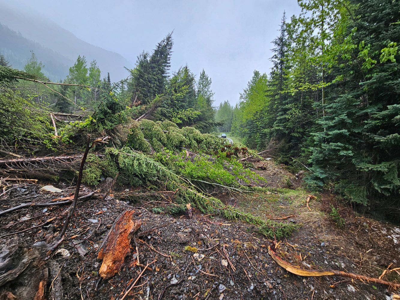
A few sections lower down are getting some water runnels, but generally good condition to the 10km mark. Here the slopes have slid onto to the road in...
Francis Bailey - Jun 06, 2026

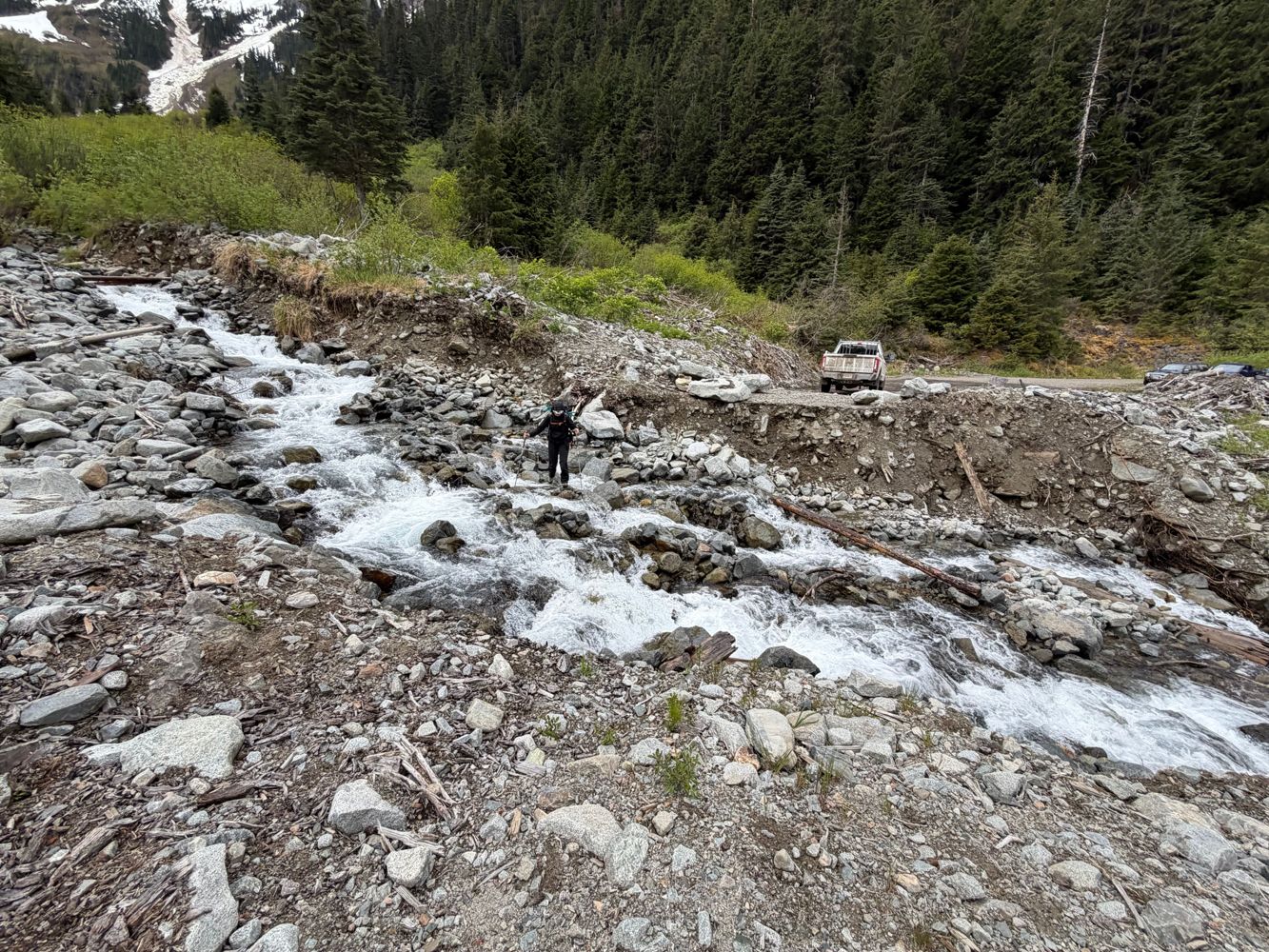
The August 1 storm caused several washouts that have degraded the road above the river ford where the bridge used to be. The worst section was the lar...
Edwina Podemski - Aug 01, 2025

Kookipi closed for road repairs until approximately August. Details at https://www.facebook.com/share/p/1AE5KyjAE3/
Matt Ion - Jun 05, 2026Carl Creek FSR
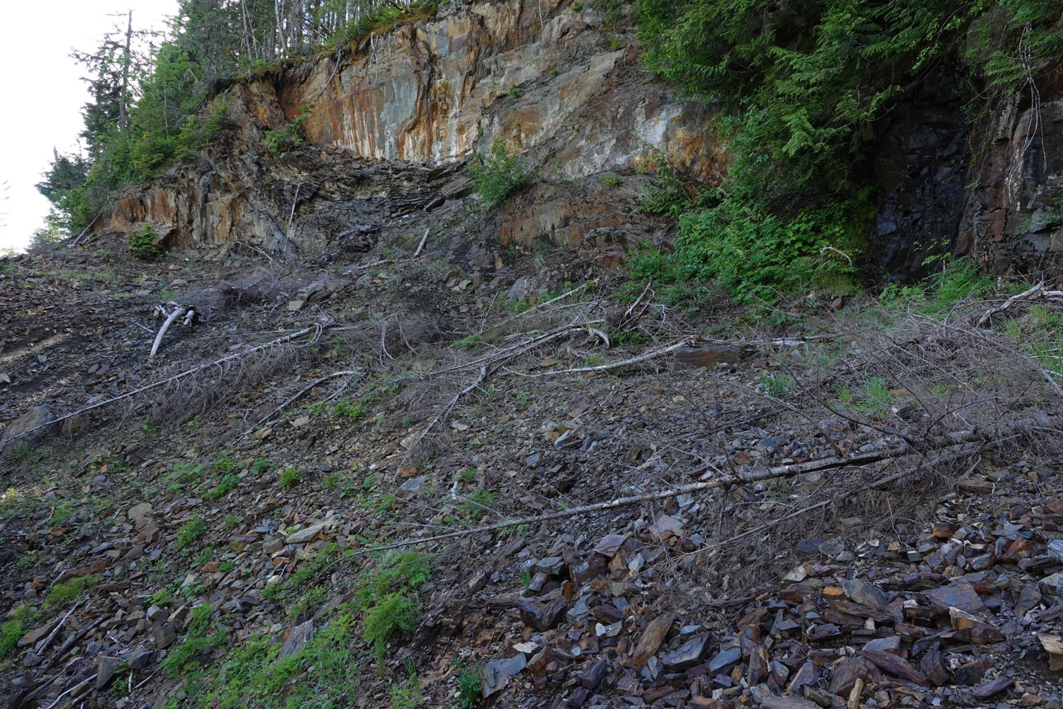
57dEasily drivable in a Subaru to ~6.5 km where a landslide blocks further access. Bridge to the west side of the creek beyond 7 km is intact but only do...
Steven Song - May 27, 2026Talked to a worker a the blockade around the 21km mark on May 31st and he said could be 1-2 weeks before it opens. If anyone has any updates this wee...
Jeff Colter - May 31, 2026Very overgrown and a bit rocky in some places. Paint job will take a beating.
Paul Lezica - Jun 02, 2026LC112
58d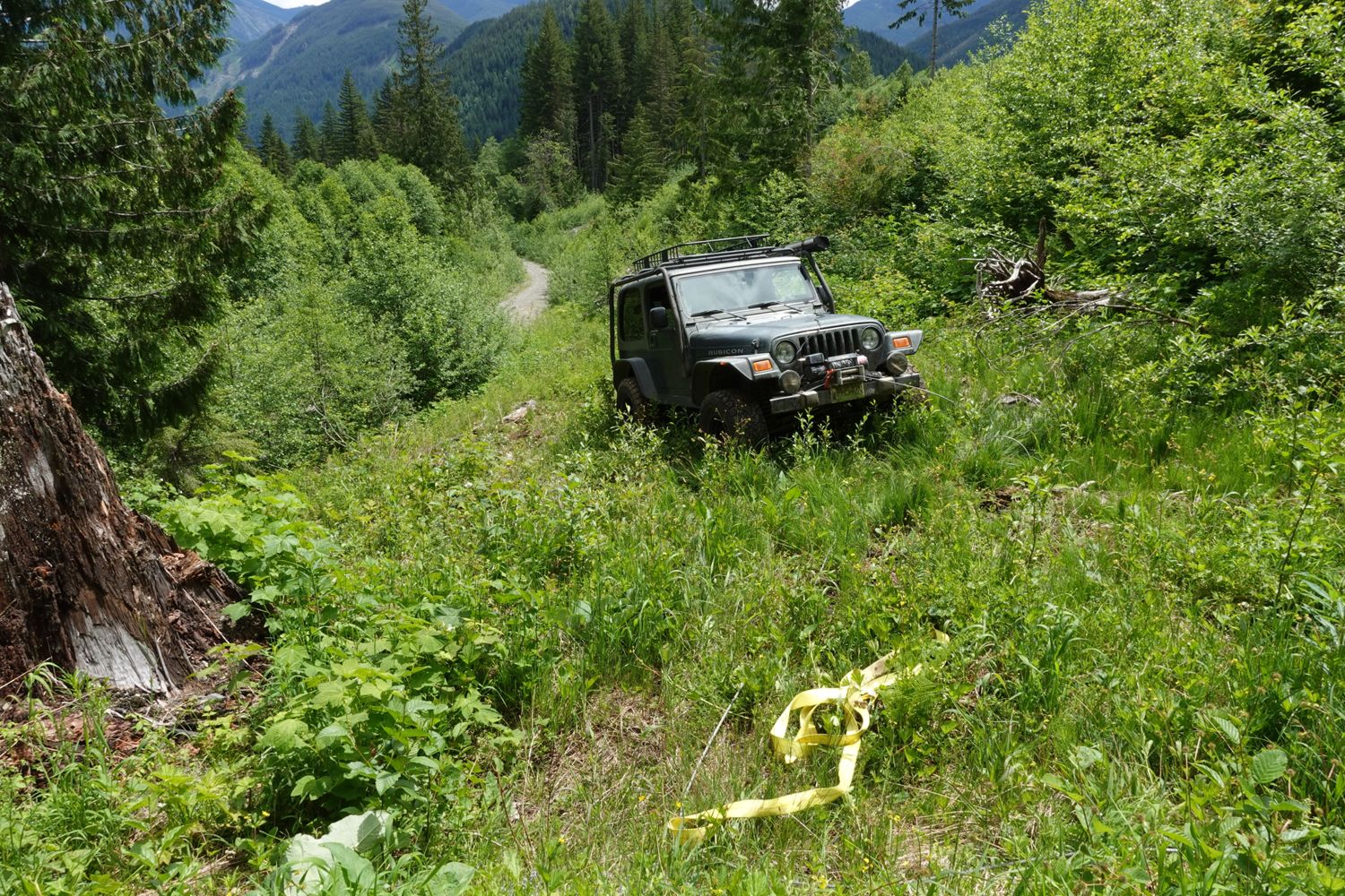
The start of this road was torn up and logs dropped across it for deactivation but I was able to push through. After around the 0.5km mark there is no...
Paul Lezica - Jun 04, 2026Roe Creek FSR
59d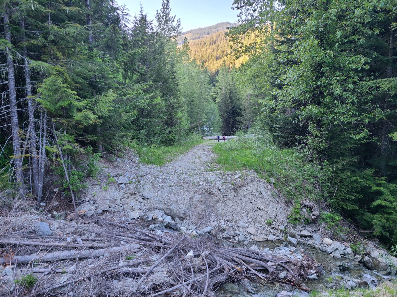
No major changes from last update. Road is snow free and had no issues driving in a midsize SUV with average ground clearance and AWD (Nissan X-Trail)...
Jesse Listoen - May 31, 2026Road in nice condition, easily made it to the gate in a crosstrek. Went through traffic control during construction hours and had no problems or waits...
Stu Morris - Jun 02, 2026NH600
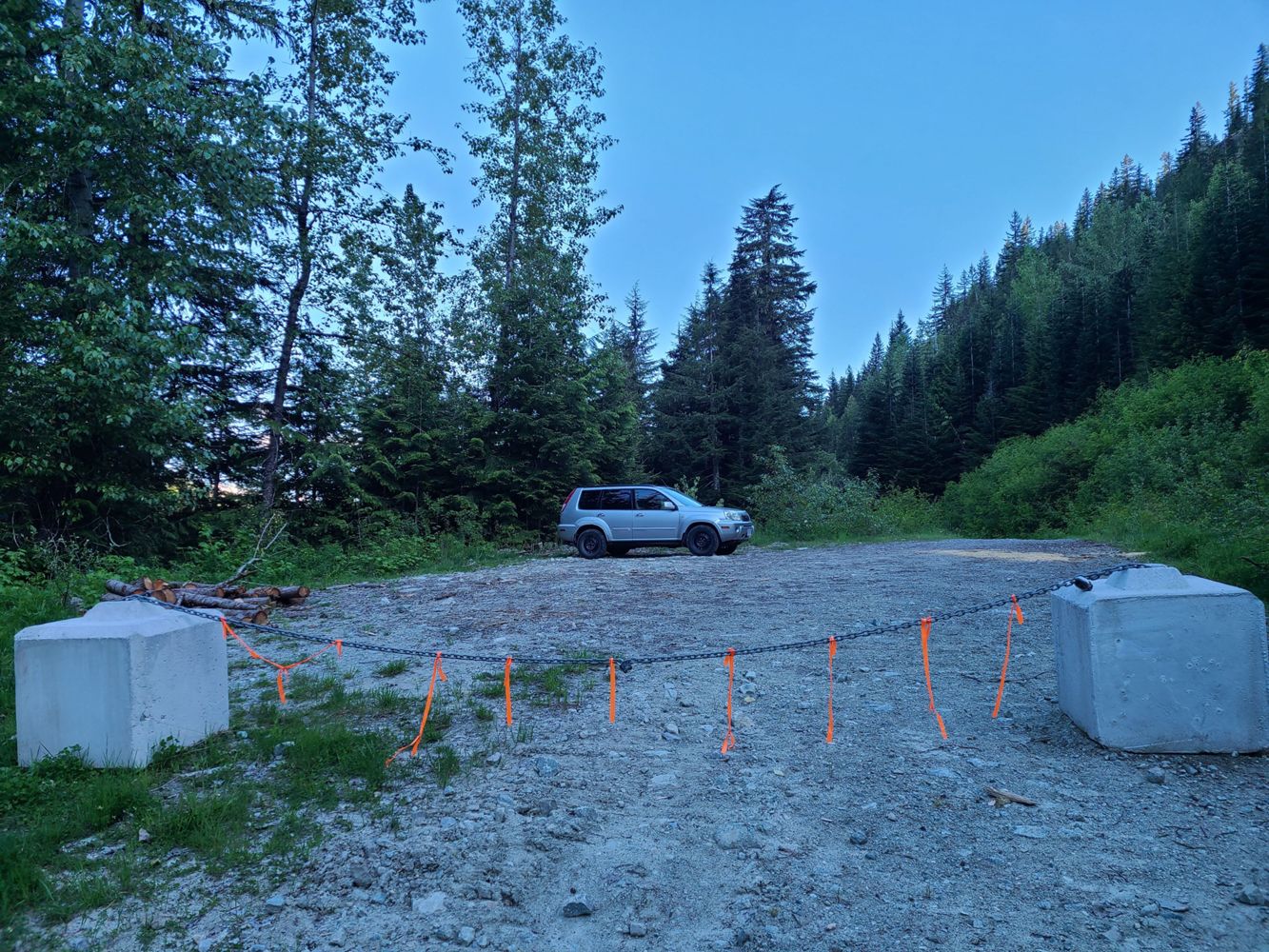
60dN600 spur is driveable with a Subaru up to 700m. there is a small parking lot probably can fit aroun 5 vehicles. No waterbars up to this point.
Teng Pasion - May 30, 2026