Road Bulletins
RENNELL ROAD
45dClosed at KM1 due to washout states the signage at the start of the road. Didn’t venture any further.
Seems to be getting worked on.
Drove this road in its entirety. Great condition and frequently maintained. Drove in a low clearance car without issue. Plenty of logging traffic, a r...
Heath Anderson - Jun 03, 2026R100
45dDrove a short distance to access the beach trail. No issues on this stretch in a low clearance car, just some potholes and bumps.
Road appears to be ...
Kwoiek Creek FSR
46d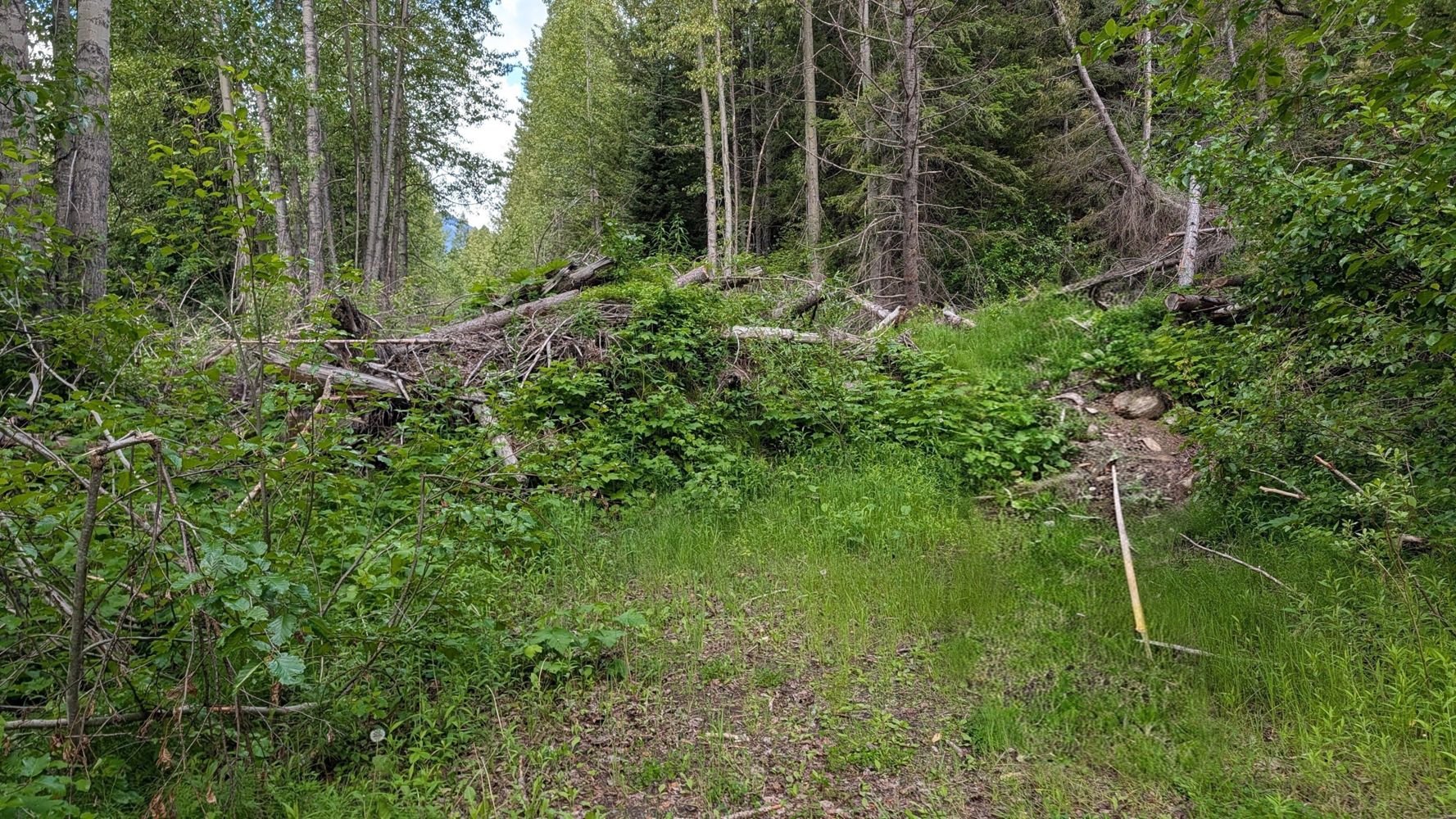
Improved conditions from the previous report - road is well trimmed, except a short overgrown section after the lake.
Slide is still there at 16.5km...
Fisher Main
46d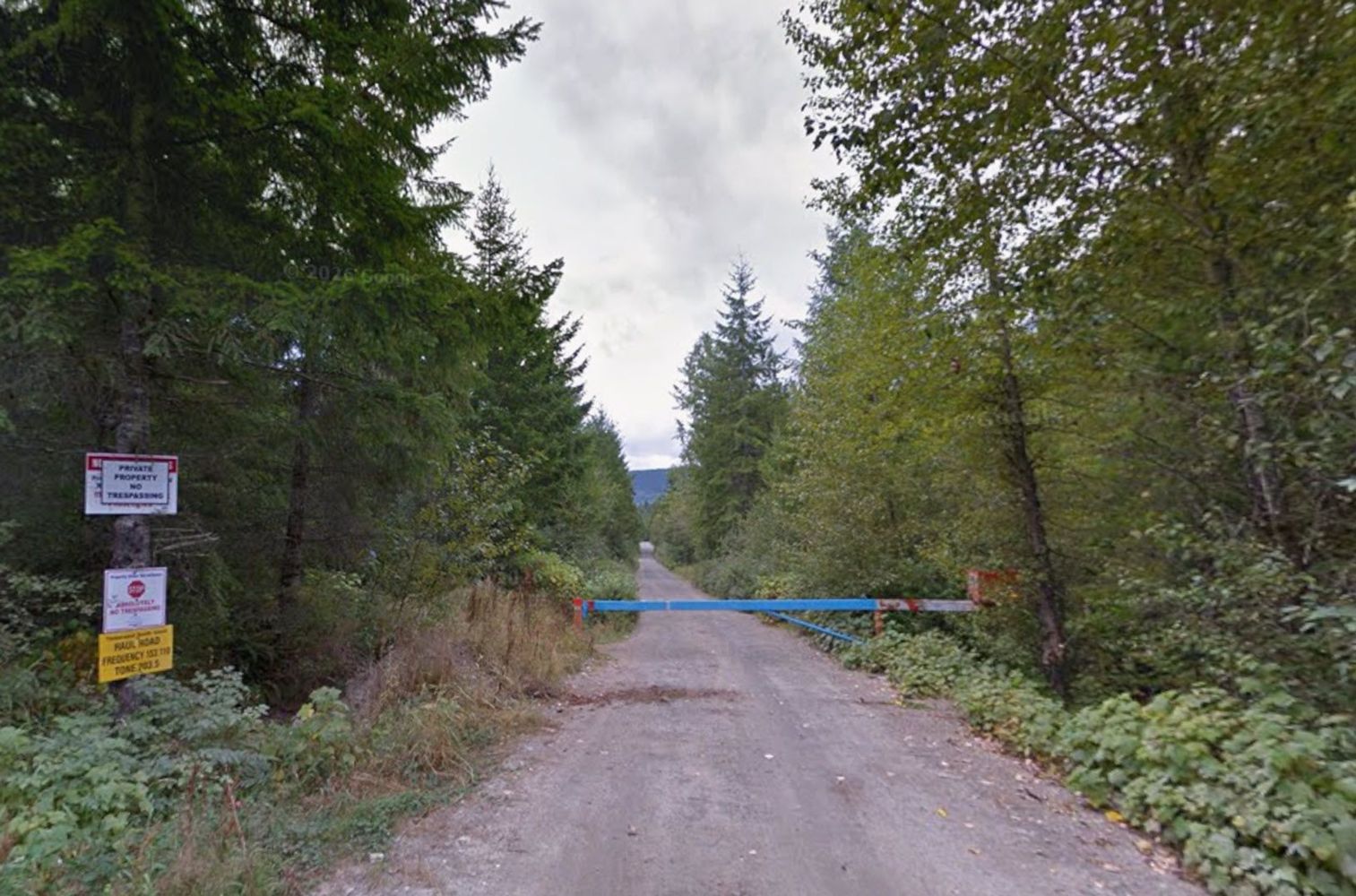
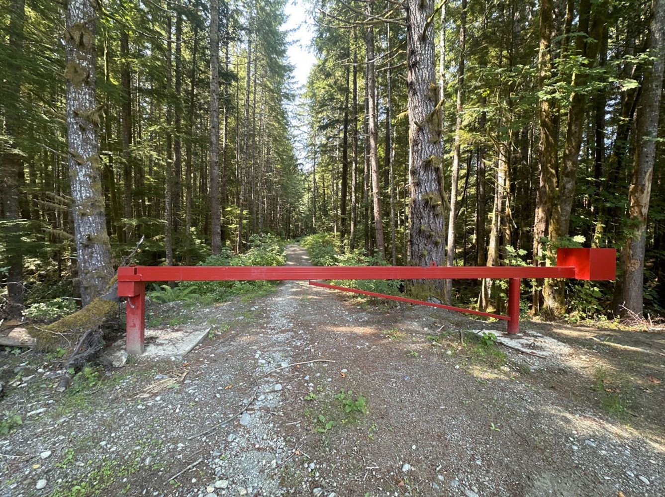
Locked gate at Fisher Road, access to Fisher Main from Fisher Road is not accessible as it also on a Private road off of Fisher Road
Chris Lang - Jun 13, 2026SIDE BAY MAIN
46dBest conditions of an FSR I've ever seen. Western Forest Products is doing a great job maintaining this whole area. Well graded, smooth, wide, minima...
Teeto Bonito - Jun 04, 2026Best conditions of an FSR I've ever seen. Well graded, smooth, wide, minimal potholes, etc. I would recommend a 4x4 with some ground clearance to be...
Teeto Bonito - Jun 04, 2026RESTLESS
46dRoad is clear from Side Bay to Gooding Cove. Best conditions of an FSR I've ever seen. Well graded, smooth, wide, minimal potholes, etc. I would rec...
Teeto Bonito - Jun 05, 2026HEATERMAIN
47dWaterbars the whole length; passable in a stock 4runner with mild hitch dragging. Little bushy, expect a little west coast pin striping.
Washed ...
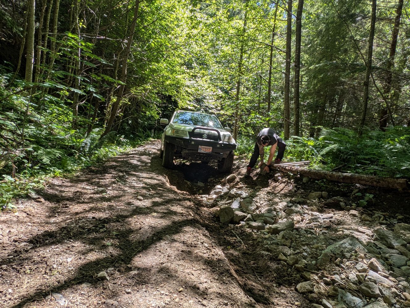
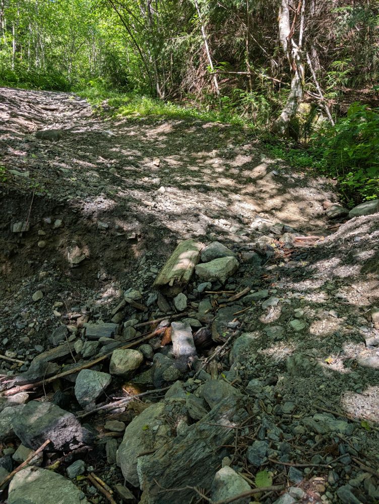
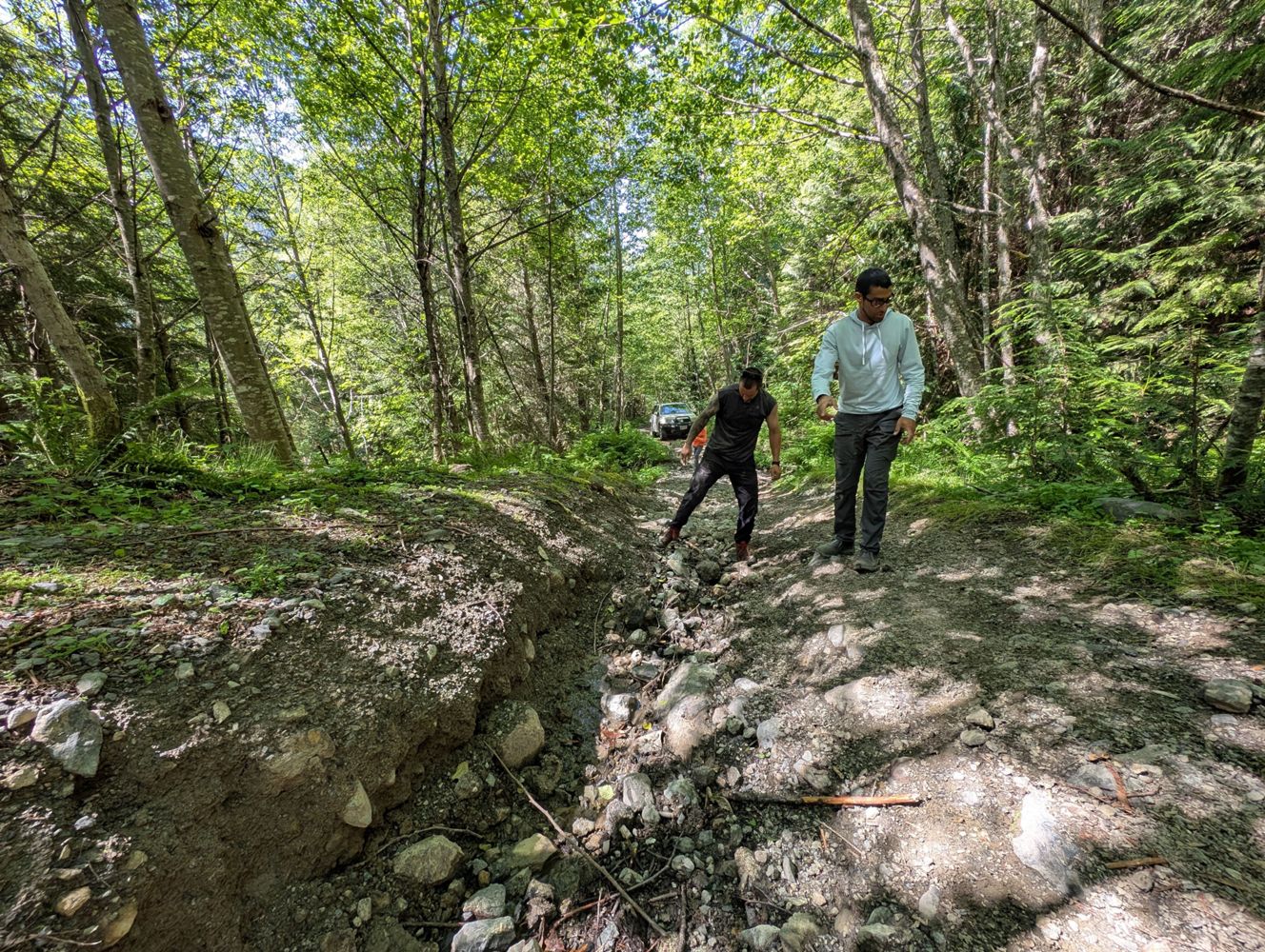
Adding a few photos re Tareef's post. Unsurprisingly, photos don't do it justice as to how difficult/technical this FSR is.
June Tai - Jun 14, 2026Reported as open on FB today. Possibly only temporary through the summer.
https://m.facebook.com/story.php?story_fbid=10163016457831009&id=17581...
Drove this to get to the Williamson lake trailhead
Took some work moving boulders and shoveling some dirt around to fill in the worst spots in some...
Mamquam FSR
47d
went up to the 16km mark, smooth surface most of the way. few potholes, very manageable. 50+ km/h is very possible. some loose rocks after 13km. done ...
Michael Kendrick - Jun 14, 2026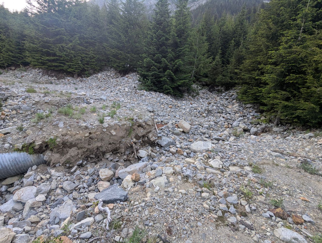
We checked out this road on Sunday, June 14, 2026. The road is in decent condition but we did not drive our Pontiac Vibe down this road. A 4x4 / high ...
Yumi Imai - Jun 14, 2026We drove up on Sunday, June 14, 2026. Our Pontiac Vibe made it up to the gate at the junction of BR2500 and BR2510. That gate is locked. The road is i...
Yumi Imai - Jun 14, 2026High Bar Road
47dSome talus slumps across the road on the switchbacks at the southern end (need a grader to clear) but still drive-able with high clearance 4x4 or adve...
Steve LaCourse - Jun 11, 2026We drove up on Sunday, June 14, 2026. The gate to Cogburn looked closed & locked but if you go up to it, it opens. We opened it and closed it behind u...
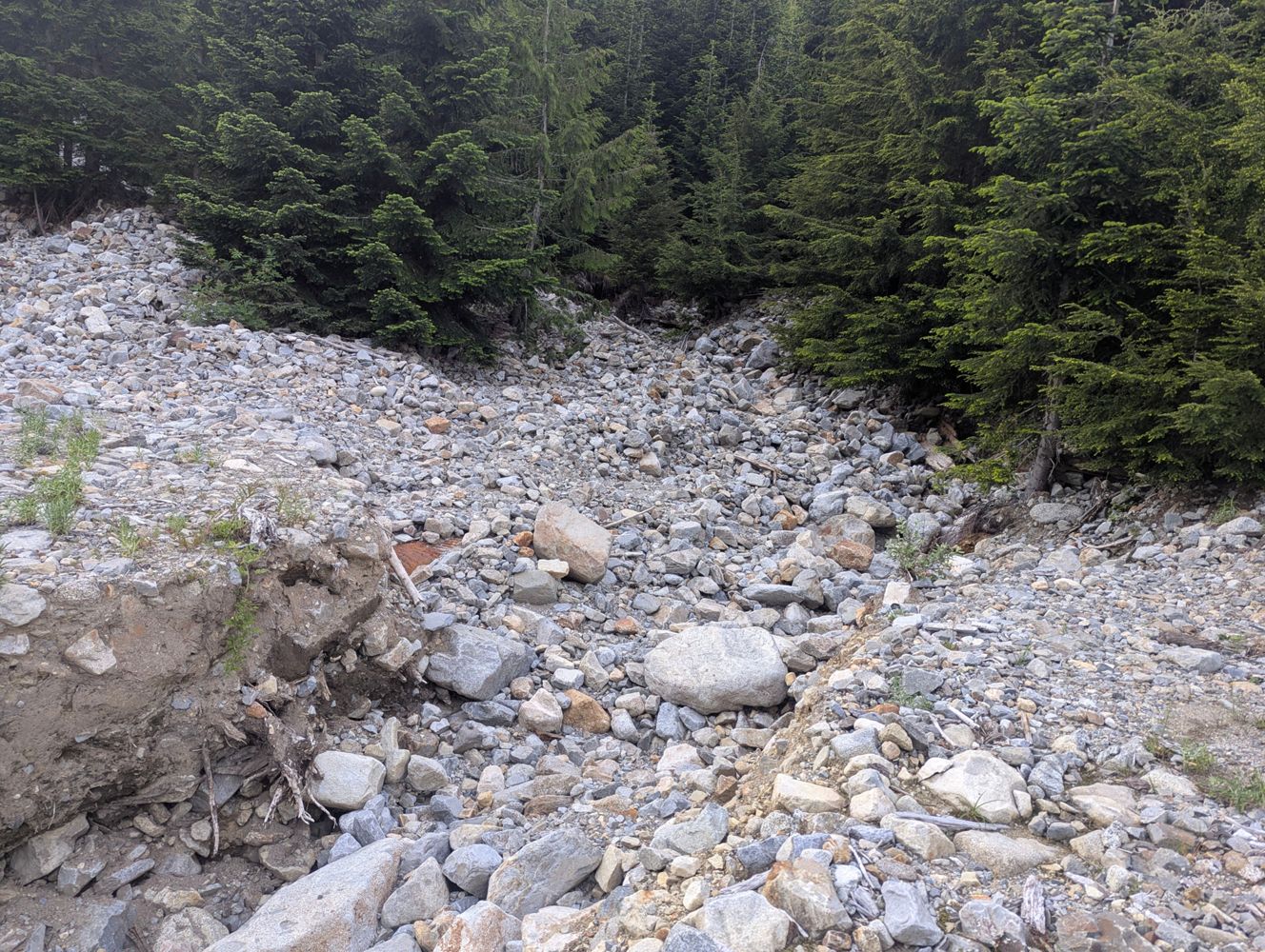
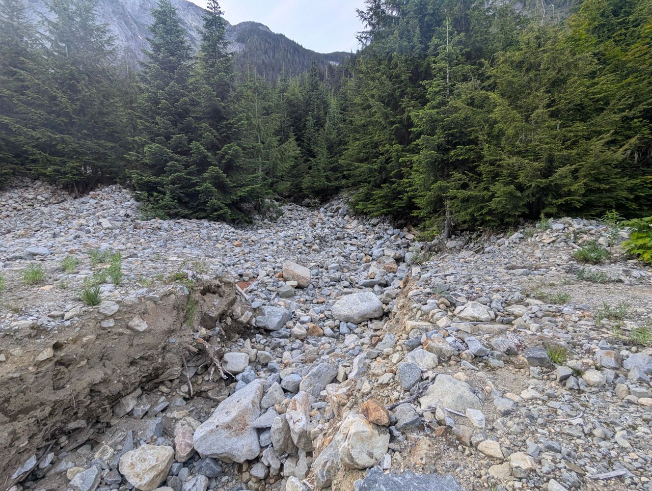
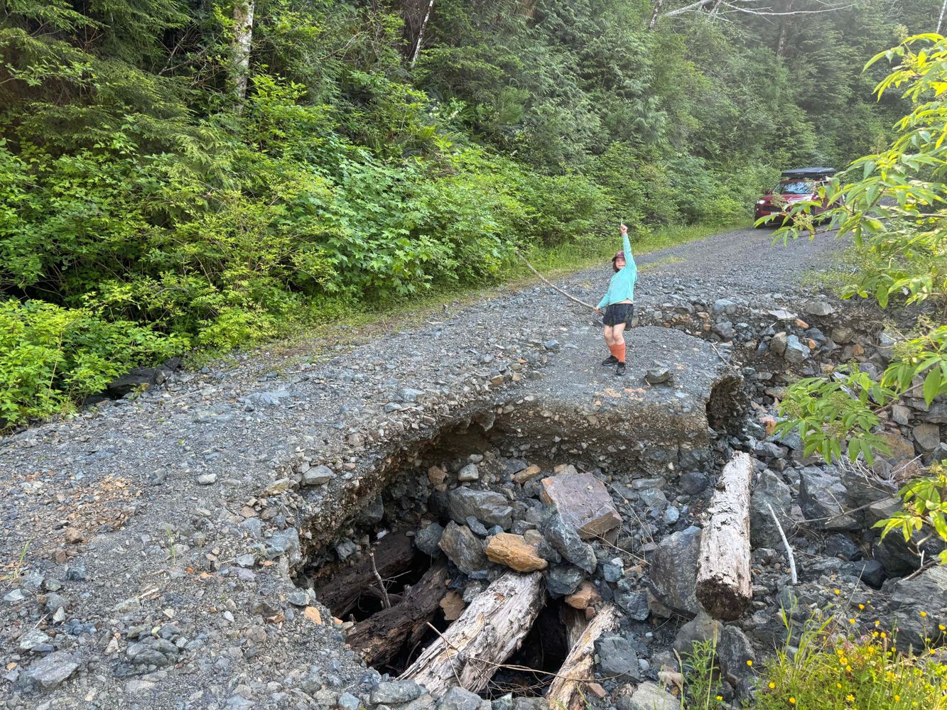
Yumi Imai - Jun 14, 2026Washed out (3 feet deep, 4 feet wide with vertical sides) @ 0.5 km, then a large tree down, and multiple other even larger washouts further along. We...
Evan Crawford - Jun 12, 2026KLASKINO MAIN
48d
Confirm completely blocked at 33. Can access @ km 34 via Klaskish / Caycuse, but there is another washout at ~35.5 (we drove a 4runner across, but we...
Evan Crawford - Jun 12, 2026Della Creek FSR
48dRoad is in excellent condition, even a low clearance 2WD can probably make it currently. One rutted section where you may need to pick the right line,...
Andrew Knapman - Jun 12, 2026Similar condition to previous report. The road is narrow and loose with numerous small, sharp water bars for the majority, but anything with clearance...
Andrew Knapman - Jun 13, 2026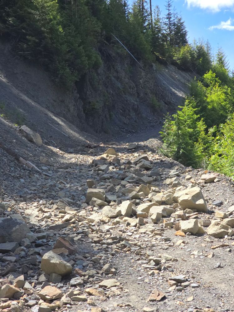
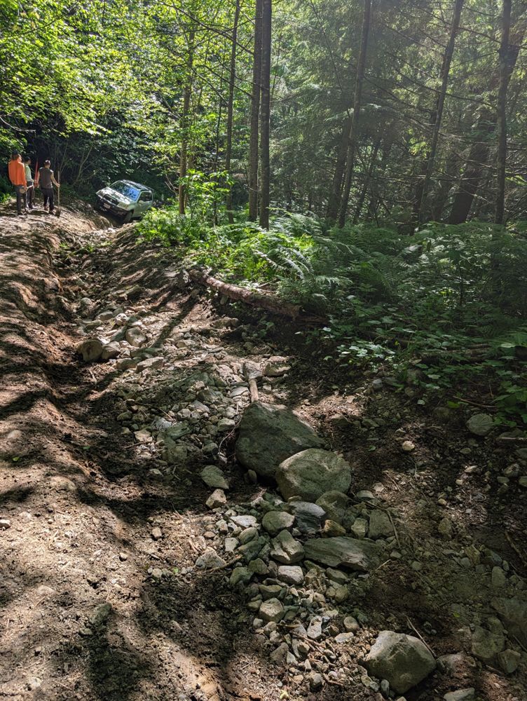
Road is still blocked at km12.5 up. One can see a line, but rocks are quite sharp and we aimed on the side of caution and walk the additional 2km to t...
Simon Mayer - Jun 14, 2026